Area Overview for B36 9TR
Photos of B36 9TR
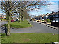
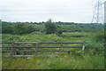
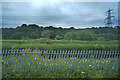
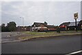
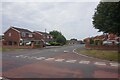
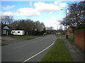
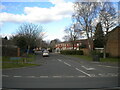
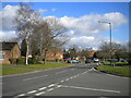
34 photos from this area
Area Information
Key information about the B36 9TR including its size, population, and administrative classification.
- Area Type
- Postcode
- Area Size
- 4846 m²
- Population
- 1455
- Population Density
- 3363 people/km²
House Prices in B36 9TR
12
Properties
£215,594
Average Sold Price
£129,000
Lowest Price
£262,500
Highest Price
Showing 12 properties
| Address | Type | Beds | Baths | Last Sale Price | Last Sale Date | |
|---|---|---|---|---|---|---|
| 12 Redliff Avenue, Castle Bromwich, Solihull, B36 9TR | Semi-detached | 3 | 1 | £260,000 | Nov 2018 | |
| 3 Redliff Avenue, Castle Bromwich, Solihull, B36 9TR | Semi-detached | 3 | 1 | £252,000 | Aug 2018 | |
| 2 Redliff Avenue, Castle Bromwich, Solihull, B36 9TR | Semi-detached | 4 | 1 | £225,000 | Jun 2018 | |
| 4 Redliff Avenue, Castle Bromwich, Solihull, B36 9TR | Semi-detached | 3 | 1 | £262,500 | Sep 2017 | |
| 5 Redliff Avenue, Castle Bromwich, Solihull, B36 9TR | Detached | - | - | £206,950 | Oct 2008 | |
| 9 Redliff Avenue, Castle Bromwich, Solihull, B36 9TR | Semi-detached | - | - | £204,950 | Oct 2007 | |
| 1 Redliff Avenue, Castle Bromwich, Solihull, B36 9TR | Detached | - | - | £210,000 | Sep 2007 | |
| 11 Redliff Avenue, Castle Bromwich, Solihull, B36 9TR | Semi-detached | - | - | £189,950 | Jul 2005 | |
| 10 Redliff Avenue, Castle Bromwich, Solihull, B36 9TR | Detached | - | - | £129,000 | Jun 2002 | |
| 8 Redliff Avenue, Castle Bromwich, Solihull, B36 9TR | Semi-detached | - | - | - | - |
Page 1 of 2
Energy Efficiency in B36 9TR
Amenities
Schools
| Rank | School | Type | Entry gender | Ages |
|---|
Explore more schools in this area
Go to Schools tabDemographics
Household Size
Family (3-5 people)
most common
Accommodation Type
Houses
most common
Tenure
93
majority
Ethnic Group
White
most common
Religion
N/A
most common
Household Composition
N/A
most common
Age
47
median
Adults (30-64 years)
most common
Household Deprivation
N/A
with no deprivation
NS-SEC
34
in Lower managerial occupations
Explore more demographic insights in this area
Go to Demographics tabPlanning
Planning Constraints
- Flood RiskPremium
- Ramsar Wetland SitesPremium
- Area of Outstanding Natural BeautyPremium
- Protected Nature ReservePremium
- Protected WoodlandPremium