Area Overview for B36 9JE
Photos of B36 9JE


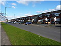
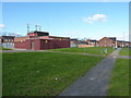
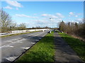
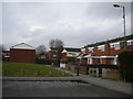
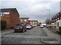

30 photos from this area
Area Information
Key information about the B36 9JE including its size, population, and administrative classification.
- Area Type
- Postcode
- Area Size
- 1.7 hectares
- Population
- 1539
- Population Density
- 5427 people/km²
House Prices in B36 9JE
30
Properties
£197,647
Average Sold Price
£66,500
Lowest Price
£315,000
Highest Price
Showing 30 properties
| Address | Type | Beds | Baths | Last Sale Price | Last Sale Date | |
|---|---|---|---|---|---|---|
| 161 Blandford Avenue, Castle Bromwich, Solihull, B36 9JE | house | - | - | £260,000 | Dec 2021 | |
| 175 Blandford Avenue, Castle Bromwich, Solihull, B36 9JE | house | - | - | £305,000 | Dec 2021 | |
| 155 Blandford Avenue, Castle Bromwich, Solihull, B36 9JE | house | - | - | £315,000 | Sep 2021 | |
| 185 Blandford Avenue, Castle Bromwich, Solihull, B36 9JE | Semi-detached | 3 | 1 | £244,000 | Nov 2019 | |
| 183 Blandford Avenue, Castle Bromwich, Solihull, B36 9JE | Semi-detached | 3 | 2 | £250,000 | Oct 2019 | |
| 159 Blandford Avenue, Castle Bromwich, Solihull, B36 9JE | Semi-detached | 3 | 1 | £200,000 | Jun 2016 | |
| 132 Blandford Avenue, Castle Bromwich, Solihull, B36 9JE | Semi-detached | 3 | 1 | £195,000 | Aug 2015 | |
| 128 Blandford Avenue, Castle Bromwich, Solihull, B36 9JE | Semi-detached | 3 | - | £190,000 | Feb 2015 | |
| 124 Blandford Avenue, Castle Bromwich, Solihull, B36 9JE | house | - | - | £152,000 | May 2011 | |
| 130 Blandford Avenue, Castle Bromwich, Solihull, B36 9JE | house | 3 | - | £165,500 | Jan 2011 |
Page 1 of 3
Energy Efficiency in B36 9JE
Amenities
Schools
| Rank | School | Type | Entry gender | Ages |
|---|
Explore more schools in this area
Go to Schools tabDemographics
Household Size
Family (3-5 people)
most common
Accommodation Type
Houses
most common
Tenure
92
majority
Ethnic Group
White
most common
Religion
N/A
most common
Household Composition
N/A
most common
Age
47
median
Adults (30-64 years)
most common
Household Deprivation
N/A
with no deprivation
NS-SEC
30
in Lower managerial occupations
Explore more demographic insights in this area
Go to Demographics tabPlanning
Planning Constraints
- Flood RiskPremium
- Ramsar Wetland SitesPremium
- Area of Outstanding Natural BeautyPremium
- Protected Nature ReservePremium
- Protected WoodlandPremium