Area Overview for B36 8UN
Photos of B36 8UN

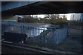
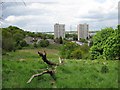
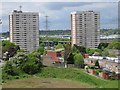
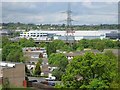
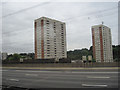
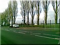
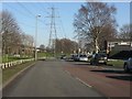
26 photos from this area
Area Information
Key information about the B36 8UN including its size, population, and administrative classification.
- Area Type
- Postcode
- Area Size
- 6496 m²
- Population
- 1514
- Population Density
- 3193 people/km²
House Prices in B36 8UN
22
Properties
£104,029
Average Sold Price
£26,840
Lowest Price
£155,000
Highest Price
Showing 22 properties
| Address | Type | Beds | Baths | Last Sale Price | Last Sale Date | |
|---|---|---|---|---|---|---|
| 28 Haydock Close, Birmingham, B36 8UN | Terraced | 3 | 1 | £155,000 | Oct 2024 | |
| 22 Haydock Close, Birmingham, B36 8UN | Terraced | 3 | 1 | £150,000 | Jan 2021 | |
| 40 Haydock Close, Birmingham, B36 8UN | Terraced | 3 | 1 | £135,000 | Aug 2019 | |
| 14 Haydock Close, Birmingham, B36 8UN | Terraced | 4 | 1 | £140,000 | Aug 2018 | |
| 10 Haydock Close, Birmingham, B36 8UN | Terraced | 3 | 1 | £115,000 | Jul 2016 | |
| 32 Haydock Close, Birmingham, B36 8UN | Terraced | - | - | £102,950 | Aug 2007 | |
| 20 Haydock Close, Birmingham, B36 8UN | house | - | - | £92,500 | May 2006 | |
| 38 Haydock Close, Birmingham, B36 8UN | house | - | - | £77,500 | Mar 2003 | |
| 16 Haydock Close, Birmingham, B36 8UN | Terraced | - | - | £45,500 | Sep 2001 | |
| 12 Haydock Close, Birmingham, B36 8UN | Terraced | - | - | £26,840 | Dec 2000 |
Page 1 of 3
Energy Efficiency in B36 8UN
Amenities
Schools
| Rank | School | Type | Entry gender | Ages |
|---|
Explore more schools in this area
Go to Schools tabDemographics
Household Size
Family (3-5 people)
most common
Accommodation Type
Houses
most common
Tenure
60
majority
Ethnic Group
White
most common
Religion
N/A
most common
Household Composition
N/A
most common
Age
47
median
Adults (30-64 years)
most common
Household Deprivation
N/A
with no deprivation
NS-SEC
16
in Lower managerial occupations
Explore more demographic insights in this area
Go to Demographics tabPlanning
Planning Constraints
- Flood RiskPremium
- Ramsar Wetland SitesPremium
- Area of Outstanding Natural BeautyPremium
- Protected Nature ReservePremium
- Protected WoodlandPremium