Area Overview for B36 8TG
Photos of B36 8TG


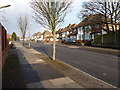
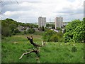
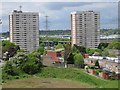
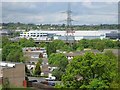
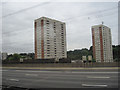
26 photos from this area
Area Information
Key information about the B36 8TG including its size, population, and administrative classification.
- Area Type
- Postcode
- Area Size
- 1.0 hectares
- Population
- 2211
- Population Density
- 6424 people/km²
House Prices in B36 8TG
25
Properties
£130,465
Average Sold Price
£79,950
Lowest Price
£215,000
Highest Price
Showing 25 properties
| Address | Type | Beds | Baths | Last Sale Price | Last Sale Date | |
|---|---|---|---|---|---|---|
| 124 Bromford Road, Birmingham, B36 8TG | Terraced | 3 | - | £150,000 | Aug 2025 | |
| 104 Bromford Road, Birmingham, B36 8TG | Semi-detached | 3 | 1 | £190,000 | Apr 2023 | |
| 94 Bromford Road, Birmingham, B36 8TG | house | - | - | £118,000 | Nov 2021 | |
| 84 Bromford Road, Birmingham, B36 8TG | house | - | - | £215,000 | Oct 2021 | |
| 120 Bromford Road, Birmingham, B36 8TG | house | - | - | £170,000 | Jul 2021 | |
| 92 Bromford Road, Birmingham, B36 8TG | Terraced | 3 | - | £100,000 | May 2020 | |
| 118 Bromford Road, Birmingham, B36 8TG | Terraced | - | - | £100,000 | Sep 2018 | |
| 130 Bromford Road, Birmingham, B36 8TG | house | - | - | £130,000 | Aug 2018 | |
| 102 Bromford Road, Birmingham, B36 8TG | Terraced | 3 | 1 | £163,000 | Mar 2018 | |
| 122 Bromford Road, Birmingham, B36 8TG | Terraced | 3 | 1 | £114,950 | Nov 2016 |
Page 1 of 3
Energy Efficiency in B36 8TG
Amenities
Schools
| Rank | School | Type | Entry gender | Ages |
|---|
Explore more schools in this area
Go to Schools tabDemographics
Household Size
Family (3-5 people)
most common
Accommodation Type
Houses
most common
Tenure
68
majority
Ethnic Group
asian_total
most common
Religion
N/A
most common
Household Composition
N/A
most common
Age
47
median
Adults (30-64 years)
most common
Household Deprivation
N/A
with no deprivation
NS-SEC
19
in Lower managerial occupations
Explore more demographic insights in this area
Go to Demographics tabPlanning
Planning Constraints
- Flood RiskPremium
- Ramsar Wetland SitesPremium
- Area of Outstanding Natural BeautyPremium
- Protected Nature ReservePremium
- Protected WoodlandPremium