Area Overview for B36 8LQ
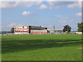
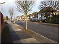
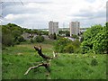
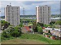
Photos of B36 8LQ


Area Information
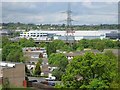
Living in B36 8LQ, a small residential cluster in Bromford & Hodge Hill, offers a blend of suburban tranquillity and proximity to Birmingham’s urban infrastructure. With a population of 1,987, this area is part of a larger ward that includes post-war housing estates like the Bromford Estate and The Firs, alongside industrial zones north of the M6 motorway. The community is defined by its diversity, with a significant Asian population and a median age of 22, though the most common age range is adults aged 30–64. Historically, the area was shaped by industries such as steel production and milling, with remnants like the former Bromford Mill and Hodge Hill Common adding character. Open spaces, including the Cole Valley Nature Conservation Area, contrast with the residential fabric. While the M6 divides industrial and residential areas, initiatives like Firs and Bromford Neighbours Together aim to strengthen local ties. For buyers, this area balances affordability with access to transport networks and amenities, though its smaller size means proximity to Birmingham’s city centre is key.
- Area Type
- Postcode
- Area Size
- Not available
- Population
- 1987
- Population Density
- 7811 people/km²
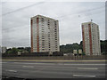
The property market in B36 8LQ is characterised by a high rate of home ownership (74%) and a predominance of houses over flats, suggesting a focus on owner-occupied properties rather than rental units. This aligns with the area’s post-war housing estates, which were built to accommodate growing families. The concentration of houses implies a more spacious, suburban living environment, though the small size of the postcode area means the housing stock is limited to immediate surroundings. For buyers, this suggests a market where properties are likely to be long-term investments rather than short-term rentals. The lack of flats may appeal to those seeking larger living spaces, but it also means fewer options for first-time buyers or those seeking smaller units. The area’s proximity to Birmingham’s industrial zones may influence property values, though specific price trends are not available.
House Prices in B36 8LQ
No properties found in this postcode.
Energy Efficiency in B36 8LQ
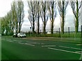
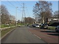
Residents of B36 8LQ have access to a range of amenities within practical reach, including retail options like Spar, Tesco Hodge, and Aldi Hodge, which cater to daily shopping needs. The area’s proximity to rail stations such as Stechford and Lea Hall, along with metro stops like Bull Street and Corporation Street, ensures connectivity to Birmingham’s wider transport network. Open spaces like Hodge Hill Common and the Cole Valley Nature Conservation Area provide opportunities for outdoor recreation, contrasting with the residential and industrial surroundings. While the area lacks major commercial centres, its smaller scale means amenities are concentrated in nearby towns. The presence of historical sites, such as the former Bromford Mill, adds cultural value. For those prioritising convenience, the mix of retail, transport, and green spaces offers a balanced lifestyle, though the area’s industrial heritage may influence its character.
Amenities
Schools
| Rank | School | Type | Entry gender | Ages |
|---|
Explore more schools in this area
Go to Schools tabDemographics
The community in B36 8LQ is predominantly composed of adults aged 30–64, with a median age of 22, reflecting a mix of younger and middle-aged residents. Home ownership is high at 74%, with houses being the primary accommodation type, suggesting a stable, family-oriented demographic. The area’s predominant ethnic group is Asian_total, contributing to a diverse population that is more ethnically varied than Birmingham as a whole. This diversity is accompanied by a younger age profile, which may influence local services and amenities. The high home ownership rate indicates a long-term presence of residents, though the data does not specify income levels or deprivation rates. The absence of detailed socioeconomic data means that while the area’s demographic profile is clear, its economic challenges or advantages remain unexplored.
Household Size
Accommodation Type
Tenure
Ethnic Group
Religion
Household Composition
Age
Household Deprivation
NS-SEC
Explore more demographic insights in this area
Go to Demographics tabPlanning
Planning Constraints
- Flood RiskPremium
- Ramsar Wetland SitesPremium
- Area of Outstanding Natural BeautyPremium
- Protected Nature ReservePremium
- Protected WoodlandPremium
- Crime RiskPremium