Area Overview for B36 8HF
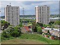
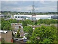
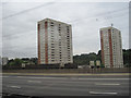
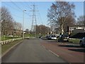
Photos of B36 8HF


Area Information
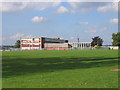
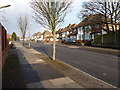
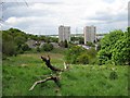
B36 8HF lies within the Bromford & Hodge Hill area of east Birmingham, a suburban ward defined by its mix of post-war housing estates and industrial zones. With a population of 2,211, it is a small, tightly knit community situated approximately 7km east of Birmingham city centre. The area is bordered by the River Tame and River Cole, and its history is steeped in industrial heritage, from the 13th-century Bromford Bridge to the former steelworks of Fort Dunlop. Residents live in a landscape divided by the M6 motorway, with residential clusters like the Bromford Estate and The Firs contrasting with industrial parks such as Bromford Gate. The area’s character is shaped by its open spaces, including Hodge Hill Common, and community initiatives like Bromford Neighbours Together. Daily life here balances suburban tranquillity with proximity to Birmingham’s urban amenities, though transport links between industrial and residential zones remain limited.
- Area Type
- Postcode
- Area Size
- Not available
- Population
- 2211
- Population Density
- 6424 people/km²
The property market in B36 8HF is characterised by a high rate of home ownership (68%) and a predominance of houses, indicating a focus on family-oriented, owner-occupied housing. This suggests that the area is not primarily a rental market, though the exact proportion of rental properties is not specified. The presence of post-war housing estates such as the Firs and Bromford Estate, built in the 1950s and 1960s, implies a stock of mid-20th-century properties. Given the small size of the postcode area and its proximity to Birmingham, buyers should consider the limited availability of alternative property types, such as flats or newer developments. The market may appeal to those seeking larger homes in a suburban setting, but the lack of detailed data on property prices or recent developments means potential buyers should conduct further local research.
House Prices in B36 8HF
No properties found in this postcode.
Energy Efficiency in B36 8HF
Residents of B36 8HF have access to a range of amenities within practical reach, including retail options like Tesco Hodge, Iceland Washwood, and Aldi Hodge, which cater to everyday shopping needs. The area’s proximity to rail and metro stations ensures easy access to Birmingham’s urban centres, while open spaces such as Hodge Hill Common and the Cole Valley Nature Conservation Area provide opportunities for recreation. The historical Bromford Mill site and Fort Dunlop industrial park add a layer of local interest, though the area’s character is defined by its post-war housing estates and community initiatives. The mix of retail, transport, and green spaces contributes to a lifestyle that balances suburban convenience with access to urban amenities, though the lack of additional leisure facilities may require residents to venture further for cultural or entertainment options.
Amenities
Schools
The nearest school to B36 8HF is the Heart of Birmingham Vocational College, a special school catering to students with specific educational needs. No other schools are listed in the data, so families with children may need to look beyond the immediate area for mainstream primary or secondary education. The presence of a vocational school highlights the area’s focus on specialist education, though it does not provide a full range of school types. Parents seeking a broader selection of schools may find it necessary to explore nearby postcodes or consider commuting to larger educational hubs in Birmingham. The absence of additional schools in the data underscores the importance of verifying local options before relocating.
| Rank | School | Type | Entry gender | Ages |
|---|
Explore more schools in this area
Go to Schools tabDemographics
The population of B36 8HF has a median age of 47, with the majority of residents aged between 30 and 64. Home ownership is strong, with 68% of properties owned by their occupants, reflecting a community rooted in long-term residency. The accommodation type is predominantly houses, suggesting a mix of family homes and larger properties. The predominant ethnic group is the Asian community, which constitutes the largest share of the population. This demographic profile indicates a stable, middle-aged population with established ties to the area. While deprivation data is not explicitly provided, the higher proportion of home ownership and the presence of post-war housing estates suggest a mix of socioeconomic backgrounds. The area’s diversity is evident in its cultural fabric, though specific data on deprivation or income levels is absent.
Household Size
Accommodation Type
Tenure
Ethnic Group
Religion
Household Composition
Age
Household Deprivation
NS-SEC
Explore more demographic insights in this area
Go to Demographics tabPlanning
Planning Constraints
- Flood RiskPremium
- Ramsar Wetland SitesPremium
- Area of Outstanding Natural BeautyPremium
- Protected Nature ReservePremium
- Protected WoodlandPremium