Area Overview for B36 8ES
Photos of B36 8ES


Area Information
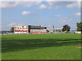
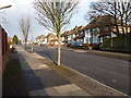
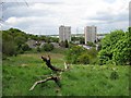
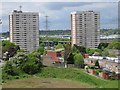
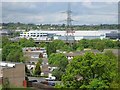
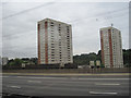
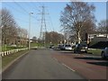
Living in B36 8ES means being part of a small, tightly knit residential cluster in east Birmingham, where the population of 2,098 reflects a community shaped by post-war housing developments and historical industrial activity. This area, encompassing parts of Bromford and Hodge Hill, sits around 7km east of Birmingham city centre, bordered by the River Tame and River Cole. Its character is defined by a mix of post-war housing estates, like the Bromford Estate, and open spaces such as Hodge Hill Common. The area’s demographics include a higher proportion of Asian residents and a younger age profile than the city overall, with most residents aged 30–64. Daily life balances proximity to industrial zones north of the M6 motorway with access to retail and transport hubs. While the area’s separation between residential and industrial zones is notable, initiatives like local community groups aim to strengthen social ties. For buyers, B36 8ES offers a compact, affordable footprint with a blend of practical living and historical roots.
- Area Type
- Postcode
- Area Size
- Not available
- Population
- 2098
- Population Density
- 6823 people/km²
The property market in B36 8ES is dominated by owner-occupied homes, with 86% of residents living in their own properties. Houses, rather than flats or apartments, make up the majority of the accommodation stock, reflecting a preference for family-friendly, standalone living. This suggests a market that caters to long-term residents rather than renters, though specific rental data is not available. The small size of the area means the housing stock is limited, with properties likely concentrated around post-war estates and nearby developments. Buyers should consider the proximity to industrial zones and the M6 motorway, which may influence property values and desirability. The high home ownership rate indicates a stable market, but the lack of newer developments may limit options for those seeking modern housing.
House Prices in B36 8ES
No properties found in this postcode.
Energy Efficiency in B36 8ES
Residents of B36 8ES enjoy a range of amenities within practical reach, including retail options like Spar, Tesco Hodge, and Aldi Hodge. These shops provide everyday essentials, supporting a convenient lifestyle. The area’s transport links, including rail and metro stations, connect residents to Birmingham’s broader network, enhancing accessibility for work, leisure, and shopping. Open spaces such as Hodge Hill Common and the Cole Valley Nature Conservation Area offer opportunities for outdoor activities, contrasting with the post-war housing estates that dominate the residential landscape. While the area lacks major commercial hubs, its proximity to industrial zones and transport corridors ensures a balance between practicality and green spaces. This mix of retail, transport, and natural areas contributes to a lifestyle that prioritises accessibility and community.
Amenities
Schools
Residents of B36 8ES have access to several primary schools, including Bromford Infant School, Bromford Junior School, and Hodge Hill Primary School. The latter is notable for its Ofsted rating of “good,” reflecting its quality of education. These schools serve the local community, offering a range of primary education options for families with young children. The absence of secondary schools in the immediate area means students may need to travel to nearby districts for further education. The presence of multiple primary schools suggests a focus on early education, which is crucial for families prioritising proximity to schools. However, the lack of secondary-level institutions could be a consideration for those planning long-term in the area.
| Rank | School | Type | Entry gender | Ages |
|---|
Explore more schools in this area
Go to Schools tabDemographics
The population of B36 8ES has a median age of 22, though the most common age range is 30–64 years, indicating a community skewed toward working-age adults. Home ownership is high at 86%, with houses being the predominant accommodation type. The area’s demographic profile is marked by a significant Asian population, reflecting broader trends in Birmingham’s diversity. This mix influences local culture and community dynamics, though specific data on deprivation or socioeconomic challenges is not provided. The high home ownership rate suggests a stable, long-term resident base, with many families residing in owner-occupied properties. The presence of post-war housing estates and the absence of younger age groups (under 20) may indicate a community focused on established households rather than transient populations.
Household Size
Accommodation Type
Tenure
Ethnic Group
Religion
Household Composition
Age
Household Deprivation
NS-SEC
Explore more demographic insights in this area
Go to Demographics tabPlanning
Planning Constraints
- Flood RiskPremium
- Ramsar Wetland SitesPremium
- Area of Outstanding Natural BeautyPremium
- Protected Nature ReservePremium
- Protected WoodlandPremium