Area Overview for B36 8DL
Photos of B36 8DL
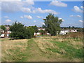
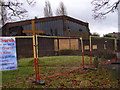
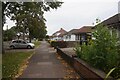
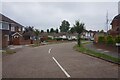
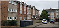
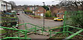
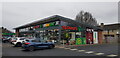
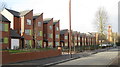

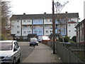
33 photos from this area
Area Information
Key information about the B36 8DL including its size, population, and administrative classification.
- Area Type
- Postcode
- Area Size
- 4333 m²
- Population
- 1792
- Population Density
- 5866 people/km²
House Prices in B36 8DL
10
Properties
£129,875
Average Sold Price
£67,000
Lowest Price
£231,000
Highest Price
Showing 10 properties
| Address | Type | Beds | Baths | Last Sale Price | Last Sale Date | |
|---|---|---|---|---|---|---|
| 27 Chipperfield Road, Birmingham, B36 8DL | Semi-detached | 3 | 1 | £231,000 | Jul 2025 | |
| 39 Chipperfield Road, Birmingham, B36 8DL | house | - | - | £148,000 | Jan 2013 | |
| 33 Chipperfield Road, Birmingham, B36 8DL | house | - | - | £110,000 | Jan 2009 | |
| 37 Chipperfield Road, Birmingham, B36 8DL | house | - | - | £140,000 | Jul 2008 | |
| 21 Chipperfield Road, Birmingham, B36 8DL | Terraced | 3 | 1 | £141,000 | Jan 2008 | |
| 23 Chipperfield Road, Birmingham, B36 8DL | house | - | - | £120,000 | Aug 2004 | |
| 31 Chipperfield Road, Birmingham, B36 8DL | Semi-detached | - | - | £82,000 | Feb 2003 | |
| 29 Chipperfield Road, Birmingham, B36 8DL | house | 3 | - | £67,000 | Feb 2003 | |
| 25 Chipperfield Road, Birmingham, B36 8DL | Semi-detached | - | - | - | - | |
| 35 Chipperfield Road, Birmingham, B36 8DL | Semi-detached | - | - | - | - |
Energy Efficiency in B36 8DL
Amenities
Schools
| Rank | School | Type | Entry gender | Ages |
|---|
Explore more schools in this area
Go to Schools tabDemographics
Household Size
Family (3-5 people)
most common
Accommodation Type
Houses
most common
Tenure
77
majority
Ethnic Group
asian_total
most common
Religion
N/A
most common
Household Composition
N/A
most common
Age
47
median
Adults (30-64 years)
most common
Household Deprivation
N/A
with no deprivation
NS-SEC
20
in Lower managerial occupations
Explore more demographic insights in this area
Go to Demographics tabPlanning
Planning Constraints
- Flood RiskPremium
- Ramsar Wetland SitesPremium
- Area of Outstanding Natural BeautyPremium
- Protected Nature ReservePremium
- Protected WoodlandPremium