Area Overview for B36 8AS
Photos of B36 8AS
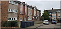
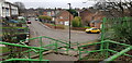

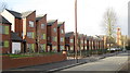

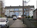
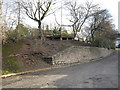
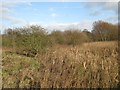
33 photos from this area
Area Information
Key information about the B36 8AS including its size, population, and administrative classification.
- Area Type
- Postcode
- Area Size
- 2.1 hectares
- Population
- 1371
- Population Density
- 9062 people/km²
House Prices in B36 8AS
68
Properties
£130,419
Average Sold Price
£24,000
Lowest Price
£245,000
Highest Price
Showing 68 properties
| Address | Type | Beds | Baths | Last Sale Price | Last Sale Date | |
|---|---|---|---|---|---|---|
| 138 Ermington Crescent, Birmingham, B36 8AS | Semi-detached | 3 | 1 | £245,000 | Sep 2025 | |
| 122 Ermington Crescent, Birmingham, B36 8AS | Semi-detached | 3 | 1 | £229,000 | Mar 2024 | |
| 162 Ermington Crescent, Birmingham, B36 8AS | house | - | - | £226,000 | Mar 2022 | |
| 168 Ermington Crescent, Birmingham, B36 8AS | house | 3 | 1 | £99,908 | Jan 2022 | |
| 121 Ermington Crescent, Birmingham, B36 8AS | house | - | - | £165,000 | Aug 2021 | |
| 149 Ermington Crescent, Birmingham, B36 8AS | Semi-detached | 3 | 1 | £175,000 | Apr 2021 | |
| 150 Ermington Crescent, Birmingham, B36 8AS | Semi-detached | 4 | - | £213,500 | Mar 2021 | |
| 109 Ermington Crescent, Birmingham, B36 8AS | Semi-detached | 3 | 1 | £216,000 | Oct 2020 | |
| 135 Ermington Crescent, Birmingham, B36 8AS | Semi-detached | 3 | 1 | £169,000 | Dec 2019 | |
| 130 Ermington Crescent, Birmingham, B36 8AS | Semi-detached | 3 | 1 | £163,500 | Sep 2019 |
Page 1 of 7
Energy Efficiency in B36 8AS
Amenities
Schools
| Rank | School | Type | Entry gender | Ages |
|---|
Explore more schools in this area
Go to Schools tabDemographics
Household Size
One person
most common
Accommodation Type
Houses
most common
Tenure
34
majority
Ethnic Group
White
most common
Religion
N/A
most common
Household Composition
N/A
most common
Age
47
median
Adults (30-64 years)
most common
Household Deprivation
N/A
with no deprivation
NS-SEC
13
in Lower managerial occupations
Explore more demographic insights in this area
Go to Demographics tabPlanning
Planning Constraints
- Flood RiskPremium
- Ramsar Wetland SitesPremium
- Area of Outstanding Natural BeautyPremium
- Protected Nature ReservePremium
- Protected WoodlandPremium