Area Overview for B36 0ST
Photos of B36 0ST

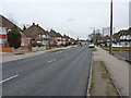
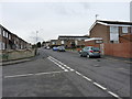


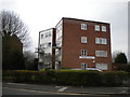
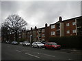


28 photos from this area
Area Information
Key information about the B36 0ST including its size, population, and administrative classification.
- Area Type
- Postcode
- Area Size
- 9702 m²
- Population
- 1421
- Population Density
- 7956 people/km²
House Prices in B36 0ST
39
Properties
£117,075
Average Sold Price
£20,000
Lowest Price
£235,000
Highest Price
Showing 39 properties
| Address | Type | Beds | Baths | Last Sale Price | Last Sale Date | |
|---|---|---|---|---|---|---|
| 84 Tamar Drive, Smiths Wood, Solihull, B36 0ST | Terraced | 3 | 1 | £180,000 | Feb 2024 | |
| 65 Tamar Drive, Smiths Wood, Solihull, B36 0ST | Terraced | 1 | 1 | £235,000 | Jan 2024 | |
| 80 Tamar Drive, Smiths Wood, Solihull, B36 0ST | house | - | - | £156,000 | Sep 2021 | |
| 86 Tamar Drive, Smiths Wood, Solihull, B36 0ST | Terraced | 3 | - | £129,000 | Jun 2017 | |
| 108 Tamar Drive, Smiths Wood, Solihull, B36 0ST | Terraced | 3 | - | £124,000 | Feb 2017 | |
| 100 Tamar Drive, Smiths Wood, Solihull, B36 0ST | Terraced | 3 | - | £117,000 | Mar 2016 | |
| 58 Tamar Drive, Smiths Wood, Solihull, B36 0ST | Flat | 2 | 1 | £64,750 | Oct 2011 | |
| 72 Tamar Drive, Smiths Wood, Solihull, B36 0ST | house | 4 | - | £110,000 | Jul 2011 | |
| 74 Tamar Drive, Smiths Wood, Solihull, B36 0ST | house | - | - | £35,000 | Jan 1999 | |
| 52 Tamar Drive, Smiths Wood, Solihull, B36 0ST | Flat | - | - | £20,000 | Jan 1998 |
Page 1 of 4
Energy Efficiency in B36 0ST
Amenities
Schools
| Rank | School | Type | Entry gender | Ages |
|---|
Explore more schools in this area
Go to Schools tabDemographics
Household Size
Family (3-5 people)
most common
Accommodation Type
Houses
most common
Tenure
35
majority
Ethnic Group
White
most common
Religion
N/A
most common
Household Composition
N/A
most common
Age
47
median
Adults (30-64 years)
most common
Household Deprivation
N/A
with no deprivation
NS-SEC
16
in Lower managerial occupations
Explore more demographic insights in this area
Go to Demographics tabPlanning
Planning Constraints
- Flood RiskPremium
- Ramsar Wetland SitesPremium
- Area of Outstanding Natural BeautyPremium
- Protected Nature ReservePremium
- Protected WoodlandPremium