Area Overview for B36 0ET
Photos of B36 0ET
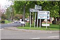


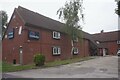
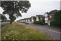
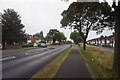
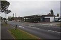
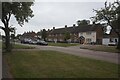
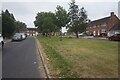

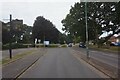
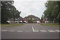
30 photos from this area
Area Information
Key information about the B36 0ET including its size, population, and administrative classification.
- Area Type
- Postcode
- Area Size
- 3.3 hectares
- Population
- 1519
- Population Density
- 4956 people/km²
House Prices in B36 0ET
58
Properties
£192,960
Average Sold Price
£53,000
Lowest Price
£358,000
Highest Price
Showing 58 properties
| Address | Type | Beds | Baths | Last Sale Price | Last Sale Date | |
|---|---|---|---|---|---|---|
| 237 Chester Road, Solihull, B36 0ET | Semi-detached | 3 | - | £358,000 | Dec 2024 | |
| 215 Chester Road, Solihull, B36 0ET | Semi-detached | 3 | 1 | £245,000 | Dec 2024 | |
| 203 Chester Road, Solihull, B36 0ET | Semi-detached | 3 | 1 | £255,000 | Sep 2024 | |
| 191 Chester Road, Solihull, B36 0ET | Retail | 3 | 1 | £287,500 | Mar 2022 | |
| 245 Chester Road, Solihull, B36 0ET | Semi-detached | 3 | 1 | £270,000 | Apr 2021 | |
| 223 Chester Road, Solihull, B36 0ET | Semi-detached | 3 | - | £297,500 | Mar 2021 | |
| 233 Chester Road, Solihull, B36 0ET | house | - | - | £285,000 | Mar 2021 | |
| 241 Chester Road, Solihull, B36 0ET | house | - | - | £280,000 | Jan 2021 | |
| 257 Chester Road, Solihull, B36 0ET | Semi-detached | 3 | 1 | £275,000 | May 2019 | |
| 249 Chester Road, Solihull, B36 0ET | Semi-detached | 5 | 1 | £315,000 | Mar 2018 |
Page 1 of 6
Energy Efficiency in B36 0ET
Amenities
Schools
| Rank | School | Type | Entry gender | Ages |
|---|
Explore more schools in this area
Go to Schools tabDemographics
Household Size
Two person
most common
Accommodation Type
Houses
most common
Tenure
91
majority
Ethnic Group
White
most common
Religion
N/A
most common
Household Composition
N/A
most common
Age
47
median
Adults (30-64 years)
most common
Household Deprivation
N/A
with no deprivation
NS-SEC
33
in Lower managerial occupations
Explore more demographic insights in this area
Go to Demographics tabPlanning
Planning Constraints
- Flood RiskPremium
- Ramsar Wetland SitesPremium
- Area of Outstanding Natural BeautyPremium
- Protected Nature ReservePremium
- Protected WoodlandPremium