Area Overview for B36 0DB
Photos of B36 0DB
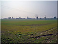

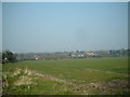
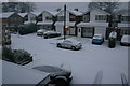

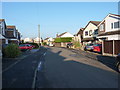
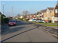
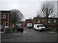

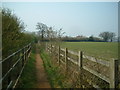


19 photos from this area
Area Information
Key information about the B36 0DB including its size, population, and administrative classification.
- Area Type
- Postcode
- Area Size
- 8824 m²
- Population
- 1553
- Population Density
- 7018 people/km²
House Prices in B36 0DB
30
Properties
£86,661
Average Sold Price
£38,500
Lowest Price
£135,000
Highest Price
Showing 30 properties
| Address | Type | Beds | Baths | Last Sale Price | Last Sale Date | |
|---|---|---|---|---|---|---|
| 526 Auckland Drive, Smiths Wood, Solihull, B36 0DB | house | - | - | £135,000 | Dec 2020 | |
| 534 Auckland Drive, Smiths Wood, Solihull, B36 0DB | Terraced | 3 | - | £129,000 | Mar 2017 | |
| 560 Auckland Drive, Smiths Wood, Solihull, B36 0DB | house | 2 | 1 | £107,000 | Sep 2016 | |
| 502 Auckland Drive, Smiths Wood, Solihull, B36 0DB | Terraced | 3 | - | £97,000 | Oct 2015 | |
| 556 Auckland Drive, Smiths Wood, Solihull, B36 0DB | Terraced | 2 | 1 | £79,000 | Nov 2014 | |
| 538 Auckland Drive, Smiths Wood, Solihull, B36 0DB | Terraced | 3 | 1 | £77,500 | Apr 2013 | |
| 520 Auckland Drive, Smiths Wood, Solihull, B36 0DB | Terraced | - | - | £97,000 | Oct 2006 | |
| 500 Auckland Drive, Smiths Wood, Solihull, B36 0DB | house | - | - | £125,000 | Aug 2006 | |
| 536 Auckland Drive, Smiths Wood, Solihull, B36 0DB | Terraced | - | - | £96,950 | Jul 2005 | |
| 504 Auckland Drive, Smiths Wood, Solihull, B36 0DB | house | - | - | £85,000 | Apr 2003 |
Page 1 of 3
Energy Efficiency in B36 0DB
Amenities
Schools
| Rank | School | Type | Entry gender | Ages |
|---|
Explore more schools in this area
Go to Schools tabDemographics
Household Size
Family (3-5 people)
most common
Accommodation Type
Houses
most common
Tenure
57
majority
Ethnic Group
White
most common
Religion
N/A
most common
Household Composition
N/A
most common
Age
47
median
Adults (30-64 years)
most common
Household Deprivation
N/A
with no deprivation
NS-SEC
18
in Lower managerial occupations
Explore more demographic insights in this area
Go to Demographics tabPlanning
Planning Constraints
- Flood RiskPremium
- Ramsar Wetland SitesPremium
- Area of Outstanding Natural BeautyPremium
- Protected Nature ReservePremium
- Protected WoodlandPremium