Area Overview for B35 7DA
Photos of B35 7DA
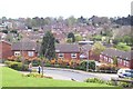
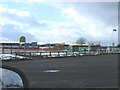
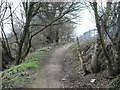
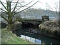

46 photos from this area
Area Information
Key information about the B35 7DA including its size, population, and administrative classification.
- Area Type
- Postcode
- Area Size
- 7709 m²
- Population
- 1575
- Population Density
- 5959 people/km²
House Prices in B35 7DA
27
Properties
£135,994
Average Sold Price
£41,000
Lowest Price
£200,000
Highest Price
Showing 27 properties
| Address | Type | Beds | Baths | Last Sale Price | Last Sale Date | |
|---|---|---|---|---|---|---|
| 43 Beale Close, Birmingham, B35 7DA | Terraced | 3 | 1 | £195,000 | Dec 2023 | |
| 25 Beale Close, Birmingham, B35 7DA | Terraced | 3 | 1 | £200,000 | Apr 2023 | |
| 18 Beale Close, Birmingham, B35 7DA | Retail | 3 | 1 | £190,000 | May 2022 | |
| 45 Beale Close, Birmingham, B35 7DA | Terraced | 3 | 1 | £145,000 | Aug 2020 | |
| 29 Beale Close, Birmingham, B35 7DA | Terraced | 3 | 1 | £158,000 | Jan 2020 | |
| 49 Beale Close, Birmingham, B35 7DA | Terraced | 3 | 1 | £150,000 | Aug 2019 | |
| 51 Beale Close, Birmingham, B35 7DA | house | - | - | £89,950 | Mar 2003 | |
| 37 Beale Close, Birmingham, B35 7DA | Terraced | - | - | £55,000 | Sep 2002 | |
| 39 Beale Close, Birmingham, B35 7DA | Terraced | 3 | - | £41,000 | Jun 2000 | |
| 5 Beale Close, Birmingham, B35 7DA | Flat | - | - | - | - |
Page 1 of 3
Energy Efficiency in B35 7DA
Amenities
Schools
| Rank | School | Type | Entry gender | Ages |
|---|
Explore more schools in this area
Go to Schools tabDemographics
Household Size
One person
most common
Accommodation Type
Houses
most common
Tenure
25
majority
Ethnic Group
White
most common
Religion
N/A
most common
Household Composition
N/A
most common
Age
47
median
Adults (30-64 years)
most common
Household Deprivation
N/A
with no deprivation
NS-SEC
14
in Lower managerial occupations
Explore more demographic insights in this area
Go to Demographics tabPlanning
Planning Constraints
- Flood RiskPremium
- Ramsar Wetland SitesPremium
- Area of Outstanding Natural BeautyPremium
- Protected Nature ReservePremium
- Protected WoodlandPremium