Area Overview for B35 6AR
Photos of B35 6AR
Area Information
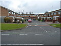
Living in B35 6AR means residing within Castle Vale, a distinct residential cluster in eastern Birmingham. This specific postcode covers a small group of homes situated within the larger housing estate that once occupied the Castle Bromwich Aerodrome site. You are part of a community of 1,521 people spread across a 2.5 km² area. Locals often describe the character of the estate as having transformed significantly since the 1990s. The area was built between 1964 and 1969 on the site of a major airfield that served both World Wars. Today, the neighbourhood features a mix of family households and mature residents. The landscape includes a 15-kilometre network of footpaths created during Project Wagtail, with key facilities like The Sanctuary providing a central meeting point. Daily life here involves a focus on local community venues such as the primary care centre on Tangmere Drive and proximity to several railway lines. While the area retains historical significance as a postwar overspill estate, substantial regeneration efforts have altered the living environment. Residents now enjoy improved conditions following a decade-long renewal project that began in 1993. The postcode serves as a gateway to wider shopping and transport hubs just outside the estate perimeter, blending local convenience with city centre access.
- Area Type
- Postcode
- Area Size
- Not available
- Population
- 1521
- Population Density
- 1300 people/km²
The property market in B35 6AR revolves around specific housing characteristics rather than luxury or high-value placements. Houses dominate the accommodation type, distinguishing this cluster from blocks of flats found in other Birmingham areas. Currently, 42% of homes in this postcode area are owner-occupied, which means over half the residents are renters. You are looking at a housing stock that has evolved over nearly 60 years, originally built between 1964 and 1969. The regeneration efforts initiated by Castle Vale Housing Action Trust in 1993 have improved conditions, yet the market remains rooted in practical, functional homes rather than speculative developments. The area is not characterised by new-build entrances or exclusive listings. Instead, you will find established residences within a planned community layout that includes retail and office units. Because the postcode covers only a small residential cluster within the 2.5 km² estate, prices are likely influenced by the broader supply and demand dynamics of the Castle Vale estate. The mix of owner-occupied and rented properties suggests a stable yet fluid market. Prospective buyers should expect a range of home styles suited to the large-scale development history. The presence of houses rather than high-rises offers different living conditions compared to the estate's historical peak of seventeen high-rise blocks on Farnborough Road.
House Prices in B35 6AR
No properties found in this postcode.
Energy Efficiency in B35 6AR
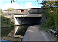
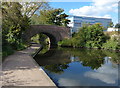
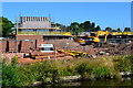
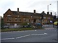
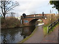
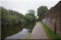
Your lifestyle in B35 6AR benefits from a cluster of amenities located within practical reach of the residential zone. Five retail options are nearby, including Sainsburys Castle, Aldi Chester, and Farmfoods Erdington, ensuring you can access groceries and essentials without travelling far. For public transport, five rail stations serve the immediate vicinity, led by Chester Road Railway Station, Erdington Railway Station, and Wylde Green Railway Station. These stations connect directly to the wider Birmingham network, including connections at Bull Street, St Chads, and Corporation Street for Metro riders. The locale is centred around Tangmere Drive, home to The Sanctuary, a community events venue that opened in May 2000. This 2,500 m² facility serves as a meeting point for local organisations and hosts various activities. A health village has developed here, featuring a primary care centre completed in 2004 at a cost of £4 million. Project Wagtail created a 15-kilometre network of footpaths that bisect the estate, providing safe walking routes. Originally, the area included five schools, two churches, and a swimming pool, though current usage may vary. The five notable retail outlets and five rail stations ensure your daily needs are met with minimal disruption. You can walk to The Sanctuary for community events or visit Aldi Chester for weekly shopping. The integration of health, retail, and transport makes this area conducive to an active, well-connected life.
Amenities
Schools
| Rank | School | Type | Entry gender | Ages |
|---|
Explore more schools in this area
Go to Schools tabDemographics
The community in B35 6AR is defined by a mature population, with a median age of 47 years. The most common age range among residents consists of adults aged between 30 and 64 years. This demographic profile suggests a neighbourhood focused on stability rather than rapid population turnover. Home ownership stands at 42%, indicating that the majority of households in this specific cluster live in rented accommodation. The primary accommodation type is houses, which aligns with the housing stock found throughout the wider estate. Ethnically, the predominant group is White, reflecting a long-established residential history on the site. With a population density of 1,300 people per square kilometre, you will find a compact community where neighbours are often aware of one another. The age structure means schools near the area are likely to cater largely to teenagers and those returning for university or adult education, rather than hosting primary-aged cohorts in high numbers. This demographic reality shapes local interaction, often centring around community events at venues like The Sanctuary or health village activities. The concentration of working-age adults alongside older residents creates a social environment that values established local networks.
Household Size
Accommodation Type
Tenure
Ethnic Group
Religion
Household Composition
Age
Household Deprivation
NS-SEC
Explore more demographic insights in this area
Go to Demographics tabPlanning
Planning Constraints
- Flood RiskPremium
- Ramsar Wetland SitesPremium
- Area of Outstanding Natural BeautyPremium
- Protected Nature ReservePremium
- Protected WoodlandPremium
- Crime RiskPremium