Area Overview for B34 7SP
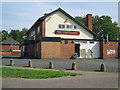
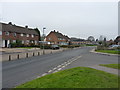
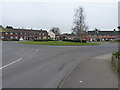
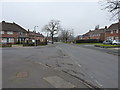
Photos of B34 7SP
Area Information
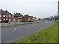
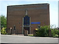
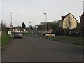
Living in B34 7SP means residing within Shard End, a defined ward in the Hodge Hill district of east Birmingham. This postcode covers a specific residential cluster of 2,369 square metres containing 1,895 people, creating a densely packed urban environment characteristic of post-war development. The area borders Castle Bromwich to the north and Kingshurst to the east, marking a transition zone within the West Midlands. You will find yourself in a location that underwent significant transformation after World War II, shifting from rural farmland to a council housing estate. The narrative of this place includes historic landmarks like All Saints Church, consecrated in 1955, and modern regeneration projects such as All Saints Square, which opened in 2013. Daily life here is shaped by the legacy of the 1940s building plan and compulsory purchases from 1946. You are standing on land that was once part of the manor of Castle Bromwich before being annexed by Birmingham in 1931. The immediate surroundings feature the River Cole, Norman Chamberlain Playing Fields, and the town centre at Shard End Crescent. Despite its small footprint, this area offers a tangible connection to Birmingham's industrial history and its rapid post-war expansion, providing a distinct identity separate from the more leafy suburbs to the north.
- Area Type
- Postcode
- Area Size
- 2369 m²
- Population
- 1895
- Population Density
- 5356 people/km²
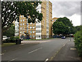
The property market in B34 7SP is characterised by a stock dominated by houses, which serves as the primary accommodation type for the 1,895 residents in this postcode area. With a home ownership rate of exactly 47%, this neighbourhood sits near the balance point of owner-occupiers and renters, suggesting a mixed market dynamic. Unlike many inner-city estates where council tenancies predominated historically, this area has seen significant tenant purchases and private sales, contributing to the substantial number of households buying their homes. The housing stock originates from the post-war development plans initiated in 1945 and construction that began in the late 1940s. You will encounter a mix of original council-built properties and homes that have been improved or converted over the years. The regeneration of All Saints Square in 2013 introduced new homes, office space, and retail units, adding to the variety of properties available. Because this is a small residential cluster covering only 2,369 square metres, new listings may not appear with high frequency, making existing stock vital. The market reflects the long-term residency of the area, with older properties alongside more modern additions from the post-2010 development phase. Buyers should expect a market driven by established properties within a static geographical footprint.
House Prices in B34 7SP
Showing 13 properties
| Address | Type | Beds | Baths | Last Sale Price | Last Sale Date | |
|---|---|---|---|---|---|---|
| 317 Kendrick Avenue, Birmingham, B34 7SP | house | 2 | 1 | £97,500 | Oct 2022 | |
| 313 Kendrick Avenue, Birmingham, B34 7SP | Terraced | - | - | £90,000 | Jul 2021 | |
| 311 Kendrick Avenue, Birmingham, B34 7SP | Terraced | 3 | 1 | £180,000 | Dec 2018 | |
| 303 Kendrick Avenue, Birmingham, B34 7SP | Terraced | 2 | 1 | £70,000 | Sep 2017 | |
| 323 Kendrick Avenue, Birmingham, B34 7SP | house | - | - | £70,000 | Aug 2016 | |
| 309 Kendrick Avenue, Birmingham, B34 7SP | Terraced | 2 | - | £65,000 | Mar 2016 | |
| 301 Kendrick Avenue, Birmingham, B34 7SP | house | 4 | - | £216,400 | Oct 2006 | |
| 299 Kendrick Avenue, Birmingham, B34 7SP | house | - | - | £216,400 | Aug 2006 | |
| 319 Kendrick Avenue, Birmingham, B34 7SP | Terraced | - | - | £83,125 | Mar 2005 | |
| 321 Kendrick Avenue, Birmingham, B34 7SP | Terraced | - | - | £83,125 | Mar 2005 |
Energy Efficiency in B34 7SP
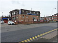
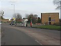
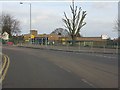
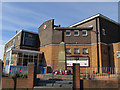
Your lifestyle in B34 7SP is supported by a practical network of amenities located within easy reach. Retail options are plentiful, with five major stores including Morrisons Castle, Aldi Castle, and Farmfoods Castle, ensuring your daily shopping needs are met without long journeys. Beyond grocery retail, you have access to five railway stations within a reasonable distance, such as Lea Hall and Marston Green, which facilitates travel around the region. For larger trips, Birmingham International Airport and Birmingham Intl Railway Station are nearby, alongside the business district at Bull Street. The area itself offers recreational features like Shard End Lake and Norman Chamberlain Playing Fields, which were former gravel pits, providing open space for leisure. Cultural and community life revolves around Shard End Crescent, the village centre known for its shops, pub, and church. The 2013 regeneration of All Saints Square added a post office, library, council office, and new businesses, enhancing the daily convenience factor. You live in an area where essential services and leisure facilities are clustered together, reducing the need for extensive travel for routine errands or weekend activities.
Amenities
Schools
Families living in B34 7SP have several educational options within close proximity, primarily focusing on primary education. Hillstone Primary School stands as a key institution in the area and holds a Ofsted rating of "good", indicating a standard of education that meets government expectations for quality. Longmeadow School operates nearby as another primary option for local children. You do not have specific information regarding secondary schools in this immediate postcode coverage, but the available primary choices provide a solid foundation for early education. The presence of two primary schools suggests that parents can choose between different schools depending on their child's specific needs or catchment considerations. Both institutions serve the immediate residential cluster, ensuring that the youngest residents have access to nearby educational facilities without needing daily travel to distant city schools. This concentration of primary schools supports the demographic reality of a community with many adult residents in the 30 to 64 age range, who are statistically likely to be raising school-aged children.
| Rank | School | Type | Entry gender | Ages |
|---|
Explore more schools in this area
Go to Schools tabDemographics
The community within B34 7SP is defined by a mature population profile, with a median age of 47 years. Most residents fall into the adult category, specifically those between 30 and 64 years old, suggesting a neighbourhood populated by established families and professionals. Almost half of the households, representing 47% of the total, own their homes outright or with a mortgage, while the remaining residents rent their properties. The predominant accommodation type consists of houses, aligning with the historical development of the housing estate from the late 1940s. Demographically, the White ethnic group is the largest demographic in this specific postcode area. This data paints a picture of a stable, predominantly adult community with a strong inclination towards property ownership. The high concentration of adults between the ages of 30 and 64 indicates a settled population rather than a transient student or young professional hub. You are looking at an area where the majority of residents have likely lived here for decades, moving through life stages rather than cycling rapidly through the property market. This stability is evident in the high home ownership rate compared to many other urban districts. The population density is simply a function of the limited land size holding nearly 1,900 people, creating an urban feel without the sprawling growth of larger metropolitan wards.
Household Size
Accommodation Type
Tenure
Ethnic Group
Religion
Household Composition
Age
Household Deprivation
NS-SEC
Explore more demographic insights in this area
Go to Demographics tabPlanning
Planning Constraints
- Flood RiskPremium
- Ramsar Wetland SitesPremium
- Area of Outstanding Natural BeautyPremium
- Protected Nature ReservePremium
- Protected WoodlandPremium