Area Overview for B34 6SZ
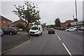
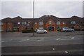
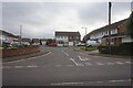
Photos of B34 6SZ

Area Information
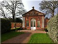
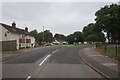
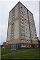
Living in B34 6SZ means residing in Shard End, a post-war housing estate located in the Hodge Hill district of east Birmingham. This postcode covers a specific residential cluster with a population of 1,559 people. The area borders Castle Bromwich to the north and Kingshurst to the east. Historically part of the manor of Castle Bromwich, the land remained rural until major development occurred after World War II. Town planning began in 1945, with building starting in the late 1940s along Coleshill Road, Bradford Road, and Chester Road. The character of B34 6SZ is defined by its urban council housing stock, featuring tower blocks alongside improved residential areas where tenants have purchased their homes. A 2013 regeneration project transformed All Saints Square into a modern hub containing a library, council office, post office, and new businesses. You will find the Shard End Crescent village centre offers local shops, a pub, and the rebuilt All Saints Church. The area retains significant green spaces, including Shard End Lake and Norman Chamberlain Playing Fields, which were formerly a gravel pit. Daily life here blends convenience with a distinct post-war architectural heritage. The region is bounded by the River Cole and offers a mix of community facilities and structural history that shapes the neighbourhood's unique identity.
- Area Type
- Postcode
- Area Size
- Not available
- Population
- 1559
- Population Density
- 4636 people/km²
The property market in B34 6SZ is characterised by a specific blend of housing stock and ownership patterns. Houses represent the predominant form of accommodation in this postcode. Forty-four per cent of the 1,559 residents own their homes outright or with a mortgage. This ownership rate indicates that the area is not exclusively a rental market but holds significant value for buyers seeking to settle down. The presence of post-war tower blocks alongside traditional housing suggests a varied investment opportunity, allowing you to choose between modern maisonettes and traditional houses. When evaluating homes in B34 6SZ, you must consider the 2013 regeneration of All Saints Square, which introduced new residential units alongside commercial spaces. The area's history of tenant purchasing programmes has improved conditions in some parts of the estate, particularly Crescent and nearby streets. Buying here offers access to a mature neighbourhood with established infrastructure rather than a speculative new-build development. The mix of houses and flats provides flexibility for different family sizes. Because the area borders Castle Bromwich and Kingshurst, you may find larger properties in the immediate vicinity that command different prices than the core estate. The market reflects a balance between affordable council housing conversions and more private residential properties.
House Prices in B34 6SZ
No properties found in this postcode.
Energy Efficiency in B34 6SZ
Residents of B34 6SZ enjoy immediate access to a range of amenities within practical reach of their homes. The area hosts five notable retail outlets, including Co-op Shard, Iceland Castle, and Tesco Castle, ensuring your daily shopping needs are met without travelling far. Five railway stations, including Lea Hall and Stechford, provide transport links. Nearby metro connections approach Birmingham International Airport and Bull Street railway station, enhancing your mobility beyond the local district. The Shard End Crescent village centre forms the heart of local life, featuring shops, a pub, and the rebuilt All Saints Church. You can visit Shard End Library for quiet study or community events. Nearby, Norman Chamberlain Playing Fields and Shard End Lake offer recreational space for evenings and weekends. The 2013 regeneration of All Saints Square added a modern touch to this historic setting, introducing a diverse mix of businesses and a car park. The Coleshill Road, Bradford Road, and Chester Road borders connect you to broader activities in Hodge Hill and beyond. This blend of retail convenience, transport links, and open spaces creates a balanced lifestyle where you can easily commute, shop, and relax without needing to leave the estate entirely.
Amenities
Schools
Families considering B34 6SZ have two primary primary schools close by, both rated as good by Ofsted. Brownmead Junior and Infant School serves as a local educational option for younger children. Brownmead Primary Academy also operates nearby and holds a good Ofsted rating, ensuring high standards for your children's education. While both institutions are the only schools explicitly listed for this immediate postcode, their proximity means that schooling is a manageable part of the daily routine. The presence of two primary schools suggests a strong local focus on early education. Brownmead Primary Academy's good rating provides assurance to parents regarding academic performance and management standards. Brownmead Junior and Infant School offer a similar catchment area, likely feeding into the same secondary pathways not detailed in this specific dataset. You will not find comprehensive secondary schools directly within the B34 6SZ postcode boundary, but the primary education options are well-regarded. This setup is typical for post-war estates where families often share a common set of educational resources. The good ratings of these schools make B34 6SZ an attractive option for those who prioritise primary education quality without needing to travel far. The local schools are a key asset for anyone relocating here with children.
| Rank | School | Type | Entry gender | Ages |
|---|
Explore more schools in this area
Go to Schools tabDemographics
The community in B34 6SZ consists of 1,559 residents. The median age for the population is 47 years, meaning the most common age group comprises adults between 30 and 64 years old. This demographic profile suggests the area attracts relatively mature buyers and established families rather than young singles or students. Forty-four per cent of households own their homes, indicating a substantial level of stability within the community. The remaining residents likely rent, reflecting a mixed market consistent with many post-war estates. Houses remain the predominant accommodation type in this postcode, shaping the families that call this area home. The predominant ethnic group is White, which aligns with the broader historical context of the Shard End estate. The age distribution suggests that you may encounter fewer young professionals compared to other newer developments in the wider West Midlands. The demographic makeup is stable and settled, with residents who have likely grown up in the area or moved there for its established community feel. The concentration of adults in their prime working years suggests a labour-force community where employment stability is key. This steady population structure supports local services and creates a predictable environment for new arrivals seeking a quiet, neighbourly location.
Household Size
Accommodation Type
Tenure
Ethnic Group
Religion
Household Composition
Age
Household Deprivation
NS-SEC
Explore more demographic insights in this area
Go to Demographics tabPlanning
Planning Constraints
- Flood RiskPremium
- Ramsar Wetland SitesPremium
- Area of Outstanding Natural BeautyPremium
- Protected Nature ReservePremium
- Protected WoodlandPremium