Area Overview for B34 6RA
Photos of B34 6RA
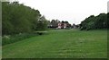
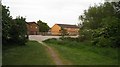
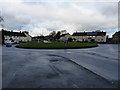
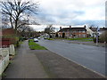
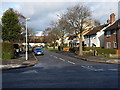
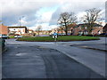
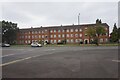
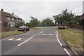
20 photos from this area
Area Information
Key information about the B34 6RA including its size, population, and administrative classification.
- Area Type
- Postcode
- Area Size
- 7820 m²
- Population
- 1559
- Population Density
- 4636 people/km²
House Prices in B34 6RA
26
Properties
£142,929
Average Sold Price
£88,500
Lowest Price
£210,000
Highest Price
Showing 26 properties
| Address | Type | Beds | Baths | Last Sale Price | Last Sale Date | |
|---|---|---|---|---|---|---|
| 35 Moorfield Road, Birmingham, B34 6RA | Terraced | 3 | 1 | £175,000 | Sep 2025 | |
| 37 Moorfield Road, Birmingham, B34 6RA | Terraced | 3 | 1 | £165,000 | Aug 2025 | |
| 10 Moorfield Road, Birmingham, B34 6RA | Semi-detached | 2 | 2 | £210,000 | Jul 2025 | |
| 39 Moorfield Road, Birmingham, B34 6RA | Terraced | 3 | - | £137,000 | Feb 2017 | |
| 2 Moorfield Road, Birmingham, B34 6RA | Semi-detached | 3 | - | £120,000 | Dec 2014 | |
| 33 Moorfield Road, Birmingham, B34 6RA | Terraced | 3 | - | £88,500 | Aug 2013 | |
| 1 Moorfield Road, Birmingham, B34 6RA | Terraced | - | - | £105,000 | Jul 2005 | |
| 16 Moorfield Road, Birmingham, B34 6RA | house | - | - | - | - | |
| 11 Moorfield Road, Birmingham, B34 6RA | Flat | - | - | - | - | |
| 9 Moorfield Road, Birmingham, B34 6RA | Flat | - | - | - | - |
Page 1 of 3
Energy Efficiency in B34 6RA
Amenities
Schools
| Rank | School | Type | Entry gender | Ages |
|---|
Explore more schools in this area
Go to Schools tabDemographics
Household Size
One person
most common
Accommodation Type
Houses
most common
Tenure
44
majority
Ethnic Group
White
most common
Religion
N/A
most common
Household Composition
N/A
most common
Age
47
median
Adults (30-64 years)
most common
Household Deprivation
N/A
with no deprivation
NS-SEC
18
in Lower managerial occupations
Explore more demographic insights in this area
Go to Demographics tabPlanning
Planning Constraints
- Flood RiskPremium
- Ramsar Wetland SitesPremium
- Area of Outstanding Natural BeautyPremium
- Protected Nature ReservePremium
- Protected WoodlandPremium