Area Overview for B34 6QN
Photos of B34 6QN

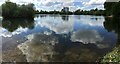
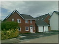
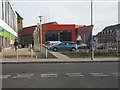
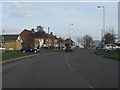

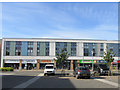

23 photos from this area
Area Information
Key information about the B34 6QN including its size, population, and administrative classification.
- Area Type
- Postcode
- Area Size
- 1.5 hectares
- Population
- 1833
- Population Density
- 6975 people/km²
House Prices in B34 6QN
43
Properties
£91,429
Average Sold Price
£15,200
Lowest Price
£157,000
Highest Price
Showing 43 properties
| Address | Type | Beds | Baths | Last Sale Price | Last Sale Date | |
|---|---|---|---|---|---|---|
| 415 Heath Way, Shard End, Birmingham, B34 6QN | house | 2 | 1 | £157,000 | Dec 2018 | |
| 405 Heath Way, Shard End, Birmingham, B34 6QN | house | - | - | £74,400 | Apr 2018 | |
| 391 Heath Way, Shard End, Birmingham, B34 6QN | Terraced | 2 | - | £130,000 | Dec 2017 | |
| 413 Heath Way, Shard End, Birmingham, B34 6QN | Terraced | 2 | 1 | £80,000 | Aug 2017 | |
| 431 Heath Way, Shard End, Birmingham, B34 6QN | Semi-detached | 2 | 1 | £105,000 | Mar 2013 | |
| 417 Heath Way, Shard End, Birmingham, B34 6QN | house | - | - | £112,000 | Dec 2011 | |
| 429 Heath Way, Shard End, Birmingham, B34 6QN | house | - | - | £112,000 | Feb 2008 | |
| 423 Heath Way, Shard End, Birmingham, B34 6QN | Terraced | - | - | £112,500 | Apr 2005 | |
| 419 Heath Way, Shard End, Birmingham, B34 6QN | Semi-detached | - | - | £107,000 | Dec 2004 | |
| 393 Heath Way, Shard End, Birmingham, B34 6QN | house | - | - | £99,950 | Jul 2004 |
Page 1 of 5
Energy Efficiency in B34 6QN
Amenities
Schools
| Rank | School | Type | Entry gender | Ages |
|---|
Explore more schools in this area
Go to Schools tabDemographics
Household Size
One person
most common
Accommodation Type
Houses
most common
Tenure
43
majority
Ethnic Group
White
most common
Religion
N/A
most common
Household Composition
N/A
most common
Age
47
median
Adults (30-64 years)
most common
Household Deprivation
N/A
with no deprivation
NS-SEC
19
in Lower managerial occupations
Explore more demographic insights in this area
Go to Demographics tabPlanning
Planning Constraints
- Flood RiskPremium
- Ramsar Wetland SitesPremium
- Area of Outstanding Natural BeautyPremium
- Protected Nature ReservePremium
- Protected WoodlandPremium