Area Overview for B34 6LN
Photos of B34 6LN
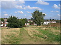
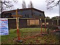
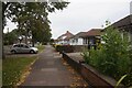
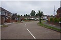
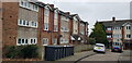
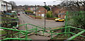
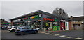
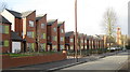
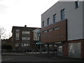
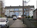
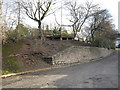
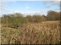
33 photos from this area
Area Information
Key information about the B34 6LN including its size, population, and administrative classification.
- Area Type
- Postcode
- Area Size
- 2.1 hectares
- Population
- 1593
- Population Density
- 5611 people/km²
House Prices in B34 6LN
49
Properties
£182,392
Average Sold Price
£25,500
Lowest Price
£350,000
Highest Price
Showing 49 properties
| Address | Type | Beds | Baths | Last Sale Price | Last Sale Date | |
|---|---|---|---|---|---|---|
| 20 Ashville Avenue, Birmingham, B34 6LN | Detached | 3 | 1 | £310,000 | Mar 2024 | |
| 18 Ashville Avenue, Birmingham, B34 6LN | Retail | 3 | 1 | £325,000 | Sep 2022 | |
| 68 Ashville Avenue, Birmingham, B34 6LN | house | - | - | £285,000 | Sep 2021 | |
| 98 Ashville Avenue, Birmingham, B34 6LN | house | 4 | 1 | £350,000 | Jul 2021 | |
| 46 Ashville Avenue, Birmingham, B34 6LN | Semi-detached | 5 | 1 | £259,000 | Mar 2021 | |
| 52 Ashville Avenue, Birmingham, B34 6LN | house | - | - | £200,000 | Feb 2021 | |
| 100 Ashville Avenue, Birmingham, B34 6LN | Semi-detached | 3 | 1 | £228,000 | Oct 2019 | |
| 80 Ashville Avenue, Birmingham, B34 6LN | Semi-detached | 3 | 1 | £210,000 | May 2019 | |
| 56 Ashville Avenue, Birmingham, B34 6LN | Detached | 3 | 1 | £262,500 | Feb 2019 | |
| 54 Ashville Avenue, Birmingham, B34 6LN | Semi-detached | 3 | 1 | £231,000 | Feb 2019 |
Page 1 of 5
Energy Efficiency in B34 6LN
Amenities
Schools
| Rank | School | Type | Entry gender | Ages |
|---|
Explore more schools in this area
Go to Schools tabDemographics
Household Size
One person
most common
Accommodation Type
Houses
most common
Tenure
66
majority
Ethnic Group
White
most common
Religion
N/A
most common
Household Composition
N/A
most common
Age
47
median
Adults (30-64 years)
most common
Household Deprivation
N/A
with no deprivation
NS-SEC
20
in Lower managerial occupations
Explore more demographic insights in this area
Go to Demographics tabPlanning
Planning Constraints
- Flood RiskPremium
- Ramsar Wetland SitesPremium
- Area of Outstanding Natural BeautyPremium
- Protected Nature ReservePremium
- Protected WoodlandPremium