Area Overview for B34 6HS
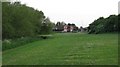
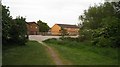
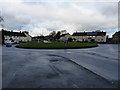
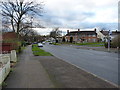
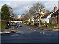
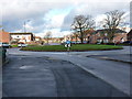
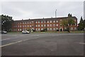
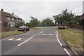
Photos of B34 6HS
Area Information
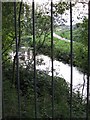
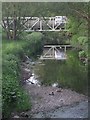
B34 6HS represents a small, tightly packed residential cluster in Bromford and Hodge Hill, just east of Birmingham city centre. This specific postcode covers an area of 7,314 square metres and houses a population of 1,677 residents. The location sits near the coordinates 52.497836, -1.799627, placing it close to the River Tame and River Cole. You are looking at a historic environment where Hodge Hill was first recorded in 1569 and the Domesday Book listed Bromford Mill in 1086 as a corn mill. The area has seen significant development, including the 1950s Firs Estate and the 1966 Bromford Estate built on the former site of the Birmingham Racecourse. The ward boundaries include the M6 motorway, which divides industrial zones to the north from residential neighbourhoods to the east. This separation is a defining feature of daily life here. You can find yourself living within reach of notable landmarks such as Hodge Hill Common and the Fort Shopping Park. The local character remains distinct from the wider city, offering a suburban feel bounded by watercourses and major road infrastructure. Recent community initiatives like Firs and Bromford Neighbours Together, established in 2011, aim to bring neighbours closer together within these established neighbourhoods.
- Area Type
- Postcode
- Area Size
- 7314 m²
- Population
- 1677
- Population Density
- 3669 people/km²
The property market in B34 6HS is dominated by owner-occupied housing. Fifty-two per cent of all households in this postcode own their homes, indicating a community deeply invested in the local area. This high ownership rate contrasts with rental-heavy city centres, suggesting stable, long-term residents. All accommodation within B34 6HS is classified as houses, meaning there are no flats or apartments available in this specific immediate cluster. These properties are part of a larger historical context: the area includes the 1966 Bromford Estate built on the former Birmingham Racecourse site and the 1950s Firs Estate. Buyers looking at homes here can expect traditional structures typical of post-war estates or historic cottages near the rivers. The presence of industrial zones to the north, separated by the M6 motorway, means the housing is distinctly suburban rather than mixed-use. For those seeking a house in a residential ward near the River Tame and River Cole, this offers a specific niche within East Birmingham. The low population density of 229,295 people per square kilometre, driven by the small area size of 7,314 square metres, creates a concentrated neighbourhood feel rather than a sparse open estate.
House Prices in B34 6HS
Showing 30 properties
| Address | Type | Beds | Baths | Last Sale Price | Last Sale Date | |
|---|---|---|---|---|---|---|
| 16 Embleton Grove, Birmingham, B34 6HS | Terraced | 3 | 1 | £200,000 | Jun 2021 | |
| 38 Embleton Grove, Birmingham, B34 6HS | Flat | - | - | £85,500 | May 2021 | |
| 10 Embleton Grove, Birmingham, B34 6HS | house | - | - | £127,000 | Feb 2021 | |
| 62 Embleton Grove, Birmingham, B34 6HS | Terraced | - | - | - | - | |
| 52 Embleton Grove, Birmingham, B34 6HS | Terraced | - | - | - | - | |
| 64 Embleton Grove, Birmingham, B34 6HS | Terraced | - | - | - | - | |
| 50 Embleton Grove, Birmingham, B34 6HS | Terraced | - | - | - | - | |
| 26 Embleton Grove, Birmingham, B34 6HS | house | - | - | - | - | |
| 34 Embleton Grove, Birmingham, B34 6HS | Flat | - | - | - | - | |
| 42 Embleton Grove, Birmingham, B34 6HS | house | - | - | - | - |
Energy Efficiency in B34 6HS
Daily life in B34 6HS is defined by immediate access to essential retail and rail hubs. Within practical reach of residents are five retail outlets, specifically Heron Shard, Spar, and Co-op Shard. These provide all the groceries and daily necessities you need without a long journey. For travel, you have five rail options nearby: Stechford, Lea Hall, and Marston Green stations serve as the main interchange points. If you need to fly, Birmingham International Airport and its railway station are just five amenities away, or you can head to Bull Street for central connections. The area includes larger commercial zones like Fort Shopping Park and Fort Dunlop to the north. Residents also benefit from green spaces such as Hodge Hill Common and the Cole Valley Nature Conservation Area. The proximity to the River Tame and River Cole adds a scenic element to the suburban walk. While the area is separated from industrial zones by the M6, the residential estates like Bromford and The Firs offer a quiet environment. Community groups such as Firs and Bromford Neighbours Together work actively to improve local life. You can find dining and leisure through the venues at the nearby shopping parks, though you may need to drive over the motorway if you live on the residential side to access the main expansion areas.
Amenities
Schools
| Rank | School | Type | Entry gender | Ages |
|---|
Explore more schools in this area
Go to Schools tabDemographics
The community in B34 6HS has a distinct age profile with a median age of 47 years. The most common age group consists of adults between 30 and 64 years, reflecting a diverse social mix rather than a retirement enclave or young student housing hub. Over half of the residents, specifically 52 per cent, own their homes outright or with a mortgage. The remaining 48 per cent of households live in other arrangements. Accommodation in this small postcode area consists entirely of houses. You will not find flats or apartments within this specific cluster of 1,677 people. The predominant ethnic group is White, aligning with the wider trends in the Bromford and Hodge Hill ward. While the wider ward encompasses a higher proportion of BAME residents and younger demographics than Birmingham overall, this specific immediate area shows a different demographic weight with a median age of 47. This suggests households tend to be more established families or mature couples rather than a transient or youthful population. The housing stock is traditional, rooted in the post-war development of the Bromford Estate and the historic roots of the Bromford Mill.
Household Size
Accommodation Type
Tenure
Ethnic Group
Religion
Household Composition
Age
Household Deprivation
NS-SEC
Explore more demographic insights in this area
Go to Demographics tabPlanning
Planning Constraints
- Flood RiskPremium
- Ramsar Wetland SitesPremium
- Area of Outstanding Natural BeautyPremium
- Protected Nature ReservePremium
- Protected WoodlandPremium