Area Overview for B34 6AZ
Photos of B34 6AZ

Area Information
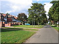
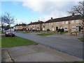
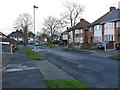
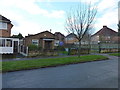
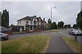
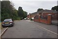
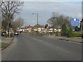
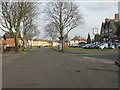
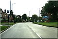
B34 6AZ lies in the eastern suburbs of Birmingham, a small postcode area defined by its mix of residential clusters and proximity to industrial zones. With a population of 2150, it is a compact community nestled near the River Tame and River Cole, approximately 7km from Birmingham’s city centre. The area includes neighbourhoods like Bromford Estate and The Firs, remnants of post-war housing developments from the 1950s and 1960s. While industrial activity thrives north of the M6 motorway, residential areas are characterised by a younger demographic, with a median age of 22 and a majority of residents aged 30–64. The ward’s history is steeped in industrial legacy, from 13th-century Bromford Bridge to the former steelworks of Fort Dunlop. Despite its proximity to major roads, the area retains pockets of open space, including Hodge Hill Common and the Cole Valley Nature Conservation Area. Daily life here balances suburban living with access to nearby retail, transport, and historical sites, offering a distinct blend of practicality and heritage.
- Area Type
- Postcode
- Area Size
- Not available
- Population
- 2150
- Population Density
- 3939 people/km²
The property market in B34 6AZ is dominated by owner-occupied homes, with 74% of residents living in their own properties. The area’s accommodation is primarily houses, which is unusual for a postcode in Birmingham, where flats are more common. This suggests a housing stock that includes post-war developments like the Bromford Estate and The Firs, which were built on former industrial sites. The high home ownership rate indicates a stable market, though the small population of 2150 means the area is not a major hub for property speculation. Buyers should consider that the housing stock is largely older, with limited new builds. The proximity to industrial zones and the M6 motorway may influence property values, but the area’s compact size and specific amenities—such as nearby rail links and retail options—could appeal to those seeking affordability within a suburban setting.
House Prices in B34 6AZ
No properties found in this postcode.
Energy Efficiency in B34 6AZ
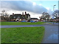
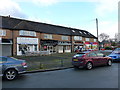
Residents of B34 6AZ have access to a range of nearby amenities, including five retail outlets such as Spar, Aldi Hodge, and Tesco Hodge, providing essential shopping options. The area is served by five railway stations—Stechford, Lea Hall, and Adderley Park, along with metro stops at Bull Street, Corporation Street, and St Chads—facilitating easy travel to Birmingham’s city centre and beyond. Open spaces like Hodge Hill Common and the Cole Valley Nature Conservation Area offer recreational opportunities, while historical sites such as Bromford Mill and Fort Dunlop add cultural depth. The presence of the Firs Estate and Bromford Estate suggests a community-oriented environment, though the separation between industrial and residential zones may limit social interaction. The mix of retail, transport, and green space creates a lifestyle that balances practicality with access to both urban and natural environments.
Amenities
Schools
| Rank | School | Type | Entry gender | Ages |
|---|
Explore more schools in this area
Go to Schools tabDemographics
B34 6AZ has a median age of 22, significantly younger than Birmingham’s overall average, with the largest age group being adults aged 30–64. Home ownership is high at 74%, reflecting a community where most residents live in their own homes rather than renting. The predominant accommodation type is houses, which contrasts with the citywide trend of flats. The area’s demographic profile is marked by a strong presence of the Asian community, making up the largest ethnic group. This diversity contributes to a distinct cultural fabric, though it also means the area’s social dynamics differ from more homogenous suburbs. The high proportion of owner-occupied homes suggests stability, but the lack of specific deprivation data means it is unclear how economic pressures affect residents. The younger age profile implies a dynamic, possibly transient population, with potential implications for local services and infrastructure demand.
Household Size
Accommodation Type
Tenure
Ethnic Group
Religion
Household Composition
Age
Household Deprivation
NS-SEC
Explore more demographic insights in this area
Go to Demographics tabPlanning
Planning Constraints
- Flood RiskPremium
- Ramsar Wetland SitesPremium
- Area of Outstanding Natural BeautyPremium
- Protected Nature ReservePremium
- Protected WoodlandPremium