Area Overview for B33 9UP
Photos of B33 9UP


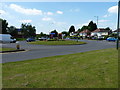
23 photos from this area
Area Information
Key information about the B33 9UP including its size, population, and administrative classification.
- Area Type
- Postcode
- Area Size
- 1.3 hectares
- Population
- 1820
- Population Density
- 2435 people/km²
House Prices in B33 9UP
17
Properties
£98,014
Average Sold Price
£46,500
Lowest Price
£165,000
Highest Price
Showing 17 properties
| Address | Type | Beds | Baths | Last Sale Price | Last Sale Date | |
|---|---|---|---|---|---|---|
| 12 Thaxted Road, Birmingham, B33 9UP | Terraced | 3 | 1 | £153,000 | Apr 2019 | |
| 2 Thaxted Road, Birmingham, B33 9UP | Terraced | 3 | 1 | £165,000 | Feb 2019 | |
| 5 Thaxted Road, Birmingham, B33 9UP | Maisonette | 2 | 1 | £113,100 | Aug 2016 | |
| 9 Thaxted Road, Birmingham, B33 9UP | Flat | - | - | £80,500 | Feb 2013 | |
| 3 Thaxted Road, Birmingham, B33 9UP | Maisonette | 2 | 1 | £76,500 | Jul 2007 | |
| 11 Thaxted Road, Birmingham, B33 9UP | Flat | - | - | £51,500 | Aug 2001 | |
| 8 Thaxted Road, Birmingham, B33 9UP | house | 3 | - | £46,500 | Oct 1996 | |
| 10 Thaxted Road, Birmingham, B33 9UP | Terraced | 3 | - | - | - | |
| 22 Thaxted Road, Birmingham, B33 9UP | Terraced | 3 | 1 | - | - | |
| 6 Thaxted Road, Birmingham, B33 9UP | house | - | - | - | - |
Page 1 of 2
Energy Efficiency in B33 9UP
Amenities
Schools
| Rank | School | Type | Entry gender | Ages |
|---|
Explore more schools in this area
Go to Schools tabDemographics
Household Size
One person
most common
Accommodation Type
Houses
most common
Tenure
49
majority
Ethnic Group
White
most common
Religion
N/A
most common
Household Composition
N/A
most common
Age
47
median
Adults (30-64 years)
most common
Household Deprivation
N/A
with no deprivation
NS-SEC
18
in Lower managerial occupations
Explore more demographic insights in this area
Go to Demographics tabPlanning
Planning Constraints
- Flood RiskPremium
- Ramsar Wetland SitesPremium
- Area of Outstanding Natural BeautyPremium
- Protected Nature ReservePremium
- Protected WoodlandPremium