Area Overview for B33 9UD
Photos of B33 9UD
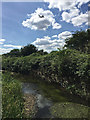
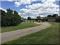
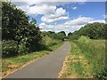
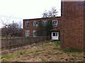
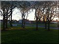

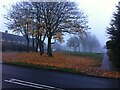
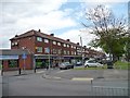
43 photos from this area
Area Information
Key information about the B33 9UD including its size, population, and administrative classification.
- Area Type
- Postcode
- Area Size
- 2.1 hectares
- Population
- 1937
- Population Density
- 3512 people/km²
House Prices in B33 9UD
46
Properties
£114,545
Average Sold Price
£35,950
Lowest Price
£205,000
Highest Price
Showing 46 properties
| Address | Type | Beds | Baths | Last Sale Price | Last Sale Date | |
|---|---|---|---|---|---|---|
| 141 Gressel Lane, Birmingham, B33 9UD | house | 3 | 1 | £205,000 | Apr 2025 | |
| 111 Gressel Lane, Birmingham, B33 9UD | Terraced | 2 | 1 | £190,000 | Jun 2024 | |
| 137 Gressel Lane, Birmingham, B33 9UD | house | 2 | - | £176,000 | Sep 2021 | |
| 181 Gressel Lane, Birmingham, B33 9UD | house | - | - | £161,000 | Nov 2020 | |
| 183 Gressel Lane, Birmingham, B33 9UD | Semi-detached | 3 | 2 | £183,000 | Apr 2020 | |
| 179 Gressel Lane, Birmingham, B33 9UD | Terraced | 2 | 1 | £104,000 | Jun 2019 | |
| 173 Gressel Lane, Birmingham, B33 9UD | Terraced | 2 | 1 | £98,000 | Aug 2018 | |
| 189 Gressel Lane, Birmingham, B33 9UD | Terraced | 3 | - | £124,000 | Sep 2017 | |
| 149 Gressel Lane, Birmingham, B33 9UD | Terraced | 3 | 1 | £125,000 | Apr 2017 | |
| 175 Gressel Lane, Birmingham, B33 9UD | Terraced | 3 | 1 | £130,000 | Mar 2017 |
Page 1 of 5
Energy Efficiency in B33 9UD
Amenities
Schools
| Rank | School | Type | Entry gender | Ages |
|---|
Explore more schools in this area
Go to Schools tabDemographics
Household Size
Family (3-5 people)
most common
Accommodation Type
Houses
most common
Tenure
39
majority
Ethnic Group
White
most common
Religion
N/A
most common
Household Composition
N/A
most common
Age
47
median
Adults (30-64 years)
most common
Household Deprivation
N/A
with no deprivation
NS-SEC
17
in Lower managerial occupations
Explore more demographic insights in this area
Go to Demographics tabPlanning
Planning Constraints
- Flood RiskPremium
- Ramsar Wetland SitesPremium
- Area of Outstanding Natural BeautyPremium
- Protected Nature ReservePremium
- Protected WoodlandPremium