Area Overview for B33 9TP
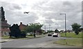
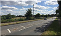
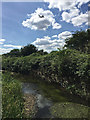
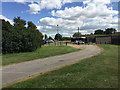
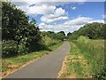
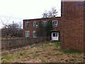
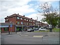
Photos of B33 9TP


Area Information
B33 9TP represents a specific residential cluster within the wider Glebe Farm and Tile Cross ward of Birmingham City Council. This postcode covers an area of 1,271 square metres, serving a population of 1,937 people. The location sits in the northern part of Birmingham, positioned between the River Cole to the north and the Birmingham Loop railway line to the south. Historically, the land belonged to the ancient parish of Yardley and was part of the Forest of Arden before becoming agricultural clearing. The Walters family occupied the site of Glebe Farm from the Middle Ages until 1517. Later, in 1883, the land transferred to the vicar of Yardley before the Glebe Farm Council Estate was built in the 1930s, creating over 1,360 houses. Today, you live in a locality defined by this layered history and its immediate geography. The area encompasses communities including Kitt's Green and Tile Cross. While the physical footprint is small, the setting provides access to both rural reminders and urban infrastructure. The community in B33 9TP has a distinctly mature profile with a median age of 47 years. Adults between 30 and 64 years constitute the most common age range within the population. This suggests a neighbourhood dominated by established families or older households rather than young people just entering the area. Home ownership stands at 39%, indicating that a significant portion of residents live in their own homes, though rental properties also form a notable part of the housing stock. The predominant ethnic group is White, reflecting a traditional demographic makeup. Accommodation types are primarily houses, which aligns with the history of the Glebe Farm Council Estate. You will find that the area is largely settled with long-term residents. The older population average may suggest fewer children living in the immediate vicinity compared to newer suburban expansions, although local schools indicate that families do reside here. The property market in B33 9TP is characterised by a specific mix of tenure and architecture. Houses represent the main accommodation type, a trait established after the large-scale development of the Glebe Farm Council Estate in the 1930s. With 39% home ownership, the area sits in a balanced position between owner-occupied and rental sectors. This means you cannot assume a stock of exclusively tenanted flats or detached villas. The housing likely consists of semi-detached or terraced houses typical of the council estate from that era. Buying homes here offers access to a established cluster rather than a single detached dwelling. The population density is recorded as 1523703 people per square kilometre, which suggests a compact and closely built environment. You are moving into a site with a defined physical boundary and a consistent style of building. The small area size of 1,271 square metres reinforces the idea that properties are arranged in a dense cluster. Three schools serve the educational needs of children living in B33 9TP. Sir Wilfrid Martineau School operates as a primary institution in the area. The International School also functions as a primary provider for local families. For older children, Tile Cross Academy serves as an academy with an Ofsted rating of good. This mix of primary and secondary academy provision ensures that families have direct access to education without needing to travel far outside their immediate locality. Tile Cross Academy's rating provides a clear benchmark for academic standards within the neighbourhood. You will find that both Sir Wilfrid Martineau School and The International School are attached to the local community infrastructure. The presence of a 'good' rated academy alongside two primary schools creates a comprehensive educational pathway for residents of this ward. Digital connectivity for residents of B33 9TP is supported by robust infrastructure. The fixed broadband score registers at 96, which indicates excellent quality for high-speed internet access. This level of connectivity ensures you can maintain reliable communication streams and manage business needs from home without interruption. Mobile coverage scores 85, reflecting a good standard of signal strength across the postcode. These figures suggest that relying on streaming services, remote work platforms, or video calls will be seamless. The area is bounded by the Birmingham Loop railway line to the south, providing a physical channel for transport infrastructure. Nearby rail options include Lea Hall Railway Station, Stechford Railway Station, and Marston Green Railway Station. You benefit from strong digital links while remaining within practical reach of these physical transport hubs. Weekly shopping and daily needs are accessible through several nearby retail and transport hubs. Lidl Stetchford offers a major supermarket option for everyday groceries. The Co-op Shard and Asda Sheldon provide additional retail choices within a practical reach. Commuters and workers can access Birmingham International Airport, the Birmingham Intl Railway Station, and locations near Bull Street. These transport nodes are listed as key metro amenities, meaning you have multiple points of departure and arrival for travel. The presence of five rail stations, five retail locations, and five metro-related points highlights a well-serviced environment. Residents can manage household budgets at the local stores or travel to wider opportunities across the city. The combination of accessible retail and major transport links simplifies daily logistics for homeowners in this postcode. Several environmental and safety assessments apply to the location of B33 9TP. Flood risk, Ramsar Wetland Sites, Area of Outstanding Natural Beauty, Protected Nature Reserve, and Protected Woodland assessments all show a pass. The scores for these categories are 0, indicating no flood risk coverage and no protected nature features within the area's boundaries. This clears constraints for planning and confirms that the land does not sit on sensitive ecological ground. However, crime risk presents a significant consideration for the community. The crime assessment level is Critical with a score of 32, meaning crime rates are above average. Enhanced security measures are recommended for residents. While the land is free from natural planning constraints, the higher crime statistic requires practical vigilance. You must weigh the clear environmental pass against the need for robust personal and property security. Who typically lives in B33 9TP and what is the population like?Residents in B33 9TP have a median age of 47, with most being adults between 30 and 64. The population totals 1,937 across 1,271 square metres. Home ownership is at 39%, and the predominant ethnic group is White. The area is primarily composed of houses rather than other accommodation types. Which schools serve children living in this area?Children in B33 9TP are served by Sir Wilfrid Martineau School, The International School, and Tile Cross Academy. The first two are primary schools. Tile Cross Academy is a secondary academy with a good Ofsted rating. This mix provides education from primary through to secondary levels locally. How safe is this area to live in?While flood and environmental constraints are not an issue, crime risk is Critical. The safety score is 32 out of 100, indicating crime rates above average. Enhanced security measures are recommended for residents. Other assessments for flood, wetlands, and nature reserves pass with a score of 0. What digital and transport options are available?Digital connectivity is strong with a fixed broadband score of 96 and a mobile coverage score of 85. Nearby amenities include five railway stations such as Stechford and Marston Green, plus major air and rail links at Birmingham International. Retail options include Lidl Stetchford, Co-op Shard, and Asda Sheldon.
- Area Type
- Postcode
- Area Size
- 1271 m²
- Population
- 1937
- Population Density
- 3512 people/km²
The property market in B33 9TP is characterised by a specific mix of tenure and architecture. Houses represent the main accommodation type, a trait established after the large-scale development of the Glebe Farm Council Estate in the 1930s. With 39% home ownership, the area sits in a balanced position between owner-occupied and rental sectors. This means you cannot assume a stock of exclusively tenanted flats or detached villas. The housing likely consists of semi-detached or terraced houses typical of the council estate from that era. Buying homes here offers access to a established cluster rather than a single detached dwelling. The population density is recorded as 1523703 people per square kilometre, which suggests a compact and closely built environment. You are moving into a site with a defined physical boundary and a consistent style of building. The small area size of 1,271 square metres reinforces the idea that properties are arranged in a dense cluster. Three schools serve the educational needs of children living in B33 9TP. Sir Wilfrid Martineau School operates as a primary institution in the area. The International School also functions as a primary provider for local families. For older children, Tile Cross Academy serves as an academy with an Ofsted rating of good. This mix of primary and secondary academy provision ensures that families have direct access to education without needing to travel far outside their immediate locality. Tile Cross Academy's rating provides a clear benchmark for academic standards within the neighbourhood. You will find that both Sir Wilfrid Martineau School and The International School are attached to the local community infrastructure. The presence of a 'good' rated academy alongside two primary schools creates a comprehensive educational pathway for residents of this ward. Digital connectivity for residents of B33 9TP is supported by robust infrastructure. The fixed broadband score registers at 96, which indicates excellent quality for high-speed internet access. This level of connectivity ensures you can maintain reliable communication streams and manage business needs from home without interruption. Mobile coverage scores 85, reflecting a good standard of signal strength across the postcode. These figures suggest that relying on streaming services, remote work platforms, or video calls will be seamless. The area is bounded by the Birmingham Loop railway line to the south, providing a physical channel for transport infrastructure. Nearby rail options include Lea Hall Railway Station, Stechford Railway Station, and Marston Green Railway Station. You benefit from strong digital links while remaining within practical reach of these physical transport hubs. Weekly shopping and daily needs are accessible through several nearby retail and transport hubs. Lidl Stetchford offers a major supermarket option for everyday groceries. The Co-op Shard and Asda Sheldon provide additional retail choices within a practical reach. Commuters and workers can access Birmingham International Airport, the Birmingham Intl Railway Station, and locations near Bull Street. These transport nodes are listed as key metro amenities, meaning you have multiple points of departure and arrival for travel. The presence of five rail stations, five retail locations, and five metro-related points highlights a well-serviced environment. Residents can manage household budgets at the local stores or travel to wider opportunities across the city. The combination of accessible retail and major transport links simplifies daily logistics for homeowners in this postcode. Several environmental and safety assessments apply to the location of B33 9TP. Flood risk, Ramsar Wetland Sites, Area of Outstanding Natural Beauty, Protected Nature Reserve, and Protected Woodland assessments all show a pass. The scores for these categories are 0, indicating no flood risk coverage and no protected nature features within the area's boundaries. This clears constraints for planning and confirms that the land does not sit on sensitive ecological ground. However, crime risk presents a significant consideration for the community. The crime assessment level is Critical with a score of 32, meaning crime rates are above average. Enhanced security measures are recommended for residents. While the land is free from natural planning constraints, the higher crime statistic requires practical vigilance. You must weigh the clear environmental pass against the need for robust personal and property security. Who typically lives in B33 9TP and what is the population like?Residents in B33 9TP have a median age of 47, with most being adults between 30 and 64. The population totals 1,937 across 1,271 square metres. Home ownership is at 39%, and the predominant ethnic group is White. The area is primarily composed of houses rather than other accommodation types. Which schools serve children living in this area?Children in B33 9TP are served by Sir Wilfrid Martineau School, The International School, and Tile Cross Academy. The first two are primary schools. Tile Cross Academy is a secondary academy with a good Ofsted rating. This mix provides education from primary through to secondary levels locally. How safe is this area to live in?While flood and environmental constraints are not an issue, crime risk is Critical. The safety score is 32 out of 100, indicating crime rates above average. Enhanced security measures are recommended for residents. Other assessments for flood, wetlands, and nature reserves pass with a score of 0. What digital and transport options are available?Digital connectivity is strong with a fixed broadband score of 96 and a mobile coverage score of 85. Nearby amenities include five railway stations such as Stechford and Marston Green, plus major air and rail links at Birmingham International. Retail options include Lidl Stetchford, Co-op Shard, and Asda Sheldon.
House Prices in B33 9TP
Showing 5 properties
| Address | Type | Beds | Baths | Last Sale Price | Last Sale Date | |
|---|---|---|---|---|---|---|
| 49 Lea Ford Road, Birmingham, B33 9TP | house | - | - | £150,000 | Mar 2021 | |
| 47 Lea Ford Road, Birmingham, B33 9TP | Semi-detached | 3 | 1 | £110,000 | Apr 2015 | |
| 51 Lea Ford Road, Birmingham, B33 9TP | Semi-detached | - | - | - | - | |
| 53 Lea Ford Road, Birmingham, B33 9TP | Flat | - | - | - | - | |
| 55 Lea Ford Road, Birmingham, B33 9TP | Flat | - | - | - | - |
Energy Efficiency in B33 9TP
Weekly shopping and daily needs are accessible through several nearby retail and transport hubs. Lidl Stetchford offers a major supermarket option for everyday groceries. The Co-op Shard and Asda Sheldon provide additional retail choices within a practical reach. Commuters and workers can access Birmingham International Airport, the Birmingham Intl Railway Station, and locations near Bull Street. These transport nodes are listed as key metro amenities, meaning you have multiple points of departure and arrival for travel. The presence of five rail stations, five retail locations, and five metro-related points highlights a well-serviced environment. Residents can manage household budgets at the local stores or travel to wider opportunities across the city. The combination of accessible retail and major transport links simplifies daily logistics for homeowners in this postcode. Several environmental and safety assessments apply to the location of B33 9TP. Flood risk, Ramsar Wetland Sites, Area of Outstanding Natural Beauty, Protected Nature Reserve, and Protected Woodland assessments all show a pass. The scores for these categories are 0, indicating no flood risk coverage and no protected nature features within the area's boundaries. This clears constraints for planning and confirms that the land does not sit on sensitive ecological ground. However, crime risk presents a significant consideration for the community. The crime assessment level is Critical with a score of 32, meaning crime rates are above average. Enhanced security measures are recommended for residents. While the land is free from natural planning constraints, the higher crime statistic requires practical vigilance. You must weigh the clear environmental pass against the need for robust personal and property security. Who typically lives in B33 9TP and what is the population like?Residents in B33 9TP have a median age of 47, with most being adults between 30 and 64. The population totals 1,937 across 1,271 square metres. Home ownership is at 39%, and the predominant ethnic group is White. The area is primarily composed of houses rather than other accommodation types. Which schools serve children living in this area?Children in B33 9TP are served by Sir Wilfrid Martineau School, The International School, and Tile Cross Academy. The first two are primary schools. Tile Cross Academy is a secondary academy with a good Ofsted rating. This mix provides education from primary through to secondary levels locally. How safe is this area to live in?While flood and environmental constraints are not an issue, crime risk is Critical. The safety score is 32 out of 100, indicating crime rates above average. Enhanced security measures are recommended for residents. Other assessments for flood, wetlands, and nature reserves pass with a score of 0. What digital and transport options are available?Digital connectivity is strong with a fixed broadband score of 96 and a mobile coverage score of 85. Nearby amenities include five railway stations such as Stechford and Marston Green, plus major air and rail links at Birmingham International. Retail options include Lidl Stetchford, Co-op Shard, and Asda Sheldon.
Amenities
Schools
Three schools serve the educational needs of children living in B33 9TP. Sir Wilfrid Martineau School operates as a primary institution in the area. The International School also functions as a primary provider for local families. For older children, Tile Cross Academy serves as an academy with an Ofsted rating of good. This mix of primary and secondary academy provision ensures that families have direct access to education without needing to travel far outside their immediate locality. Tile Cross Academy's rating provides a clear benchmark for academic standards within the neighbourhood. You will find that both Sir Wilfrid Martineau School and The International School are attached to the local community infrastructure. The presence of a 'good' rated academy alongside two primary schools creates a comprehensive educational pathway for residents of this ward. Digital connectivity for residents of B33 9TP is supported by robust infrastructure. The fixed broadband score registers at 96, which indicates excellent quality for high-speed internet access. This level of connectivity ensures you can maintain reliable communication streams and manage business needs from home without interruption. Mobile coverage scores 85, reflecting a good standard of signal strength across the postcode. These figures suggest that relying on streaming services, remote work platforms, or video calls will be seamless. The area is bounded by the Birmingham Loop railway line to the south, providing a physical channel for transport infrastructure. Nearby rail options include Lea Hall Railway Station, Stechford Railway Station, and Marston Green Railway Station. You benefit from strong digital links while remaining within practical reach of these physical transport hubs. Weekly shopping and daily needs are accessible through several nearby retail and transport hubs. Lidl Stetchford offers a major supermarket option for everyday groceries. The Co-op Shard and Asda Sheldon provide additional retail choices within a practical reach. Commuters and workers can access Birmingham International Airport, the Birmingham Intl Railway Station, and locations near Bull Street. These transport nodes are listed as key metro amenities, meaning you have multiple points of departure and arrival for travel. The presence of five rail stations, five retail locations, and five metro-related points highlights a well-serviced environment. Residents can manage household budgets at the local stores or travel to wider opportunities across the city. The combination of accessible retail and major transport links simplifies daily logistics for homeowners in this postcode. Several environmental and safety assessments apply to the location of B33 9TP. Flood risk, Ramsar Wetland Sites, Area of Outstanding Natural Beauty, Protected Nature Reserve, and Protected Woodland assessments all show a pass. The scores for these categories are 0, indicating no flood risk coverage and no protected nature features within the area's boundaries. This clears constraints for planning and confirms that the land does not sit on sensitive ecological ground. However, crime risk presents a significant consideration for the community. The crime assessment level is Critical with a score of 32, meaning crime rates are above average. Enhanced security measures are recommended for residents. While the land is free from natural planning constraints, the higher crime statistic requires practical vigilance. You must weigh the clear environmental pass against the need for robust personal and property security. Who typically lives in B33 9TP and what is the population like?Residents in B33 9TP have a median age of 47, with most being adults between 30 and 64. The population totals 1,937 across 1,271 square metres. Home ownership is at 39%, and the predominant ethnic group is White. The area is primarily composed of houses rather than other accommodation types. Which schools serve children living in this area?Children in B33 9TP are served by Sir Wilfrid Martineau School, The International School, and Tile Cross Academy. The first two are primary schools. Tile Cross Academy is a secondary academy with a good Ofsted rating. This mix provides education from primary through to secondary levels locally. How safe is this area to live in?While flood and environmental constraints are not an issue, crime risk is Critical. The safety score is 32 out of 100, indicating crime rates above average. Enhanced security measures are recommended for residents. Other assessments for flood, wetlands, and nature reserves pass with a score of 0. What digital and transport options are available?Digital connectivity is strong with a fixed broadband score of 96 and a mobile coverage score of 85. Nearby amenities include five railway stations such as Stechford and Marston Green, plus major air and rail links at Birmingham International. Retail options include Lidl Stetchford, Co-op Shard, and Asda Sheldon.
| Rank | School | Type | Entry gender | Ages |
|---|
Explore more schools in this area
Go to Schools tabDemographics
The community in B33 9TP has a distinctly mature profile with a median age of 47 years. Adults between 30 and 64 years constitute the most common age range within the population. This suggests a neighbourhood dominated by established families or older households rather than young people just entering the area. Home ownership stands at 39%, indicating that a significant portion of residents live in their own homes, though rental properties also form a notable part of the housing stock. The predominant ethnic group is White, reflecting a traditional demographic makeup. Accommodation types are primarily houses, which aligns with the history of the Glebe Farm Council Estate. You will find that the area is largely settled with long-term residents. The older population average may suggest fewer children living in the immediate vicinity compared to newer suburban expansions, although local schools indicate that families do reside here. The property market in B33 9TP is characterised by a specific mix of tenure and architecture. Houses represent the main accommodation type, a trait established after the large-scale development of the Glebe Farm Council Estate in the 1930s. With 39% home ownership, the area sits in a balanced position between owner-occupied and rental sectors. This means you cannot assume a stock of exclusively tenanted flats or detached villas. The housing likely consists of semi-detached or terraced houses typical of the council estate from that era. Buying homes here offers access to a established cluster rather than a single detached dwelling. The population density is recorded as 1523703 people per square kilometre, which suggests a compact and closely built environment. You are moving into a site with a defined physical boundary and a consistent style of building. The small area size of 1,271 square metres reinforces the idea that properties are arranged in a dense cluster. Three schools serve the educational needs of children living in B33 9TP. Sir Wilfrid Martineau School operates as a primary institution in the area. The International School also functions as a primary provider for local families. For older children, Tile Cross Academy serves as an academy with an Ofsted rating of good. This mix of primary and secondary academy provision ensures that families have direct access to education without needing to travel far outside their immediate locality. Tile Cross Academy's rating provides a clear benchmark for academic standards within the neighbourhood. You will find that both Sir Wilfrid Martineau School and The International School are attached to the local community infrastructure. The presence of a 'good' rated academy alongside two primary schools creates a comprehensive educational pathway for residents of this ward. Digital connectivity for residents of B33 9TP is supported by robust infrastructure. The fixed broadband score registers at 96, which indicates excellent quality for high-speed internet access. This level of connectivity ensures you can maintain reliable communication streams and manage business needs from home without interruption. Mobile coverage scores 85, reflecting a good standard of signal strength across the postcode. These figures suggest that relying on streaming services, remote work platforms, or video calls will be seamless. The area is bounded by the Birmingham Loop railway line to the south, providing a physical channel for transport infrastructure. Nearby rail options include Lea Hall Railway Station, Stechford Railway Station, and Marston Green Railway Station. You benefit from strong digital links while remaining within practical reach of these physical transport hubs. Weekly shopping and daily needs are accessible through several nearby retail and transport hubs. Lidl Stetchford offers a major supermarket option for everyday groceries. The Co-op Shard and Asda Sheldon provide additional retail choices within a practical reach. Commuters and workers can access Birmingham International Airport, the Birmingham Intl Railway Station, and locations near Bull Street. These transport nodes are listed as key metro amenities, meaning you have multiple points of departure and arrival for travel. The presence of five rail stations, five retail locations, and five metro-related points highlights a well-serviced environment. Residents can manage household budgets at the local stores or travel to wider opportunities across the city. The combination of accessible retail and major transport links simplifies daily logistics for homeowners in this postcode. Several environmental and safety assessments apply to the location of B33 9TP. Flood risk, Ramsar Wetland Sites, Area of Outstanding Natural Beauty, Protected Nature Reserve, and Protected Woodland assessments all show a pass. The scores for these categories are 0, indicating no flood risk coverage and no protected nature features within the area's boundaries. This clears constraints for planning and confirms that the land does not sit on sensitive ecological ground. However, crime risk presents a significant consideration for the community. The crime assessment level is Critical with a score of 32, meaning crime rates are above average. Enhanced security measures are recommended for residents. While the land is free from natural planning constraints, the higher crime statistic requires practical vigilance. You must weigh the clear environmental pass against the need for robust personal and property security. Who typically lives in B33 9TP and what is the population like?Residents in B33 9TP have a median age of 47, with most being adults between 30 and 64. The population totals 1,937 across 1,271 square metres. Home ownership is at 39%, and the predominant ethnic group is White. The area is primarily composed of houses rather than other accommodation types. Which schools serve children living in this area?Children in B33 9TP are served by Sir Wilfrid Martineau School, The International School, and Tile Cross Academy. The first two are primary schools. Tile Cross Academy is a secondary academy with a good Ofsted rating. This mix provides education from primary through to secondary levels locally. How safe is this area to live in?While flood and environmental constraints are not an issue, crime risk is Critical. The safety score is 32 out of 100, indicating crime rates above average. Enhanced security measures are recommended for residents. Other assessments for flood, wetlands, and nature reserves pass with a score of 0. What digital and transport options are available?Digital connectivity is strong with a fixed broadband score of 96 and a mobile coverage score of 85. Nearby amenities include five railway stations such as Stechford and Marston Green, plus major air and rail links at Birmingham International. Retail options include Lidl Stetchford, Co-op Shard, and Asda Sheldon.
Household Size
Accommodation Type
Tenure
Ethnic Group
Religion
Household Composition
Age
Household Deprivation
NS-SEC
Explore more demographic insights in this area
Go to Demographics tabPlanning
Planning Constraints
- Flood RiskPremium
- Ramsar Wetland SitesPremium
- Area of Outstanding Natural BeautyPremium
- Protected Nature ReservePremium
- Protected WoodlandPremium