Area Overview for B33 9ST
Photos of B33 9ST
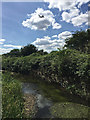
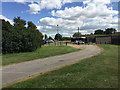
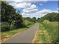
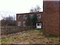
43 photos from this area
Area Information
Key information about the B33 9ST including its size, population, and administrative classification.
- Area Type
- Postcode
- Area Size
- 6514 m²
- Population
- 1582
- Population Density
- 6064 people/km²
House Prices in B33 9ST
21
Properties
£140,633
Average Sold Price
£40,000
Lowest Price
£229,000
Highest Price
Showing 21 properties
| Address | Type | Beds | Baths | Last Sale Price | Last Sale Date | |
|---|---|---|---|---|---|---|
| 75 Gressel Lane, Birmingham, B33 9ST | Terraced | 3 | 1 | £195,000 | May 2024 | |
| 87 Gressel Lane, Birmingham, B33 9ST | house | 3 | 1 | £203,750 | Dec 2023 | |
| 95 Gressel Lane, Birmingham, B33 9ST | Terraced | 3 | 1 | £229,000 | Feb 2023 | |
| 91 Gressel Lane, Birmingham, B33 9ST | house | - | - | £197,000 | Aug 2021 | |
| 81 Gressel Lane, Birmingham, B33 9ST | Terraced | 3 | 1 | £184,000 | Oct 2020 | |
| 63 Gressel Lane, Birmingham, B33 9ST | Terraced | 3 | - | £108,000 | Dec 2010 | |
| 89 Gressel Lane, Birmingham, B33 9ST | Semi-detached | - | - | £65,950 | Sep 2002 | |
| 69 Gressel Lane, Birmingham, B33 9ST | Terraced | - | - | £43,000 | Feb 2001 | |
| 97 Gressel Lane, Birmingham, B33 9ST | house | - | - | £40,000 | Apr 1995 | |
| 83 Gressel Lane, Birmingham, B33 9ST | Terraced | - | - | - | - |
Page 1 of 3
Energy Efficiency in B33 9ST
Amenities
Schools
| Rank | School | Type | Entry gender | Ages |
|---|
Explore more schools in this area
Go to Schools tabDemographics
Household Size
Family (3-5 people)
most common
Accommodation Type
Houses
most common
Tenure
47
majority
Ethnic Group
White
most common
Religion
N/A
most common
Household Composition
N/A
most common
Age
47
median
Adults (30-64 years)
most common
Household Deprivation
N/A
with no deprivation
NS-SEC
16
in Lower managerial occupations
Explore more demographic insights in this area
Go to Demographics tabPlanning
Planning Constraints
- Flood RiskPremium
- Ramsar Wetland SitesPremium
- Area of Outstanding Natural BeautyPremium
- Protected Nature ReservePremium
- Protected WoodlandPremium