Area Overview for B33 9RA
Photos of B33 9RA

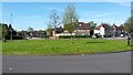
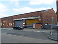
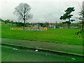
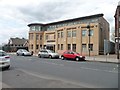
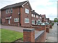
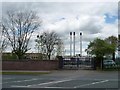


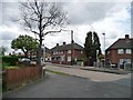

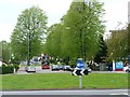
21 photos from this area
Area Information
Key information about the B33 9RA including its size, population, and administrative classification.
- Area Type
- Postcode
- Area Size
- 1.4 hectares
- Population
- 1632
- Population Density
- 6265 people/km²
House Prices in B33 9RA
34
Properties
£106,246
Average Sold Price
£26,000
Lowest Price
£216,000
Highest Price
Showing 34 properties
| Address | Type | Beds | Baths | Last Sale Price | Last Sale Date | |
|---|---|---|---|---|---|---|
| 77 Hurstcroft Road, Birmingham, B33 9RA | Terraced | 3 | 2 | £216,000 | Jun 2025 | |
| 75 Hurstcroft Road, Birmingham, B33 9RA | Terraced | 3 | 1 | £157,500 | Jan 2023 | |
| 83 Hurstcroft Road, Birmingham, B33 9RA | Semi-detached | - | - | £160,000 | Jun 2021 | |
| 85 Hurstcroft Road, Birmingham, B33 9RA | Terraced | 3 | 1 | £137,500 | Jul 2020 | |
| 81 Hurstcroft Road, Birmingham, B33 9RA | Terraced | 3 | 1 | £130,000 | Jul 2017 | |
| 73 Hurstcroft Road, Birmingham, B33 9RA | Terraced | - | - | £65,000 | Oct 2015 | |
| 65 Hurstcroft Road, Birmingham, B33 9RA | Semi-detached | 3 | 1 | £94,950 | Apr 2015 | |
| 79 Hurstcroft Road, Birmingham, B33 9RA | Terraced | 3 | 1 | £90,000 | Jan 2015 | |
| 101 Hurstcroft Road, Birmingham, B33 9RA | house | 1 | 1 | £78,000 | Oct 2010 | |
| 89 Hurstcroft Road, Birmingham, B33 9RA | Terraced | - | - | £85,000 | Apr 2007 |
Page 1 of 4
Energy Efficiency in B33 9RA
Amenities
Schools
| Rank | School | Type | Entry gender | Ages |
|---|
Explore more schools in this area
Go to Schools tabDemographics
Household Size
Family (3-5 people)
most common
Accommodation Type
Houses
most common
Tenure
42
majority
Ethnic Group
White
most common
Religion
N/A
most common
Household Composition
N/A
most common
Age
47
median
Adults (30-64 years)
most common
Household Deprivation
N/A
with no deprivation
NS-SEC
17
in Lower managerial occupations
Explore more demographic insights in this area
Go to Demographics tabPlanning
Planning Constraints
- Flood RiskPremium
- Ramsar Wetland SitesPremium
- Area of Outstanding Natural BeautyPremium
- Protected Nature ReservePremium
- Protected WoodlandPremium