Area Overview for B33 9LT
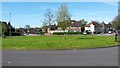
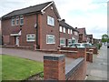
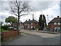
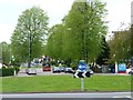
Photos of B33 9LT


Area Information
B33 9LT represents a small residential cluster within the historic ward of Glebe Farm and Tile Cross, covering an area of just under 1,500 square metres. This specific postcode sits in the north of Birmingham, West Midlands, bordered by the Birmingham Loop railway line to the south and the River Cole to the north. The locality forms part of the former parish of Yardley, an area once cleared from the Forest of Arden for agriculture. The name 'Lea' itself derives from Old English, signifying a woodland clearing that has long defined the landscape. Residents here live in a community of 1,731 people drawn to its position near these historic boundaries. Daily life for those living in B33 9LT is shaped by this proximity to transport infrastructure and natural features. The area is not merely a postbox but a tightly knit geographical space with deep roots. It encompasses the communities of Kitt's Green and Tile Cross, offering residents a sense of connection to the past while remaining integrated into modern Birmingham. The combination of ancient woodland history, agricultural origins, and contemporary residential development creates a distinct character. You are buying into a space where history meets the present, located close to the River Cole and the main rail loop that structures the local transport network. This specific cluster offers a defined environment for those seeking a foothold in this established part of the city.
- Area Type
- Postcode
- Area Size
- 1496 m²
- Population
- 1731
- Population Density
- 7186 people/km²
Homes in B33 9LT are primarily houses, distinguishing this postcode from areas dominated by flat or apartment blocks. This accommodation type aligns with the local history of the Glebe Farm and Tile Cross estates, where significant residential development occurred in the early 20th century. The 42 per cent home ownership rate indicates that nearly half of the residents own their property outright or via mortgage, while the other half comprises tenants. This split creates a dynamic market where both buyers and sellers are active participants. For prospective buyers, the predominance of houses offers space and structure that differ from urban high-density living. The specific postcode covers a small cluster, meaning inventory may be limited but each property holds distinct significance. When assessing the property market in B33 9LT, you find a landscape defined by detached or semi-detached homes rather than shared buildings. This suits families and individuals seeking garden space and privacy. The high proportion of house ownership suggests these properties often translate into solid value over time. You are looking at a market driven by traditional family requirements, where the character of the individual house defines the property's appeal more than the amenities of a shared block. This makes the area attractive for those prioritising self-contained living arrangements in the north of Birmingham.
House Prices in B33 9LT
Showing 5 properties
| Address | Type | Beds | Baths | Last Sale Price | Last Sale Date | |
|---|---|---|---|---|---|---|
| 2 Tirley Road, Birmingham, B33 9LT | house | - | - | £133,000 | Nov 2020 | |
| 3 Tirley Road, Birmingham, B33 9LT | house | - | - | £33,250 | Apr 1996 | |
| 4 Tirley Road, Birmingham, B33 9LT | house | - | - | - | - | |
| 6 Tirley Road, Birmingham, B33 9LT | Terraced | - | - | - | - | |
| 1 Tirley Road, Birmingham, B33 9LT | Semi-detached | - | - | - | - |
Energy Efficiency in B33 9LT
Living in B33 9LT offers practical access to essential amenities without requiring long travel times. Within practical reach, residents can visit the Co-op Shard and Iceland Stechford for grocery shopping and household needs. The Heron Shard provides another retail option nearby for daily purchases. For commuters, rail connectivity is immediate, with proximity to stations including Stechford, Marston Green, and Lea Hall. You can also access Birmingham International Railway Station and Bull Street for longer journeys or city centre connections. Birmingham International Airport lies within easy reach, facilitating travel for residents who take business trips or leisure flights. This mix of retail and transport creates a functional lifestyle centred on convenience. You do not need to venture deep into the city for basic supplies or short train journeys. The presence of multiple railway stations ensures your schedule is never hampered by transport delays that affect isolated locations. Supermarkets like Co-op and Iceland within walking or short driving distance simplify family budgeting and meal planning. Whether you are heading to a food store or booking a train ticket, the infrastructure surrounds you. These amenities anchor the daily rhythm of life for someone living in B33 9LT. You benefit from a neighbourhood layout that prioritises accessibility to goods and services while maintaining a residential feel away from the city core.
Amenities
Schools
Family life in B33 9LT is supported by several primary schools within practical reach. Audley Infant School provides early education for younger children, followed by Audley Junior School as pupils advance through their primary years. Additionally, Audley Primary School serves the broader community and currently holds a good Ofsted rating. This double primary setup reflects the organisational structure of local education in the Borough Council area. Living in B33 9LT places you within a designated catchment area for these institutions, ensuring your children attend schools that maintain recognised standards. The option to choose between the infant and junior sections, or the comprehensive primary school, offers flexibility for your child's education. A good Ofsted rating at Audley Primary signifies a standard of teaching that meets government requirements. When you consider homes in B33 9LT, school catchment boundaries become a critical factor in your decision. You will be positioned conveniently close to these educational facilities, reducing travel time for daily commutes to school. The presence of multiple primary options also provides backup choices if transport or capacity becomes an issue. You can rely on these schools to deliver a consistent, well-regarded education to the local children living in and around this postcode.
| Rank | School | Type | Entry gender | Ages |
|---|
Explore more schools in this area
Go to Schools tabDemographics
The community in B33 9LT has a clearly defined age profile, with a median age of 47 years. Adults between 30 and 64 years constitute the most common age range, indicating a neighbourhood populated by families and empty nesters rather than single young professionals. Home ownership stands at 42 per cent in this area, which suggests a balanced mix of landlords and owner-occupiers. The predominant ethnic group is White, reflecting the traditional demographic composition of the north of Birmingham. Given the high median age and the prevalence of house ownership, the local population likely consists of settled residents who have built lives in this postcode over time. You are part of a community where multi-generational living is common, impacting everything from local shop habits to school age dynamics. The fact that 58 per cent of homes are rented implies a significant number of tenants seeking stability in this specific zone. This demographic structure points to a neighbourly environment where long-term residency is the norm. When you buy homes in B33 9LT, you join a society where people value the area enough to buy their homes or settle into long-term tenancies. The demographics confirm this is a mature, established residential enclave rather than a rapidly changing development zone.
Household Size
Accommodation Type
Tenure
Ethnic Group
Religion
Household Composition
Age
Household Deprivation
NS-SEC
Explore more demographic insights in this area
Go to Demographics tabPlanning
Planning Constraints
- Flood RiskPremium
- Ramsar Wetland SitesPremium
- Area of Outstanding Natural BeautyPremium
- Protected Nature ReservePremium
- Protected WoodlandPremium