Area Overview for B33 9AH
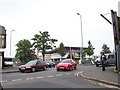
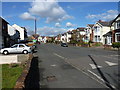
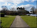
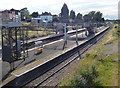
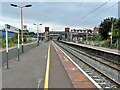
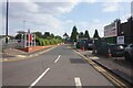
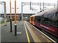
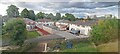
Photos of B33 9AH


Area Information
Living in B33 9AH means being part of a small, tightly knit residential cluster in north Birmingham. With a population of 1,841, this area is defined by its compact size and historical roots in the Glebe Farm and Tile Cross electoral ward. Once part of the ancient parish of Yardley, the region’s name reflects its woodland origins, with road names like The Riddings hinting at its past. Today, the area is bounded by the Birmingham Loop railway line to the south and the River Cole to the north, shaping its character as a semi-rural yet accessible suburb. Residents benefit from proximity to multiple rail stations, including Stechford and Adderley Park, and a network of metro stops such as Bull Street and Corporation Street. Daily life here balances quiet residential living with practical connectivity, making it appealing to those seeking a blend of convenience and low-density housing. The area’s demographic profile—predominantly adults aged 30–64—suggests a mature, stable community, with a strong focus on home ownership. While the population is relatively small, the presence of independent schools and retail amenities within walking distance adds to its appeal for families and professionals.
- Area Type
- Postcode
- Area Size
- Not available
- Population
- 1841
- Population Density
- 3703 people/km²
The property market in B33 9AH is dominated by owner-occupied homes, with 68% of residents living in houses rather than flats or rental properties. This suggests a market skewed towards long-term homeownership, with a focus on family homes and semi-detached or detached properties. The high home ownership rate implies a relatively stable market, less influenced by short-term rental demand. Given the area’s small size and residential character, property availability is limited, making it a niche market for buyers seeking low-density housing. The presence of independent schools and proximity to transport links may further drive demand from families prioritising education and connectivity. However, the high crime risk score could deter some buyers, though the area’s low flood and environmental risk assessments may reassure others. For those considering the area, the market offers a mix of established homes and potential for long-term value retention, though competition for properties is likely to be strong.
House Prices in B33 9AH
No properties found in this postcode.
Energy Efficiency in B33 9AH
Residents of B33 9AH enjoy a range of amenities within practical reach, enhancing daily life. The area is served by five retail outlets, including Iceland Stechford and Aldi Hodge, offering convenience for grocery shopping and everyday needs. Nearby rail stations—Stechford, Lea Hall, and Adderley Park—provide easy access to Birmingham’s transport network, while metro stops such as Bull Street and Corporation Street add to the area’s connectivity. For leisure, the proximity to the River Cole and historical sites like Glebe Farm suggest opportunities for walking and local exploration. The presence of independent schools and a mature community further enriches the social fabric. While the area lacks large parks or leisure facilities, its compact size ensures amenities are within walking distance. This blend of retail, transport, and historical context creates a lifestyle that balances convenience with a sense of place, ideal for those valuing accessibility and a quieter residential environment.
Amenities
Schools
Residents of B33 9AH have access to two independent schools within practical reach: Riverside Education and Blackwater Academy. Both institutions are rated by Ofsted, with Riverside Education achieving an outstanding rating and Blackwater Academy receiving a good rating. The presence of independent schools suggests a focus on high-quality education, appealing to families prioritising academic excellence. While no state schools are listed in the data, the availability of independent options may cater to those seeking alternative educational pathways. The mix of school types—both independent—indicates a community that values choice and investment in education. For parents, this means access to well-regarded institutions, though the absence of state schools may limit options for those seeking more affordable or diverse schooling. The proximity of these schools to the area reinforces its appeal as a family-friendly neighbourhood.
| Rank | School | Type | Entry gender | Ages |
|---|
Explore more schools in this area
Go to Schools tabDemographics
The community in B33 9AH is predominantly composed of adults aged 30–64, with a median age of 47. This suggests a mature population, likely with established careers and families. Home ownership is high, with 68% of residents owning their homes, indicating a stable and long-term demographic. The area is characterised by houses rather than flats, reflecting a preference for single-family dwellings. The predominant ethnic group is Asian, which shapes the cultural and social dynamics of the neighbourhood. While specific data on deprivation is not provided, the high home ownership rate and presence of independent schools suggest a relatively affluent community. However, the high crime risk score of 2/100 indicates potential safety concerns that may affect quality of life. The demographic profile points to a community that values stability, with residents likely prioritising family-oriented living and long-term investment in property.
Household Size
Accommodation Type
Tenure
Ethnic Group
Religion
Household Composition
Age
Household Deprivation
NS-SEC
Explore more demographic insights in this area
Go to Demographics tabPlanning
Planning Constraints
- Flood RiskPremium
- Ramsar Wetland SitesPremium
- Area of Outstanding Natural BeautyPremium
- Protected Nature ReservePremium
- Protected WoodlandPremium