Area Overview for B33 8UT
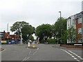
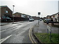
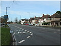
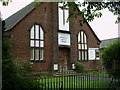
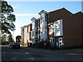
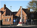
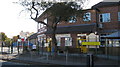
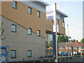
Photos of B33 8UT
Area Information
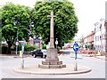
Living in B33 8UT offers a grounded experience within the Yardley West and Stechford ward of east Birmingham. This specific postcode covers a small residential cluster spanning just 1.2 hectares, creating a tightly knit environment with a population of 1701. The area sits deep within the Ward of Yardley West and Stechford, which historically comprised parts of the ancient parish of Yardley and was incorporated into Birmingham in 1911. While the wider ward contains over 13,500 residents, this particular postcode represents a quiet, concentrated stretch of housing. Nearby landmarks include the historic Blakesley Hall, a Tudor hall, and St Edburgha's Church, which dates back to the 13th century. Old Yardley, nearby, holds the status of Birmingham's first conservation area, granted in 1969, reflecting the region's commitment to preserving heritage. Stechford Station, built in 1844, serves as a vital transport anchor, linking residents to the wider city via Station Road, historically known as Stoney Lane. The area combines modern convenience with deep historical roots, situated near sites like Kent's Moat and Pershore Abbey's former lands. Choosing B33 8UT means selecting a spot with significant history yet remaining a distinct, manageable residential enclave.
- Area Type
- Postcode
- Area Size
- 1.2 hectares
- Population
- 1701
- Population Density
- 5139 people/km²
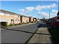
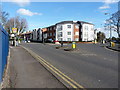
The property market in B33 8UT is dominated by houses, with 63% of residents owning their homes. This high ownership rate indicates a strong preference for freehold or shared ownership properties over rentals. The area primarily consists of houses rather than flats or apartments, aligning with the historical pattern of Yardley development since its incorporation into Birmingham in 1911. Buying a home here means joining a community where stability is the norm, as nearly two-thirds of households own their property outright or have a mortgage. The 1.2-hectare footprint of the postcode suggests a concentrated collection of residential properties rather than large-scale housing estates. As part of the Yardley West and Stechford ward, the broader housing stock includes periods ranging from Victorian to mid-20th century, though specific building dates for this postcode are not detailed. The high home ownership percentage of 63% reduces the number of landlords in the local market, potentially making it easier to find long-term rental agreements if you are not buying. This market structure is typical of established suburbs where families settle down. The predominance of houses also implies larger living spaces compared to high-density city centre areas.
House Prices in B33 8UT
Showing 31 properties
| Address | Type | Beds | Baths | Last Sale Price | Last Sale Date | |
|---|---|---|---|---|---|---|
| 22 Bowater Avenue, Birmingham, B33 8UT | Terraced | 3 | 1 | £186,000 | Dec 2023 | |
| 24 Bowater Avenue, Birmingham, B33 8UT | house | - | - | £164,000 | Oct 2020 | |
| 36 Bowater Avenue, Birmingham, B33 8UT | Terraced | 3 | 1 | £182,000 | Apr 2020 | |
| 26 Bowater Avenue, Birmingham, B33 8UT | Terraced | 3 | 1 | £170,000 | Sep 2019 | |
| 72 Bowater Avenue, Birmingham, B33 8UT | Terraced | 2 | 1 | £145,000 | Jun 2019 | |
| 20 Bowater Avenue, Birmingham, B33 8UT | house | - | - | £140,000 | Jan 2018 | |
| 16 Bowater Avenue, Birmingham, B33 8UT | Terraced | 3 | 1 | £155,500 | Nov 2017 | |
| 60 Bowater Avenue, Birmingham, B33 8UT | house | - | - | £124,000 | Jul 2014 | |
| 28 Bowater Avenue, Birmingham, B33 8UT | house | 3 | - | £105,000 | Mar 2013 | |
| 58 Bowater Avenue, Birmingham, B33 8UT | house | 3 | - | £105,000 | Jan 2012 |
Energy Efficiency in B33 8UT
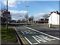
Daily life in B33 8UT is supported by a convenient ring of retail and transport options within practical reach. Five retail venues serve the immediate area, including Co-op Yardley, Iceland Yardley, and Aldi Alum. These businesses provide essentials for daily shopping, from groceries to household necessities, removing the need for long drives. Transport links are extensive, with five railway stations nearby, including Stechford Railway Station and Lea Hall Railway Station. The metro network also connects residents to Birmingham International Airport, Bull Street, and Corporation Street, facilitating easy travel across the region. Living in this postcode means having supermarkets and train stations a short drive or trip away. The area benefits from the broader heritage of Yardley, which includes Blakesley Hall and St Edburgha's Church, adding cultural depth to the local landscape. This proximity to amenities ensures that day-to-day errands are simple.
Amenities
Schools
| Rank | School | Type | Entry gender | Ages |
|---|
Explore more schools in this area
Go to Schools tabDemographics
The community in B33 8UT reflects a settled, mature neighbourhood with a median age of 47. Most residents fall into the adult age range of 30 to 64 years, indicating a population composed of families and established households rather than students or young professionals. Home ownership stands at a high 63%, suggesting that the majority of people here have secured their own properties rather than renting. This high level of ownership typically points to long-term stability within the community. The predominant ethnic group is White, which aligns with the historical character of the Yardley area. Accommodation types are primarily houses, fitting the profile of a suburb that developed over decades. The population density is extremely high at 136,298 people per square kilometre, a figure driven by the small 1.2-hectare size of the specific postcode cluster. Despite this density, the area feels residential rather than industrial. The demographic profile suggests a quieter, established environment where neighbours have likely lived for many years. Ownership rates of 63% are notably strong compared to newer city fringe developments, reinforcing the sense of permanence among residents.
Household Size
Accommodation Type
Tenure
Ethnic Group
Religion
Household Composition
Age
Household Deprivation
NS-SEC
Explore more demographic insights in this area
Go to Demographics tabPlanning
Planning Constraints
- Flood RiskPremium
- Ramsar Wetland SitesPremium
- Area of Outstanding Natural BeautyPremium
- Protected Nature ReservePremium
- Protected WoodlandPremium