Area Overview for B33 8QW
Photos of B33 8QW
Area Information
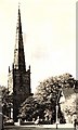
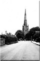
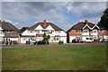
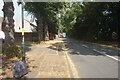
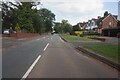
B33 8QW sits within the Yardley East Ward in east Birmingham, forming a specific residential cluster around coordinates 52.467348, -1.808465. This postcode covers a small population of 1,751 residents, creating a close-knit community feel despite being part of a larger urban fabric. Historically, this part of Bursa had deep roots, originally recorded as Gyrdleah in King Edgar's Charter in 972 AD. The area transitioned from open countryside to a bustling suburb during the 1930s, mirroring the broader history of Yardley which incorporated home buyers tripled Birmingham's area in 1911. Today, the ward feels established, blending Victorian terraced houses with municipal estates like Marlborough Farm and Fast Pits. You will find features such as Kent's Moat and Blakesley Hall, a yeoman's farmhouse dating to 1590, adding historical texture to the neighbourhood. The character of B33 8QW reflects its suburban evolution, with activity traditionally centred in nearby Sparkhill, Acocks Green, and Hay Mills. For those considering moving here, the area offers a mix of older properties and commercial hubs that have developed over a thousand years. The location provides access to key transport routes crossing the Coventry Road, Stratford Road, and Warwick Road, integrating the residential cluster into the wider Midlands network. Living in B33 8QW means settling into a district with documented lineage and a clear residential purpose.
- Area Type
- Postcode
- Area Size
- Not available
- Population
- 1751
- Population Density
- 6745 people/km²
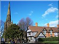
Homes in B33 8QW predominantly consist of houses, reflecting the area's evolution from scattered cottages to a dense suburban layout. Only 40% of residents own their homes, indicating that rental accommodation is also a significant feature of the local market. This split suggests a diversity of housing tenure that could appeal to both long-term owners and tenants seeking flexibility. The historical presence of large municipal estates, such as the Marlborough Farm and Fast Pits estate which contained over 2,000 houses in the 1920s and 1930s, provides a backdrop of stock likely found within or near this postcode. Buyers looking at the property market here will encounter a mix of Victorian terraced housing and these larger council-built communities. For those considering purchasing, the lower-than-average homeownership rate of 40% might indicate a competitive rental sector or specific areas where ownership is less common than in other parts of Birmingham. The accommodation type is clearly leans towards traditional family homes rather than modern flats or studio apartments. When viewing properties, you should expect to see mature character rather than new-build developments. The historical annexation of Yardley in 1911 brought significant municipal investment, meaning many current homes are part of well-established, planned communities. Understanding the proportion of owner-occupied versus rented stock is crucial for assessing market trends and potential capital growth in this specific cluster.
House Prices in B33 8QW
No properties found in this postcode.
Energy Efficiency in B33 8QW
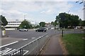
Living in B33 8QW offers convenient access to a variety of amenities within practical reach of the postcode. Retail options are well distributed, with Iceland Stechford, Asda Sheldon, and Aldi Alum all located nearby. These supermarkets provide daily essentials without a long drive. For those needing rail connections, five stations are available locally, including Stechford Railway Station, Lea Hall Railway Station, and Marston Green Railway Station. Travelers can easily access Birmingham International Airport and the central Bull Street railway station. These transport and retail nodes create a functional lifestyle where work, shopping, and travel are integrated. The history of the area, including the Yew Tree public house opened in 1926, hints at a established social history alongside modern convenience. The proximity to these major retailers and transport links means you can run your errands efficiently. Furthermore, the area is catchment for nearby commercial activity that has grown since the 1930s. You do not need to travel far for groceries or train tickets. The presence of major national retailers like Asda and Aldi within the wider area supports a self-sufficient lifestyle. Connectivity to Birmingham International Airport is a specific advantage for those requiring air travel links. This mix of retail giants and transport hubs defines the practical daily experience of residents in this specific cluster.
Amenities
Schools
Families considering schools near B33 8QW will find Trade Based Training located close to the postcode area. This institution is classified as a special school, catering to specific educational needs. While this is the only school explicitly detailed in the immediate vicinity, its presence indicates provision for specialised learning within the Yardley East Ward. The special nature of this facility means the local educational landscape supports diverse requirements for young learners. For parents assessing the area, the presence of a special school suggests a robust local infrastructure that goes beyond standard state provision. The specific location of Trade Based Training places educational integration within the community boundaries. When researching further, you should note that this is the only named educational institution provided for this specific postcode cluster. The proximity of such a facility ensures that residents have access to specialist education without needing to travel to central Birmingham for certain needs. This fact is vital for families evaluating the suitability of the area for their children's specific requirements. The data confirms at least one specialised option is available directly to the local population.
| Rank | School | Type | Entry gender | Ages |
|---|
Explore more schools in this area
Go to Schools tabDemographics
The community within B33 8QW is defined by an established age profile, with a median age of 47 years. Most residents fall into the adult category spanning 30 to 64 years, suggesting a demographic focused on stability and established families rather than transient young professionals. Homeownership stands at 40%, meaning the majority of the 1,751 residents live in their own properties rather than renting. This level of ownership indicates a settled population with significant investment in the neighbourhood. Houses are the predominant accommodation type, aligning with the historic development patterns of the area. The resident base is predominantly White, reflecting the long-standing heritage of Yardley which dates back to its inclusion in the Domesday Book. This demographic profile suggests a neighbourhood where long-term residents and families have likely shaped the local culture over decades. The concentration of adults between thirty and sixty-four years old often correlates with specific voter patterns and community engagement levels. For you as a buyer, this demographic mix implies a quiet residential environment where children and teenagers might be found near schools or playing in local parks during the day. The high rate of homeownership also suggests that prices may reflect the value placed on stable, owned homes within this specific ward boundary. Understanding these figures helps you gauge the likely character of the streets you are moving into.
Household Size
Accommodation Type
Tenure
Ethnic Group
Religion
Household Composition
Age
Household Deprivation
NS-SEC
Explore more demographic insights in this area
Go to Demographics tabPlanning
Planning Constraints
- Flood RiskPremium
- Ramsar Wetland SitesPremium
- Area of Outstanding Natural BeautyPremium
- Protected Nature ReservePremium
- Protected WoodlandPremium