Area Overview for B33 8JT
Photos of B33 8JT

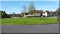
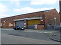
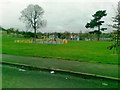
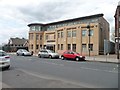
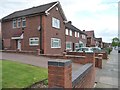


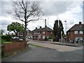

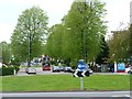
21 photos from this area
Area Information
Key information about the B33 8JT including its size, population, and administrative classification.
- Area Type
- Postcode
- Area Size
- 1.5 hectares
- Population
- 1684
- Population Density
- 7981 people/km²
House Prices in B33 8JT
28
Properties
£90,167
Average Sold Price
£19,000
Lowest Price
£225,000
Highest Price
Showing 28 properties
| Address | Type | Beds | Baths | Last Sale Price | Last Sale Date | |
|---|---|---|---|---|---|---|
| 116 Lea Hall Road, Birmingham, B33 8JT | Semi-detached | 3 | 1 | £225,000 | Aug 2023 | |
| 134 Lea Hall Road, Birmingham, B33 8JT | house | 2 | 1 | £120,000 | Dec 2022 | |
| 160 Lea Hall Road, Birmingham, B33 8JT | house | - | - | £185,000 | Aug 2022 | |
| 104 Lea Hall Road, Birmingham, B33 8JT | Semi-detached | - | - | £82,000 | Nov 2002 | |
| 136 Lea Hall Road, Birmingham, B33 8JT | house | 2 | 1 | £50,000 | Oct 2002 | |
| 138 Lea Hall Road, Birmingham, B33 8JT | Terraced | - | - | £42,000 | May 2002 | |
| 128 Lea Hall Road, Birmingham, B33 8JT | house | - | - | £50,000 | Jan 2002 | |
| 154 Lea Hall Road, Birmingham, B33 8JT | house | - | - | £38,500 | Jan 1999 | |
| 140 Lea Hall Road, Birmingham, B33 8JT | Terraced | - | - | £19,000 | Mar 1997 | |
| 132 Lea Hall Road, Birmingham, B33 8JT | Detached | 3 | 1 | - | - |
Page 1 of 3
Energy Efficiency in B33 8JT
Amenities
Schools
| Rank | School | Type | Entry gender | Ages |
|---|
Explore more schools in this area
Go to Schools tabDemographics
Household Size
Family (3-5 people)
most common
Accommodation Type
Houses
most common
Tenure
43
majority
Ethnic Group
asian_total
most common
Religion
N/A
most common
Household Composition
N/A
most common
Age
22
median
Adults (30-64 years)
most common
Household Deprivation
N/A
with no deprivation
NS-SEC
12
in Lower managerial occupations
Explore more demographic insights in this area
Go to Demographics tabPlanning
Planning Constraints
- Flood RiskPremium
- Ramsar Wetland SitesPremium
- Area of Outstanding Natural BeautyPremium
- Protected Nature ReservePremium
- Protected WoodlandPremium