Area Overview for B33 0YS
Photos of B33 0YS
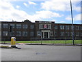
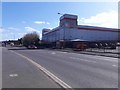
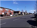
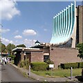
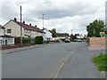
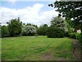
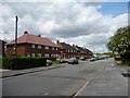
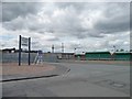
37 photos from this area
Area Information
Key information about the B33 0YS including its size, population, and administrative classification.
- Area Type
- Postcode
- Area Size
- 1.4 hectares
- Population
- 1507
- Population Density
- 3046 people/km²
House Prices in B33 0YS
52
Properties
£111,085
Average Sold Price
£52,500
Lowest Price
£226,000
Highest Price
Showing 52 properties
| Address | Type | Beds | Baths | Last Sale Price | Last Sale Date | |
|---|---|---|---|---|---|---|
| 48 Old Scott Close, Birmingham, B33 0YS | Terraced | 2 | 1 | £180,000 | Feb 2023 | |
| 1 Old Scott Close, Birmingham, B33 0YS | Terraced | 3 | 1 | £226,000 | Dec 2022 | |
| 43 Old Scott Close, Birmingham, B33 0YS | house | - | - | £165,000 | Feb 2022 | |
| 2 Old Scott Close, Birmingham, B33 0YS | house | 2 | - | £140,000 | Jan 2021 | |
| 50 Old Scott Close, Birmingham, B33 0YS | Terraced | 2 | 1 | £128,000 | Apr 2019 | |
| 4 Old Scott Close, Birmingham, B33 0YS | Terraced | 2 | 1 | £125,000 | May 2018 | |
| 5 Old Scott Close, Birmingham, B33 0YS | Terraced | 1 | 1 | £110,000 | Nov 2017 | |
| 24 Old Scott Close, Birmingham, B33 0YS | Terraced | 3 | 1 | £169,000 | Aug 2017 | |
| 22 Old Scott Close, Birmingham, B33 0YS | Terraced | 2 | 1 | £118,000 | Mar 2017 | |
| 25 Old Scott Close, Birmingham, B33 0YS | Terraced | 2 | 1 | £116,000 | Jun 2016 |
Page 1 of 6
Energy Efficiency in B33 0YS
Amenities
Schools
| Rank | School | Type | Entry gender | Ages |
|---|
Explore more schools in this area
Go to Schools tabDemographics
Household Size
One person
most common
Accommodation Type
Houses
most common
Tenure
52
majority
Ethnic Group
White
most common
Religion
N/A
most common
Household Composition
N/A
most common
Age
47
median
Adults (30-64 years)
most common
Household Deprivation
N/A
with no deprivation
NS-SEC
16
in Lower managerial occupations
Explore more demographic insights in this area
Go to Demographics tabPlanning
Planning Constraints
- Flood RiskPremium
- Ramsar Wetland SitesPremium
- Area of Outstanding Natural BeautyPremium
- Protected Nature ReservePremium
- Protected WoodlandPremium