Area Overview for B33 0TZ
Photos of B33 0TZ
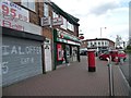
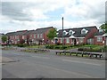
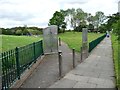
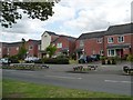
40 photos from this area
Area Information
Key information about the B33 0TZ including its size, population, and administrative classification.
- Area Type
- Postcode
- Area Size
- 1.7 hectares
- Population
- 1752
- Population Density
- 2586 people/km²
House Prices in B33 0TZ
29
Properties
£118,327
Average Sold Price
£36,500
Lowest Price
£210,000
Highest Price
Showing 29 properties
| Address | Type | Beds | Baths | Last Sale Price | Last Sale Date | |
|---|---|---|---|---|---|---|
| 11 Hidcote Grove, Birmingham, B33 0TZ | Terraced | 2 | - | £164,500 | Feb 2022 | |
| 27 Hidcote Grove, Birmingham, B33 0TZ | Retail | 2 | 1 | £210,000 | Jan 2022 | |
| 4 Hidcote Grove, Birmingham, B33 0TZ | Terraced | 3 | - | £190,000 | Mar 2021 | |
| 39 Hidcote Grove, Birmingham, B33 0TZ | house | - | - | £102,000 | Feb 2019 | |
| 5 Hidcote Grove, Birmingham, B33 0TZ | house | 2 | - | £115,000 | Jan 2019 | |
| 6 Hidcote Grove, Birmingham, B33 0TZ | Semi-detached | 3 | 1 | £187,500 | Oct 2018 | |
| 9 Hidcote Grove, Birmingham, B33 0TZ | house | - | - | £117,450 | Feb 2016 | |
| 41 Hidcote Grove, Birmingham, B33 0TZ | Terraced | 3 | - | £144,000 | Apr 2015 | |
| 19 Hidcote Grove, Birmingham, B33 0TZ | house | 2 | - | £86,000 | Jun 2014 | |
| 25 Hidcote Grove, Birmingham, B33 0TZ | house | 3 | 1 | £85,000 | Dec 2013 |
Page 1 of 3
Energy Efficiency in B33 0TZ
Amenities
Schools
| Rank | School | Type | Entry gender | Ages |
|---|
Explore more schools in this area
Go to Schools tabDemographics
Household Size
One person
most common
Accommodation Type
Houses
most common
Tenure
41
majority
Ethnic Group
White
most common
Religion
N/A
most common
Household Composition
N/A
most common
Age
47
median
Adults (30-64 years)
most common
Household Deprivation
N/A
with no deprivation
NS-SEC
14
in Lower managerial occupations
Explore more demographic insights in this area
Go to Demographics tabPlanning
Planning Constraints
- Flood RiskPremium
- Ramsar Wetland SitesPremium
- Area of Outstanding Natural BeautyPremium
- Protected Nature ReservePremium
- Protected WoodlandPremium