Area Overview for B33 0RH
Photos of B33 0RH


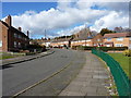
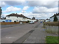
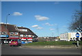
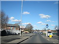

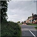
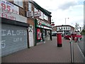
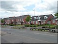
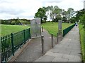
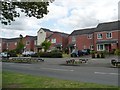
40 photos from this area
Area Information
Key information about the B33 0RH including its size, population, and administrative classification.
- Area Type
- Postcode
- Area Size
- 2.6 hectares
- Population
- 1752
- Population Density
- 2586 people/km²
House Prices in B33 0RH
64
Properties
£108,575
Average Sold Price
£37,000
Lowest Price
£206,000
Highest Price
Showing 64 properties
| Address | Type | Beds | Baths | Last Sale Price | Last Sale Date | |
|---|---|---|---|---|---|---|
| 85 Clopton Road, Birmingham, B33 0RH | Terraced | 2 | 1 | £190,000 | Jul 2025 | |
| 29 Clopton Road, Birmingham, B33 0RH | house | 2 | 1 | £206,000 | Oct 2024 | |
| 71 Clopton Road, Birmingham, B33 0RH | Maisonette | 2 | 1 | £135,000 | Nov 2023 | |
| 91 Clopton Road, Birmingham, B33 0RH | Terraced | 2 | 1 | £185,000 | Jul 2023 | |
| 58 Clopton Road, Birmingham, B33 0RH | Maisonette | 2 | 1 | £124,500 | May 2023 | |
| 47 Clopton Road, Birmingham, B33 0RH | Maisonette | 2 | 1 | £92,000 | Mar 2022 | |
| 89 Clopton Road, Birmingham, B33 0RH | house | 2 | 1 | £135,000 | Aug 2020 | |
| 102 Clopton Road, Birmingham, B33 0RH | house | - | - | £135,000 | Jun 2019 | |
| 110 Clopton Road, Birmingham, B33 0RH | Terraced | 2 | 1 | £142,000 | Jan 2019 | |
| 60 Clopton Road, Birmingham, B33 0RH | Flat | 2 | 1 | £101,000 | Aug 2018 |
Page 1 of 7
Energy Efficiency in B33 0RH
Amenities
Schools
| Rank | School | Type | Entry gender | Ages |
|---|
Explore more schools in this area
Go to Schools tabDemographics
Household Size
One person
most common
Accommodation Type
Houses
most common
Tenure
41
majority
Ethnic Group
White
most common
Religion
N/A
most common
Household Composition
N/A
most common
Age
47
median
Adults (30-64 years)
most common
Household Deprivation
N/A
with no deprivation
NS-SEC
14
in Lower managerial occupations
Explore more demographic insights in this area
Go to Demographics tabPlanning
Planning Constraints
- Flood RiskPremium
- Ramsar Wetland SitesPremium
- Area of Outstanding Natural BeautyPremium
- Protected Nature ReservePremium
- Protected WoodlandPremium