Area Overview for B33 0PB
Photos of B33 0PB
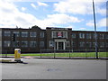
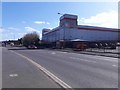
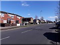
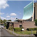
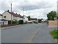
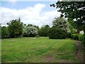
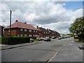
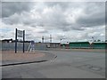
37 photos from this area
Area Information
Key information about the B33 0PB including its size, population, and administrative classification.
- Area Type
- Postcode
- Area Size
- 7521 m²
- Population
- 1507
- Population Density
- 3046 people/km²
House Prices in B33 0PB
26
Properties
£98,125
Average Sold Price
£34,000
Lowest Price
£161,000
Highest Price
Showing 26 properties
| Address | Type | Beds | Baths | Last Sale Price | Last Sale Date | |
|---|---|---|---|---|---|---|
| 115 St Giles Road, Birmingham, B33 0PB | house | - | - | £160,000 | Oct 2022 | |
| 89 St Giles Road, Birmingham, B33 0PB | house | - | - | £161,000 | Mar 2022 | |
| 91 St Giles Road, Birmingham, B33 0PB | Terraced | 3 | 1 | £135,000 | May 2020 | |
| 93 St Giles Road, Birmingham, B33 0PB | Terraced | 2 | 1 | £107,000 | Apr 2020 | |
| 95 St Giles Road, Birmingham, B33 0PB | Terraced | 3 | 1 | £110,000 | Sep 2019 | |
| 81 St Giles Road, Birmingham, B33 0PB | Terraced | 2 | 1 | £128,000 | Aug 2016 | |
| 99 St Giles Road, Birmingham, B33 0PB | house | - | - | £121,000 | Apr 2015 | |
| 105 St Giles Road, Birmingham, B33 0PB | Flat | 1 | 1 | £60,000 | Sep 2007 | |
| 103 St Giles Road, Birmingham, B33 0PB | Flat | - | - | £75,000 | Feb 2007 | |
| 85 St Giles Road, Birmingham, B33 0PB | Terraced | - | - | £46,500 | Oct 1999 |
Page 1 of 3
Energy Efficiency in B33 0PB
Amenities
Schools
| Rank | School | Type | Entry gender | Ages |
|---|
Explore more schools in this area
Go to Schools tabDemographics
Household Size
One person
most common
Accommodation Type
Houses
most common
Tenure
52
majority
Ethnic Group
White
most common
Religion
N/A
most common
Household Composition
N/A
most common
Age
47
median
Adults (30-64 years)
most common
Household Deprivation
N/A
with no deprivation
NS-SEC
16
in Lower managerial occupations
Explore more demographic insights in this area
Go to Demographics tabPlanning
Planning Constraints
- Flood RiskPremium
- Ramsar Wetland SitesPremium
- Area of Outstanding Natural BeautyPremium
- Protected Nature ReservePremium
- Protected WoodlandPremium