Area Overview for B33 0JZ
Photos of B33 0JZ


Area Information
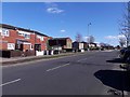
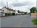
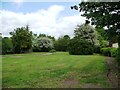
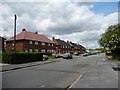
B33 0JZ represents a specific residential cluster within the larger Glebe Farm and Tile Cross ward in Birmingham. This small neighbourhood forms part of a wider community that also includes Kitt's Green, separated from the main settlement by the River Cole to the north and bounded by the Birmingham Loop railway line to the south. The population stands at 1,507, creating a tight-knit environment where residents know one another by name. Historically, this land belonged to the Forest of Arden and was once occupied by the Walters family before becoming the Glebe Farm council estate in the 1930s. The development delivered over 1,360 houses, making it a significant contributor to the local housing stock. Living in B33 0JZ means residing in an area with deep historical roots, defined by red sandstone outcrops and old woodland clearings. The layout is predominantly residential, focusing on sheltered rather than commercial or industrial activity. You will find a quiet setting that reflects its evolution from an ancient woodland clearing to a modern community. The area is situated in the north of Birmingham, West Midlands, offering a stable, settled feel that appeals to those seeking stability away from the city centre noise.
- Area Type
- Postcode
- Area Size
- Not available
- Population
- 1507
- Population Density
- 3046 people/km²
The property market in B33 0JZ is defined by its accommodation type, which consists almost entirely of houses rather than apartments or flats. This structure appeals specifically to families and buyers seeking more space and traditional gardens. With 52% of the population in the age range of 30 to 64 years, there is strong demand from established households looking for single-family homes. The high proportion of owned homes indicates that many residents have been living in these properties for a significant period, rather than being part of a short-term rental cycle. You will find a continuity of traditional architecture here, lacking the density and verticality found in city centre developments. The small population of 1,507 means that property prices may vary based on specific house condition rather than speculative redevelopment potential. The area suits those who prefer detached or semi-detached living over shared corridors or communal areas. This housing stock is well-suited to the local demographic, providing stable accommodation for adults and growing families alike. Buyers should look for properties built within the original estate phases, which date back to the early 20th century.
House Prices in B33 0JZ
No properties found in this postcode.
Energy Efficiency in B33 0JZ
Residents of B33 0JZ have practical access to five retail outlets within easy reach. Shopping opportunities include Lidl at Stetchford, Asda at Sheldon, and the Co-op in Church, providing ample choice for groceries and household essentials. For those who prefer large supermarkets, the distance to Asda Sheldon is manageable for a weekly shop. There are also five railway stations near the area, including Lea Hall, Marston Green, and Stechford stations. This rail network connects you to wider Birmingham and beyond. Additionally, five major transport hubs are within reach, serving as links to Birmingham International Airport, Bull Street, and Birmingham International Railway Station. These amenities ensure you can travel for leisure or business without relying solely on cars. The local lifestyle is defined by this accessibility to both retail and transport networks. You can manage your daily needs locally while retaining the option to travel further afield when necessary. The convenience of having supermarkets and mainline stations nearby reduces car dependency for routine tasks.
Amenities
Schools
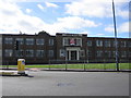
Five schools near B33 0JZ serve the educational needs of local families starting in nursery education. Gossey Lane Junior Infant and Nursery School provides early years education for young children, serving the foundational stage of a child's development. Gossey Lane Academy functions as an academy, offering secondary education with an Ofsted rating of satisfactory. The presence of both primary and secondary options within the local cluster simplifies daily commutes for parents, as children can access most of their schooling close to home. The satisfactory rating of the academy suggests a school that meets required standards, though it may not hold the highest accolades. This mix of educational institutions allows you to consider two main options for your child's path through the local system. The proximity of Gossey Lane Academy to the residential cluster means that walking to school is a viable option for many students. Families living in B33 0JZ benefit from having these facilities immediately available without needing to travel far outside the ward for the majority of their child's education.
| Rank | School | Type | Entry gender | Ages |
|---|
Explore more schools in this area
Go to Schools tabDemographics
The community in B33 0JZ reflects a settled population with a median age of 47 years. Most residents fall into the adult age range between 30 and 64 years, indicating a balance of working professionals and individuals nearing retirement. This demographic profile suggests a mature neighbourhood where families and empty nesters coexist easily. Home ownership is prevalent, with 52% of households owned outright or with a mortgage by occupants. The remaining 48% likely comprise private renters or social tenants, reflecting a mixed rental market typical of many Birmingham estates. Most homes in the area are detached or semi-detached, catering to families and larger households rather than urban singles. The predominant ethnic group is White, aligning with the broader demographic trends of the northern Birmingham wards. There is a lack of significant deprivation data provided for this specific postcode, but the high home ownership rate suggests a degree of financial stability among residents. The age structure supports local businesses, as adults represent the primary consumer base for home services and leisure facilities. This steady demographic makes the area attractive for long-term settlement rather than transient living.
Household Size
Accommodation Type
Tenure
Ethnic Group
Religion
Household Composition
Age
Household Deprivation
NS-SEC
Explore more demographic insights in this area
Go to Demographics tabPlanning
Planning Constraints
- Flood RiskPremium
- Ramsar Wetland SitesPremium
- Area of Outstanding Natural BeautyPremium
- Protected Nature ReservePremium
- Protected WoodlandPremium