Area Overview for B33 0HY
Photos of B33 0HY


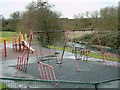
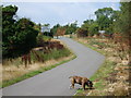
33 photos from this area
Area Information
Key information about the B33 0HY including its size, population, and administrative classification.
- Area Type
- Postcode
- Area Size
- 7.9 hectares
- Population
- 1963
- Population Density
- 2274 people/km²
House Prices in B33 0HY
47
Properties
£155,571
Average Sold Price
£30,000
Lowest Price
£317,500
Highest Price
Showing 47 properties
| Address | Type | Beds | Baths | Last Sale Price | Last Sale Date | |
|---|---|---|---|---|---|---|
| 413 The Radleys, Shard End, Birmingham, B33 0HY | Detached | 3 | 1 | £256,500 | Jul 2025 | |
| 417 The Radleys, Shard End, Birmingham, B33 0HY | Semi-detached | 3 | 1 | £195,000 | Feb 2025 | |
| 457 The Radleys, Shard End, Birmingham, B33 0HY | Terraced | 4 | 2 | £317,500 | Nov 2024 | |
| 389 The Radleys, Shard End, Birmingham, B33 0HY | house | - | - | £170,000 | May 2024 | |
| 453 The Radleys, Shard End, Birmingham, B33 0HY | house | 1 | 1 | £221,600 | Jun 2023 | |
| 393 The Radleys, Shard End, Birmingham, B33 0HY | Retail | 3 | 1 | £220,000 | Nov 2022 | |
| 395 The Radleys, Shard End, Birmingham, B33 0HY | house | 3 | - | £227,000 | Oct 2022 | |
| 399 The Radleys, Shard End, Birmingham, B33 0HY | house | - | - | £200,000 | Aug 2022 | |
| 427 The Radleys, Shard End, Birmingham, B33 0HY | house | - | - | £175,000 | Sep 2020 | |
| 387 The Radleys, Shard End, Birmingham, B33 0HY | Semi-detached | 3 | 1 | £201,000 | Nov 2019 |
Page 1 of 5
Energy Efficiency in B33 0HY
Amenities
Schools
| Rank | School | Type | Entry gender | Ages |
|---|
Explore more schools in this area
Go to Schools tabDemographics
Household Size
Family (3-5 people)
most common
Accommodation Type
Houses
most common
Tenure
27
majority
Ethnic Group
White
most common
Religion
N/A
most common
Household Composition
N/A
most common
Age
47
median
Adults (30-64 years)
most common
Household Deprivation
N/A
with no deprivation
NS-SEC
13
in Lower managerial occupations
Explore more demographic insights in this area
Go to Demographics tabPlanning
Planning Constraints
- Flood RiskPremium
- Ramsar Wetland SitesPremium
- Area of Outstanding Natural BeautyPremium
- Protected Nature ReservePremium
- Protected WoodlandPremium