Area Overview for B33 0BW
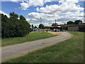
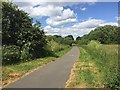
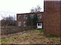
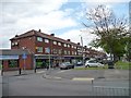
Photos of B33 0BW


Area Information
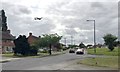
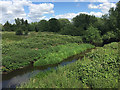
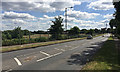
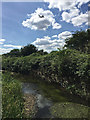
Living in B33 0BW means residing within a specific postcode area covering a small residential cluster of 1582 people. This community sits in the north of Birmingham, forming part of the Glebe Farm and Tile Cross electoral ward. The area spans 4.8 hectares, creating a tightly knit environment where density is high. You will find yourself surrounded by the history of the Forest of Arden, which once covered this land before it was cleared for farming. The neighbourhood is bounded by the Birmingham Loop railway line to the south and the River Cole to the north, marking its distinct geographic limits. Originally part of the ancient parish of Yardley, the location retains the legacy of pre-industrial settlement patterns. Residents benefit from proximity to the River Cole while being close to major transport arteries. The area includes communities such as Kitt's Green and Tile Cross, offering a blend of established residential clusters. Your daily life here is defined by practicality and direct access to wider Birmingham districts without the sprawl of the city centre. This compact nature means that essential services are within practical reach, supporting a lifestyle that balances local convenience with regional connectivity. You are part of a population where nearly half of the residents own their homes, indicating a settled, long-term community.
- Area Type
- Postcode
- Area Size
- 4826 m²
- Population
- 1582
- Population Density
- 6064 people/km²
The property market in B33 0BW is characterised by a concentration of houses as the primary accommodation type. You are looking at a stock where 47% of residents are homeowners. This high ownership rate signals that the area appeals to people planning to stay rather than frequent movers. The absence of flats or apartments in the accommodation data means your search is strictly limited to standalone properties or semi-detached houses. This structure supports a quieter domestic life compared to areas dominated by tenement blocks. Buyers considering homes in B33 0BW will find that the market is skewed towards families or individuals desiring private gardens and direct access to outside space. The small size of the postcode area, covering only 4826 square metres, limits the total volume of listings available at any given time. This scarcity often drives local property values and creates a community where neighbours know each other well. The 47% homeownership figure suggests that the market may be competitive for those seeking to buy. You are purchasing into a neighbourhood where the ethos is traditionally grounded in property rather than flat-sharing or high-density living. This makes the area particularly suitable for those who value separate land ownership and traditional brick construction typical of Birmingham's outer wards.
House Prices in B33 0BW
Showing 11 properties
| Address | Type | Beds | Baths | Last Sale Price | Last Sale Date | |
|---|---|---|---|---|---|---|
| 5 Heritage Way, Birmingham, B33 0BW | Bungalow | - | - | - | - | |
| 4 Heritage Way, Birmingham, B33 0BW | Bungalow | - | - | - | - | |
| 6 Heritage Way, Birmingham, B33 0BW | Bungalow | - | - | - | - | |
| 9 Heritage Way, Birmingham, B33 0BW | Bungalow | - | - | - | - | |
| 11 Heritage Way, Birmingham, B33 0BW | Bungalow | - | - | - | - | |
| 1 Heritage Way, Birmingham, B33 0BW | Bungalow | - | - | - | - | |
| 3 Heritage Way, Birmingham, B33 0BW | Bungalow | - | - | - | - | |
| 7 Heritage Way, Birmingham, B33 0BW | Bungalow | - | - | - | - | |
| 10 Heritage Way, Birmingham, B33 0BW | Bungalow | - | - | - | - | |
| 2 Heritage Way, Birmingham, B33 0BW | Bungalow | - | - | - | - |
Energy Efficiency in B33 0BW
Your lifestyle in B33 0BW benefits from a robust array of amenities located within practical reach. Retailers include five major locations such as Lidl Stetchford, Asda Sheldon, and the Co-op Shard. These supermarkets provide all the groceries and daily necessities you need without lengthy journeys. For rail enthusiasts or commuters, five stations serve the area, including Lea Hall, Marston Green, and Stechford Railway Station. This density of transport hubs means you can access local amenities independently or take a train into central Birmingham quickly. Five metro connections are also available, including Birmingham International Airport and Birmingham Intl Railway Station, linking you to the wider national network. These transport nodes are not just for travel but often house social venues and information points. The area research confirms that historically, this land was forested until the 1930s when council estates were built. This history adds a layer of character to the surroundings, distinct from the city centre. You live in a ward that includes Glebe Farm, Kitt's Green, and Tile Cross, each with its own local shops and pubs. The combination of modern connectivity and historical depth creates a balanced living environment.
Amenities
Schools
Families considering homes in B33 0BW have limited educational options immediately adjacent to the postcode. The only school listed in the data is Hallmoor School, which functions as a special educational needs provision. This facility serves children with specific learning requirements rather than offering a standard primary or secondary education for the general population. The presence of a special school indicates that the broader ward, Glebe Farm and Tile Cross, accommodates diverse educational needs. There is no data available for other school types in the immediate immediate vicinity of the specific postcode B33 0BW. Potential buyers should note that this means standard state schools may be further away or located in adjacent electoral wards. The location is bounded by the River Cole and the Birmingham Loop railway line, which influences where general schools can be situated. When planning for children, you must look beyond the specific postcode to the wider Birmingham City Council catchment area. The mix of school types is currently represented solely by this special provision. This gap in standard school data suggests that most families attending nearby institutions range to communities like Yardley or Sheldon where comprehensive colleges are located.
| Rank | School | Type | Entry gender | Ages |
|---|
Explore more schools in this area
Go to Schools tabDemographics
The community in B33 0BW is defined by a mature population profile. The median age is 47 years, and the most common age range consists of adults between 30 and 64 years old. This demographic suggests the area attracts families and professionals seeking stability rather than transient housing. Home ownership stands at 47%, meaning nearly one in two residents owns their property outright or with a mortgage. This figure indicates a significant portion of residents are invested in the area for the long term. The predominant ethnic group is White, reflecting the historical development of the region from the Forest of Arden era. Accommodation types are exclusively Houses, meaning you will not find flats or apartments in this specific postcode cluster. With a population density of 327,776 people per square kilometre, the land use is efficient. The area supports a total of 1582 individuals across 4826 square metres of land. While the density is high relative to the area size, the exclusive presence of houses provides a sense of traditional suburban living. This data points to a neighbourhood where character comes from individual properties rather than shared hallways or blocks. Buyers should expect a quiet environment dominated by single-family dwellings rather than multi-unit complexes. The lack of rental accounts in the specific accommodation type data suggests a market focused on private homeownership.
Household Size
Accommodation Type
Tenure
Ethnic Group
Religion
Household Composition
Age
Household Deprivation
NS-SEC
Explore more demographic insights in this area
Go to Demographics tabPlanning
Planning Constraints
- Flood RiskPremium
- Ramsar Wetland SitesPremium
- Area of Outstanding Natural BeautyPremium
- Protected Nature ReservePremium
- Protected WoodlandPremium