Area Overview for B32 9AN
Photos of B32 9AN


Area Information
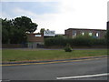
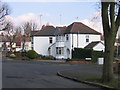
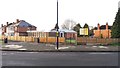
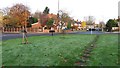
Living in B32 9AN, part of Quinton in Birmingham, offers a blend of suburban tranquillity and proximity to a major city. The area’s population of 1,595 reflects its small, tight-knit residential cluster, though this figure likely dates to pre-1911 records. Quinton itself is a suburb with a history as a village, retaining some Victorian terraced homes amid post-1980s housing estates. Its location 5 miles west of Birmingham city centre means residents enjoy a quieter lifestyle while remaining within reach of urban amenities. The area’s character is shaped by green spaces like Woodgate Valley Country Park and Quinton Recreation Ground, balanced with modern infrastructure. With no major planning constraints, the landscape is low-risk for development, though the M5 motorway nearby has altered parts of the original village. Daily life here combines local charm with practical connectivity, making it appealing to those seeking a stable, family-oriented environment without full city immersion.
- Area Type
- Postcode
- Area Size
- Not available
- Population
- Not available
- Population Density
- Not available
The property market in B32 9AN is dominated by owner-occupied homes, with 72% of residents living in houses rather than flats. This indicates a focus on family-friendly, single-family dwellings, typical of suburban areas. The high home ownership rate suggests a stable market with long-term residents, reducing turnover and fostering community continuity. Given the area’s small size and the prevalence of houses, property availability is likely limited within B32 9AN itself, but nearby suburbs may offer more options. Buyers should consider the mix of older Victorian terraces and post-1980s housing estates, which can vary in condition and value. The lack of planning constraints means development pressure is low, preserving the area’s character but limiting new builds. For those seeking a home with space and a sense of permanence, this market aligns with traditional suburban ideals.
House Prices in B32 9AN
No properties found in this postcode.
Energy Efficiency in B32 9AN
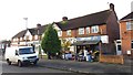
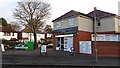
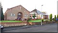
Residents of B32 9AN have access to a range of local amenities within practical reach. Retail options include Tesco Quinton, Co-op Hagley, and Co-op Harborne, providing everyday shopping needs. The area’s proximity to railway stations like Rowley Regis and Langley Green facilitates commuting, while metro stops such as Edgbaston Village and Kenrick Park offer additional transport links. Leisure opportunities include Quinton Recreation Ground and Woodgate Valley Country Park, offering green space for walking, cycling, or relaxation. The historic Christ Church and Quinton Library provide cultural and community hubs. The mix of local shops, transport, and open spaces creates a balanced lifestyle, combining convenience with the ability to enjoy outdoor activities. This accessibility ensures daily life remains practical and enjoyable, whether for errands, socialising, or recreation.
Amenities
Schools
| Rank | School | Type | Entry gender | Ages |
|---|
Explore more schools in this area
Go to Schools tabDemographics
The community in B32 9AN is predominantly middle-aged, with a median age of 47 and the most common age group being adults aged 30–64. This suggests a stable, established population, likely with families and long-term residents. Home ownership is high at 72%, indicating a strong preference for owning property over renting, which can contribute to community cohesion. The area is characterised by houses rather than flats, reflecting a residential focus. The predominant ethnic group is White, though specific diversity data is not provided. The age profile and ownership rates suggest a mature, low-turnover population, which can influence local services and amenities. With no data on deprivation, it is reasonable to infer that the area’s safety and infrastructure support a quality of life aligned with its demographic profile.
Household Size
Accommodation Type
Tenure
Ethnic Group
Religion
Household Composition
Age
Household Deprivation
NS-SEC
Explore more demographic insights in this area
Go to Demographics tabPlanning
Planning Constraints
- Flood RiskPremium
- Ramsar Wetland SitesPremium
- Area of Outstanding Natural BeautyPremium
- Protected Nature ReservePremium
- Protected WoodlandPremium
- Crime RiskPremium