Area Overview for B32 4HZ
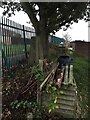
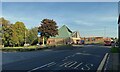
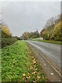
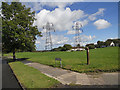
Photos of B32 4HZ
Area Information
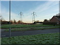
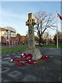
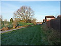
B32 4HZ represents a specific residential cluster within the larger Bartley Green area, located five miles south west of Birmingham city centre. This small postcode falls under the Birmingham Edgbaston parliamentary constituency and is represented by Preet Kaur Gill. The area forms one of Birmingham's 69 wards and ranks as the 12th most populous in the city. Historically, the location was first recorded in the Domesday Book of 1086 as Berchelai, meaning either birch tree wood or a clearing in the birch trees. Following the Second World War in 1945, the area underwent significant development with the construction of both private and council housing. A notable 1960s project, the Athol Farm council estate, included five tower blocks which have now been demolished. Administratively, boundary adjustments occurred over time, with the final transfer of part of Frankley to Birmingham taking place in April 1995. Today, the postcode serves as a small residential community where you can find homes in a suburb that balances practical living with established local history. The landscape features St. Michael and All Angels church and the Bartley Reservoir, providing defined focal points for the neighbourhood.
- Area Type
- Postcode
- Area Size
- Not available
- Population
- 1576
- Population Density
- 4655 people/km²
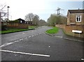
Homes in B32 4HZ are characterised as houses, which defines the primary accommodation type available in this residential cluster. The housing market here reflects a specific dynamic where only 30% of residents own their property. This relatively low ownership rate suggests a significant rental sector compared to areas with higher owner-occupation figures. You will find that the stock consists mainly of houses, differing from urban cores where flats dominate. For buyers considering this postcode, the housing mix offers single-family dwellings suitable for families or professionals who do not wish to live in apartments. The geography of the postcode covers a small residential cluster rather than a sprawling district, which often concentrates property values within a specific local boundary. The combination of house-based accommodation and a limited ownership rate creates a market where both landlords and purchasers operate on a smaller scale than in broader Birmingham wards. Prospective buyers should expect to encounter a mix of tenures within a compact area that prioritises traditional housing forms.
House Prices in B32 4HZ
No properties found in this postcode.
Energy Efficiency in B32 4HZ
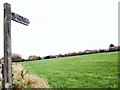
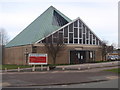
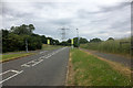
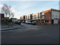
Living in B32 4HZ places you within practical reach of several key amenities that shape daily life. Retail options are accessible, with five notable stores including Budgens Woodgate, M&S Frankley South M5 Moto SF, and M&S Frankley. These high street retailers provide essentials without requiring a long journey into Birmingham city centre. For commuters and those travelling by rail, five stations are nearby, including Northfield Railway Station, Longbridge Railway Station, and Selly Oak Railway Station. These waypoints connect you to the wider transport network efficiently. Additionally, five bus or tram stops are located near Edgbaston Village, Centenary Square, and Handsworth Booth Street, offering flexible public transport choices. The presence of the parish church, St. Michael and All Angels, adds a traditional element to the local character. You also have access to the Bartley Reservoir, a significant landscape feature for walks and recreation. This combination of shopping, transit options, and green spaces defines the convenience of the area.
Amenities
Schools
| Rank | School | Type | Entry gender | Ages |
|---|
Explore more schools in this area
Go to Schools tabDemographics
The community residing in B32 4HZ has a distinct age profile, with a median age of 47 years. You are most likely to find adults aged between 30 and 64 years living here following the shift from area averages. The area records a home ownership rate of exactly 30%, meaning the majority of households rent their accommodation. Most residents live in houses rather than apartments, aligning with the traditional suburban character of the ward. The population is predominantly White, reflecting a lower share of Black, Asian and Minority Ethnic residents compared to the wider city. Historical survey data from 1998 indicates that the area recorded significant urban deprivation, with 52.4% of pupils at Bartley Green School living in areas with high dependency on income support. While this is historical data, it provides context for the socio-economic environment surrounding the postcode. The demographics suggest a stable, established community where older families and long-term residents form the core of the population structure.
Household Size
Accommodation Type
Tenure
Ethnic Group
Religion
Household Composition
Age
Household Deprivation
NS-SEC
Explore more demographic insights in this area
Go to Demographics tabPlanning
Planning Constraints
- Flood RiskPremium
- Ramsar Wetland SitesPremium
- Area of Outstanding Natural BeautyPremium
- Protected Nature ReservePremium
- Protected WoodlandPremium
- Crime RiskPremium