Area Overview for B32 4HU
Photos of B32 4HU
Area Information
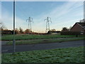
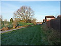
Living in B32 4HU means calling Birmingham's Bartley Green home. This specific postcode covers a small residential cluster situated approximately five miles south west of the city centre. The area is part of the Birmingham Edgbaston parliamentary constituency and represents a clearly defined suburban environment. With a total population of 1,303 residents, this neighbourhood maintains a distinct identity within the larger ward structure. The community sits within parts of the Birmingham City border, having adjusted administratively in April 1995 when Frankley was transferred to the city. Residents enjoy proximity to significant landscape features like the Bartley Reservoir and the historic parish church of St. Michael and All Angels. The area carries historical weight, having been recorded in the Domesday Book of 1086 before undergoing significant built-up expansion following the Second World War. While the post-war period saw the construction of both private homes and council housing, including the now-demolished Athol Farm tower blocks, the suburb has evolved into a quiet residential setting. Living in B32 4HU offers a balance between historical character and modern suburban convenience, away from the dense congestion sometimes found closer to the city core.
- Area Type
- Postcode
- Area Size
- Not available
- Population
- 1303
- Population Density
- 3565 people/km²
The property market in B32 4HU is characterised by a clear predominance of houses rather than flats or apartments. This housing stock suits buyers looking for traditional suburban living with private gardens and standalone structures. With only 37% of the population owning their homes, the area remains heavily reliant on the rental sector. This suggests that while there are opportunities for first-time buyers to purchase, the sheer volume of private letting means many newcomers will initially seek accommodation through the rental ladder. The small geographic cluster of this postcode means properties are likely clustered closely together, offering a consistent streetscape experience. For investors or landlords, the high rental proportion indicates sustained demand from those who cannot or prefer not to buy. Conversely, homeowners face a market where property values are supported by a quieter, house-centric environment rather than high-density urban commuting hubs. Families purchasing homes in B32 4HU will find a consistent architectural style dominated by residential structures rather than blocks of flats. The lower ownership rate compared to average suburban areas might signal affordability challenges, which could also present opportunities for buyers entering the market through reduced competition or slightly lower entry prices.
House Prices in B32 4HU
No properties found in this postcode.
Energy Efficiency in B32 4HU
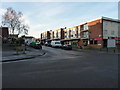
Residents of B32 4HU benefit from a range of amenities within practical reach, ensuring daily convenience without excessive travel. For your shopping needs, five retail outlets serve the locality, including Budgens Woodgate, M&S Frankley South M5 Moto SF, and the main M&S Frankley store. These retailers provide essential groceries and household goods close to your doorstep. Transport options outside the immediate cluster are abundant, with five rail stations named nearby, including Northfield Railway Station, Longbridge Railway Station, and Rowley Regis Railway Station. These stations facilitate connections to wider city networks despite being a short distance away. Beyond railways, the area has access to five metro/VoR locations such as Edgbaston Village, Centenary Square, and Handsworth Booth Street, offering further opportunities for leisure and culture. Living in B32 4HU places you within a sphere of influence that extends well beyond the small residential cluster. You can combine the quiet of a suburban home with the convenience of national chains and public transport links. This mix supports a lifestyle where daily errands are quick and accessible, while longer journeys for work or tourism remain straightforward via the nearby rail network.
Amenities
Schools
Families moving to B32 4HU will primarily rely on Kitwell Primary School for their children's education. This primary institution holds a good Ofsted rating, providing a solid foundation for young learners within the neighbourhood. The presence of this well-regarded primary school supports the area's character as a place where families establish themselves. Living in B32 4HU means children start their education journey close to home, benefiting from a local institution that meets regulatory standards for educational quality. While the data does not list secondary options directly attached to this specific postcode, the nearby history of Hillcrest School serves as a marker for the area's educational heritage. Historically, Hillcrest, formerly known as Bartley Green Grammar School for Girls, is noted as one of the most successful schools in Birmingham. This historical success story often influences the local reputation for education, even if younger children attend the current primary provision. For residents prioritising early schooling, Kitwell offers a dependable option without the need to travel far from their homes. The focus on a single, highly rated primary provider ensures that parents entering the housing market can plan confidently around educational needs from an early age.
| Rank | School | Type | Entry gender | Ages |
|---|
Explore more schools in this area
Go to Schools tabDemographics
The community in B32 4HU is defined by a mature population profile. The median age stands at 47 years, reflecting a neighbourhood where adults aged between 30 and 64 years form the most common age range. This demographic shift indicates a settled community where families and older residents have put down long-term roots rather than relying on a transient younger workforce. Home ownership sits at 37%, suggesting a mixed market where a clear majority of residents rent, though a significant portion have invested in their own properties. The predominant ethnic group in this cluster is White, aligning with a demographic trend noted in the wider Bartley Green ward which maintains a lower share of Black, Asian and Minority Ethnic populations compared to the Birmingham city average. Historical data from 1998 highlighted significant urban deprivation in the area, with high dependency on income support affecting a large proportion of households at the time. While current figures are different, the legacy of these historical economic conditions continues to influence the area's social fabric. The accommodation type is exclusively houses, providing a specific housing stock that appeals to those seeking detached or semi-detached living rather than urban flats or terraces.
Household Size
Accommodation Type
Tenure
Ethnic Group
Religion
Household Composition
Age
Household Deprivation
NS-SEC
Explore more demographic insights in this area
Go to Demographics tabPlanning
Planning Constraints
- Flood RiskPremium
- Ramsar Wetland SitesPremium
- Area of Outstanding Natural BeautyPremium
- Protected Nature ReservePremium
- Protected WoodlandPremium