Area Overview for B32 4EB
Photos of B32 4EB
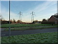

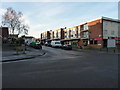
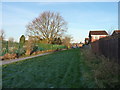
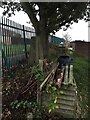
29 photos from this area
Area Information
Key information about the B32 4EB including its size, population, and administrative classification.
- Area Type
- Postcode
- Area Size
- 8937 m²
- Population
- 1576
- Population Density
- 4655 people/km²
House Prices in B32 4EB
31
Properties
£86,350
Average Sold Price
£45,000
Lowest Price
£155,000
Highest Price
Showing 31 properties
| Address | Type | Beds | Baths | Last Sale Price | Last Sale Date | |
|---|---|---|---|---|---|---|
| 83 Hasbury Road, Birmingham, B32 4EB | Flat | 1 | 1 | £82,500 | Mar 2024 | |
| 47 Hasbury Road, Birmingham, B32 4EB | Flat | 1 | 1 | £90,000 | Jan 2023 | |
| 78 Hasbury Road, Birmingham, B32 4EB | house | - | - | £155,000 | Sep 2021 | |
| 43 Hasbury Road, Birmingham, B32 4EB | Semi-detached | 3 | 2 | £140,000 | Dec 2019 | |
| 53 Hasbury Road, Birmingham, B32 4EB | Flat | 1 | - | £70,000 | Dec 2015 | |
| 61 Hasbury Road, Birmingham, B32 4EB | Flat | - | - | £52,500 | Mar 2014 | |
| 76 Hasbury Road, Birmingham, B32 4EB | house | 3 | - | £94,000 | Aug 2010 | |
| 55 Hasbury Road, Birmingham, B32 4EB | Maisonette | - | - | £75,000 | Dec 2007 | |
| 57 Hasbury Road, Birmingham, B32 4EB | Flat | - | - | £59,500 | Jun 2005 | |
| 63 Hasbury Road, Birmingham, B32 4EB | Flat | - | - | £45,000 | Mar 2002 |
Page 1 of 4
Energy Efficiency in B32 4EB
Amenities
Schools
| Rank | School | Type | Entry gender | Ages |
|---|
Explore more schools in this area
Go to Schools tabDemographics
Household Size
One person
most common
Accommodation Type
Houses
most common
Tenure
30
majority
Ethnic Group
White
most common
Religion
N/A
most common
Household Composition
N/A
most common
Age
47
median
Adults (30-64 years)
most common
Household Deprivation
N/A
with no deprivation
NS-SEC
14
in Lower managerial occupations
Explore more demographic insights in this area
Go to Demographics tabPlanning
Planning Constraints
- Flood RiskPremium
- Ramsar Wetland SitesPremium
- Area of Outstanding Natural BeautyPremium
- Protected Nature ReservePremium
- Protected WoodlandPremium