Area Overview for B32 3RF
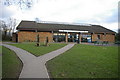
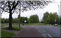
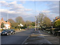
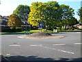
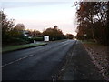
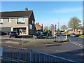
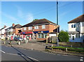
Photos of B32 3RF
Area Information
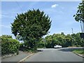
B32 3RF represents a specific postcode cluster within Bartley Green, a residential suburban ward located five miles south west of Birmingham city centre. This small residential area covers 5,580 square metres and serves a population of 1,247 residents. You will find this location deeply rooted in local history, first recorded in the Domesday Book of 1086 as Berchelai, referring to either a birch tree wood or a clearing in the trees. The area forms part of the Birmingham Edgbaston parliamentary constituency, represented by Labour Co-operative MP Preet Kaur Gill. Administratively, the boundary profile is complex; parts of this region were transferred from Worcestershire and Warwickshire to Birmingham at different times, with the final adjustment occurring in April 1995 when part of Frankley joined Birmingham. Unlike the wider city, this ward does not cover protected woodland, Ramsar wetland sites, or Areas of Outstanding Natural Beauty. Use your postcode to check the specific details of the Cluster you are interested in when searching for homes in B32 3RF.
- Area Type
- Postcode
- Area Size
- 5580 m²
- Population
- 1247
- Population Density
- 3493 people/km²
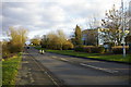
Homes in B32 3RF are characterised by a high level of home ownership, with 76 per cent of residents being owner-occupiers. This statistic defines the local property market as primarily driven by established homeowners rather than private landlords. The predominant accommodation type is houses, which aligns with the area's development history following the Second World War when both private and council housing was constructed. The absence of tower blocks, such as the five former Athol Farm council estate buildings that were demolished in the 1960s, means the streetscape is composed mainly of private residences. This specific postcode cluster offers a settled environment typical of suburban areas within Birmingham. If you are looking for homes in B32 3RF, you are entering a market where existing owners have invested in their property. The combination of high home ownership rates and a housing stock that is entirely houses suggests that you will find a quiet, residential setting suitable for families or those seeking a detached or semi-detached living arrangement.
House Prices in B32 3RF
Showing 9 properties
| Address | Type | Beds | Baths | Last Sale Price | Last Sale Date | |
|---|---|---|---|---|---|---|
| 7 Elmwoods, Birmingham, B32 3RF | Semi-detached | 3 | 1 | £325,000 | Sep 2024 | |
| 2 Elmwoods, Birmingham, B32 3RF | house | - | - | £287,000 | Nov 2019 | |
| 5 Elmwoods, Birmingham, B32 3RF | house | - | - | £240,000 | Mar 2018 | |
| 1 Elmwoods, Birmingham, B32 3RF | Detached | 3 | - | £185,000 | Jun 2013 | |
| 3 Elmwoods, Birmingham, B32 3RF | house | - | - | £175,000 | Mar 2012 | |
| 9 Elmwoods, Birmingham, B32 3RF | house | 3 | - | £170,000 | Aug 2011 | |
| 11 Elmwoods, Birmingham, B32 3RF | Detached | - | - | £169,000 | Apr 2005 | |
| 4 Elmwoods, Birmingham, B32 3RF | Detached | - | - | £77,000 | Sep 1997 | |
| 6 Elmwoods, Birmingham, B32 3RF | Detached | - | - | - | - |
Energy Efficiency in B32 3RF
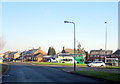
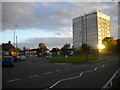
Daily life in B32 3RF centres on practical amenities located within easy practical reach of residents. You will find five retail locations nearby, including Budgens Woodgate and branches of M&S Frankley South and M&S Frankley. These supermarkets serve as primary destinations for groceries and daily shopping needs. For rail travel, five stations offer convenient access, with Rowley Regis Railway Station, Northfield Railway Station, and Old Hill Railway Station being the notable points. Additionally, five metro locations are close by, such as Edgbaston Village, Kenrick Park, and Handsworth Booth Street, providing alternative transport links. Beyond shopping and transport, the area features notable landmarks that define the local character. St. Michael and All Angels serves as the parish church for Bartley Green, offering a community focal point. Hillcrest School, formerly Bartley Green Grammar School for Girls established in 1954, remains a significant institution noted for its success. For leisure and green space, the Bartley Reservoir is a significant landscape feature. You will find these amenities integrated into your routine when living in B32 3RF.
Amenities
Schools
| Rank | School | Type | Entry gender | Ages |
|---|
Explore more schools in this area
Go to Schools tabDemographics
The community profile in B32 3RF reflects a mature demographic structure. The median age is 47 years old, placing the most common age range between 30 and 64 years. You will find that 76 per cent of residents own their homes, indicating a stable, long-term population rather than a transient rental market. Almost the entire residential stock consists of houses, consistent with the suburb's character as a suburban residential area. The predominant ethnic group is White, aligning with a ward profile that has a lower share of Black, Asian, and Minority Ethnic residents compared to the broader Birmingham city average. Historical data from a 1998 survey highlighted that 52.4 per cent of pupils at Bartley Green School lived in areas with high dependency on income support. While the ward has an older age profile than Birmingham as a whole, the demographic evidence suggests a settled neighbourhood where families and retired couples have established roots. When you are considering schools near B32 3RF, keep in mind the historical context of local education provision.
Household Size
Accommodation Type
Tenure
Ethnic Group
Religion
Household Composition
Age
Household Deprivation
NS-SEC
Explore more demographic insights in this area
Go to Demographics tabPlanning
Planning Constraints
- Flood RiskPremium
- Ramsar Wetland SitesPremium
- Area of Outstanding Natural BeautyPremium
- Protected Nature ReservePremium
- Protected WoodlandPremium