Area Overview for B32 3QY
Photos of B32 3QY
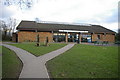
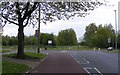
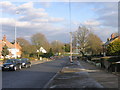
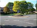
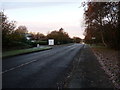
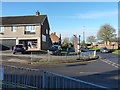
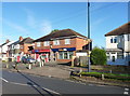
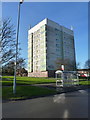
18 photos from this area
Area Information
Key information about the B32 3QY including its size, population, and administrative classification.
- Area Type
- Postcode
- Area Size
- 8459 m²
- Population
- 1446
- Population Density
- 2333 people/km²
House Prices in B32 3QY
23
Properties
£146,458
Average Sold Price
£50,000
Lowest Price
£300,000
Highest Price
Showing 23 properties
| Address | Type | Beds | Baths | Last Sale Price | Last Sale Date | |
|---|---|---|---|---|---|---|
| 64 Woodgate Lane, Birmingham, B32 3QY | Semi-detached | 3 | 2 | £300,000 | Oct 2024 | |
| 8 Woodgate Lane, Birmingham, B32 3QY | Terraced | 2 | 2 | £148,000 | Jan 2024 | |
| 68 Woodgate Lane, Birmingham, B32 3QY | Terraced | 3 | 2 | £190,000 | Jun 2023 | |
| 2 Woodgate Lane, Birmingham, B32 3QY | Retail | 2 | 1 | £147,000 | Mar 2022 | |
| 14 Woodgate Lane, Birmingham, B32 3QY | Terraced | 3 | 1 | £134,000 | May 2021 | |
| 62 Woodgate Lane, Birmingham, B32 3QY | Semi-detached | 2 | 1 | £154,000 | Jun 2020 | |
| 46 Woodgate Lane, Birmingham, B32 3QY | Flat | 1 | 1 | £80,000 | Oct 2019 | |
| 70 Woodgate Lane, Birmingham, B32 3QY | Terraced | 2 | 1 | £115,000 | Mar 2018 | |
| 16 Woodgate Lane, Birmingham, B32 3QY | Detached | 3 | 1 | £235,500 | Sep 2016 | |
| 10 Woodgate Lane, Birmingham, B32 3QY | Terraced | 2 | - | £85,000 | Jan 2011 |
Page 1 of 3
Energy Efficiency in B32 3QY
Amenities
Schools
| Rank | School | Type | Entry gender | Ages |
|---|
Explore more schools in this area
Go to Schools tabDemographics
Household Size
One person
most common
Accommodation Type
Houses
most common
Tenure
61
majority
Ethnic Group
White
most common
Religion
N/A
most common
Household Composition
N/A
most common
Age
47
median
Adults (30-64 years)
most common
Household Deprivation
N/A
with no deprivation
NS-SEC
27
in Lower managerial occupations
Explore more demographic insights in this area
Go to Demographics tabPlanning
Planning Constraints
- Flood RiskPremium
- Ramsar Wetland SitesPremium
- Area of Outstanding Natural BeautyPremium
- Protected Nature ReservePremium
- Protected WoodlandPremium