Area Overview for B32 3PY
Photos of B32 3PY


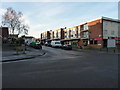
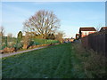
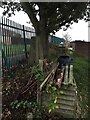
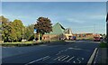
29 photos from this area
Area Information
Key information about the B32 3PY including its size, population, and administrative classification.
- Area Type
- Postcode
- Area Size
- 1.1 hectares
- Population
- 1516
- Population Density
- 5197 people/km²
House Prices in B32 3PY
37
Properties
£102,650
Average Sold Price
£38,280
Lowest Price
£170,000
Highest Price
Showing 37 properties
| Address | Type | Beds | Baths | Last Sale Price | Last Sale Date | |
|---|---|---|---|---|---|---|
| 82 Offmoor Road, Birmingham, B32 3PY | house | 3 | - | £160,000 | Sep 2025 | |
| 24 Offmoor Road, Birmingham, B32 3PY | house | - | - | £170,000 | Aug 2022 | |
| 66 Offmoor Road, Birmingham, B32 3PY | Semi-detached | 2 | 1 | £151,000 | Mar 2021 | |
| 74 Offmoor Road, Birmingham, B32 3PY | house | 3 | 2 | £145,000 | Nov 2016 | |
| 64 Offmoor Road, Birmingham, B32 3PY | house | - | - | £117,000 | Sep 2015 | |
| 68 Offmoor Road, Birmingham, B32 3PY | house | 2 | - | £88,000 | Mar 2014 | |
| 60 Offmoor Road, Birmingham, B32 3PY | house | - | - | £58,000 | Mar 2010 | |
| 38 Offmoor Road, Birmingham, B32 3PY | Maisonette | - | - | £50,500 | Mar 2008 | |
| 72 Offmoor Road, Birmingham, B32 3PY | house | - | - | £87,000 | Mar 2004 | |
| 62 Offmoor Road, Birmingham, B32 3PY | house | - | - | £38,280 | Dec 2003 |
Page 1 of 4
Energy Efficiency in B32 3PY
Amenities
Schools
| Rank | School | Type | Entry gender | Ages |
|---|
Explore more schools in this area
Go to Schools tabDemographics
Household Size
One person
most common
Accommodation Type
Houses
most common
Tenure
38
majority
Ethnic Group
White
most common
Religion
N/A
most common
Household Composition
N/A
most common
Age
47
median
Adults (30-64 years)
most common
Household Deprivation
N/A
with no deprivation
NS-SEC
18
in Lower managerial occupations
Explore more demographic insights in this area
Go to Demographics tabPlanning
Planning Constraints
- Flood RiskPremium
- Ramsar Wetland SitesPremium
- Area of Outstanding Natural BeautyPremium
- Protected Nature ReservePremium
- Protected WoodlandPremium