Area Overview for B32 3DJ
Photos of B32 3DJ
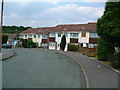
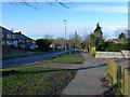
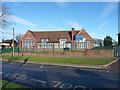
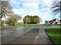
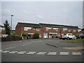
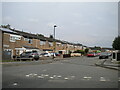
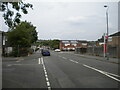
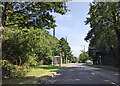
19 photos from this area
Area Information
Key information about the B32 3DJ including its size, population, and administrative classification.
- Area Type
- Postcode
- Area Size
- 2.5 hectares
- Population
- 1312
- Population Density
- 3140 people/km²
House Prices in B32 3DJ
49
Properties
£117,139
Average Sold Price
£8,000
Lowest Price
£233,000
Highest Price
Showing 49 properties
| Address | Type | Beds | Baths | Last Sale Price | Last Sale Date | |
|---|---|---|---|---|---|---|
| 18 Clover Drive, Birmingham, B32 3DJ | Terraced | 3 | 5 | £160,000 | Jun 2025 | |
| 76 Clover Drive, Birmingham, B32 3DJ | Bungalow | 2 | 1 | £216,000 | Mar 2025 | |
| 66 Clover Drive, Birmingham, B32 3DJ | Semi-detached | 2 | 1 | £233,000 | Jan 2024 | |
| 50 Clover Drive, Birmingham, B32 3DJ | Terraced | 3 | 1 | £150,000 | Nov 2022 | |
| 70 Clover Drive, Birmingham, B32 3DJ | Bungalow | 2 | 1 | £121,000 | Sep 2021 | |
| 43 Clover Drive, Birmingham, B32 3DJ | house | - | - | £8,000 | Dec 2019 | |
| 32 Clover Drive, Birmingham, B32 3DJ | Terraced | 3 | 1 | £154,000 | Feb 2019 | |
| 25 Clover Drive, Birmingham, B32 3DJ | house | - | - | £147,000 | May 2018 | |
| 62 Clover Drive, Birmingham, B32 3DJ | Terraced | 3 | 1 | £125,000 | Sep 2017 | |
| 82 Clover Drive, Birmingham, B32 3DJ | Semi-detached | 2 | 1 | £188,000 | Aug 2017 |
Page 1 of 5
Energy Efficiency in B32 3DJ
Amenities
Schools
| Rank | School | Type | Entry gender | Ages |
|---|
Explore more schools in this area
Go to Schools tabDemographics
Household Size
Family (3-5 people)
most common
Accommodation Type
Houses
most common
Tenure
78
majority
Ethnic Group
White
most common
Religion
N/A
most common
Household Composition
N/A
most common
Age
47
median
Adults (30-64 years)
most common
Household Deprivation
N/A
with no deprivation
NS-SEC
27
in Lower managerial occupations
Explore more demographic insights in this area
Go to Demographics tabPlanning
Planning Constraints
- Flood RiskPremium
- Ramsar Wetland SitesPremium
- Area of Outstanding Natural BeautyPremium
- Protected Nature ReservePremium
- Protected WoodlandPremium