Area Overview for B32 3AH
Photos of B32 3AH
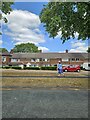
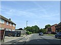
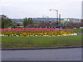
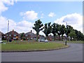
20 photos from this area
Area Information
Key information about the B32 3AH including its size, population, and administrative classification.
- Area Type
- Postcode
- Area Size
- 2.9 hectares
- Population
- 1640
- Population Density
- 2561 people/km²
House Prices in B32 3AH
24
Properties
£127,727
Average Sold Price
£87,950
Lowest Price
£183,000
Highest Price
Showing 24 properties
| Address | Type | Beds | Baths | Last Sale Price | Last Sale Date | |
|---|---|---|---|---|---|---|
| 154 Stonehouse Lane, Birmingham, B32 3AH | Terraced | 2 | 1 | £170,000 | Dec 2024 | |
| 168 Stonehouse Lane, Birmingham, B32 3AH | Terraced | 2 | 1 | £183,000 | May 2024 | |
| 158 Stonehouse Lane, Birmingham, B32 3AH | Terraced | 2 | 1 | £160,000 | Dec 2022 | |
| 174 Stonehouse Lane, Birmingham, B32 3AH | Terraced | 2 | 1 | £115,000 | Jun 2020 | |
| 166 Stonehouse Lane, Birmingham, B32 3AH | Terraced | 2 | 1 | £113,000 | Mar 2020 | |
| 162 Stonehouse Lane, Birmingham, B32 3AH | Terraced | 2 | 1 | £120,000 | Dec 2018 | |
| 164 Stonehouse Lane, Birmingham, B32 3AH | Terraced | 2 | 1 | £140,000 | Mar 2018 | |
| 142 Stonehouse Lane, Birmingham, B32 3AH | Terraced | 2 | - | £125,000 | Jul 2016 | |
| 146 Stonehouse Lane, Birmingham, B32 3AH | house | 2 | - | £97,000 | Aug 2012 | |
| 172 Stonehouse Lane, Birmingham, B32 3AH | house | - | - | £87,950 | Jul 2012 |
Page 1 of 3
Energy Efficiency in B32 3AH
Amenities
Schools
| Rank | School | Type | Entry gender | Ages |
|---|
Explore more schools in this area
Go to Schools tabDemographics
Household Size
One person
most common
Accommodation Type
Houses
most common
Tenure
53
majority
Ethnic Group
White
most common
Religion
N/A
most common
Household Composition
N/A
most common
Age
47
median
Adults (30-64 years)
most common
Household Deprivation
N/A
with no deprivation
NS-SEC
29
in Lower managerial occupations
Explore more demographic insights in this area
Go to Demographics tabPlanning
Planning Constraints
- Flood RiskPremium
- Ramsar Wetland SitesPremium
- Area of Outstanding Natural BeautyPremium
- Protected Nature ReservePremium
- Protected WoodlandPremium