Area Overview for B32 2PB
Photos of B32 2PB
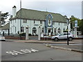
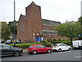
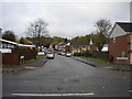
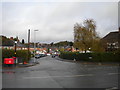
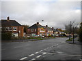
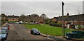
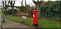
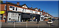
30 photos from this area
Area Information
Key information about the B32 2PB including its size, population, and administrative classification.
- Area Type
- Postcode
- Area Size
- 1.3 hectares
- Population
- 1677
- Population Density
- 6738 people/km²
House Prices in B32 2PB
36
Properties
£119,801
Average Sold Price
£31,000
Lowest Price
£267,500
Highest Price
Showing 36 properties
| Address | Type | Beds | Baths | Last Sale Price | Last Sale Date | |
|---|---|---|---|---|---|---|
| 7 Tedstone Road, Birmingham, B32 2PB | Terraced | 2 | 1 | £165,000 | May 2025 | |
| 69 Tedstone Road, Birmingham, B32 2PB | Semi-detached | 3 | 1 | £267,500 | Oct 2023 | |
| 15 Tedstone Road, Birmingham, B32 2PB | Terraced | 3 | - | £170,000 | Dec 2019 | |
| 79 Tedstone Road, Birmingham, B32 2PB | Semi-detached | 2 | 2 | £149,000 | Oct 2019 | |
| 39 Tedstone Road, Birmingham, B32 2PB | Semi-detached | 3 | 1 | £147,500 | Aug 2019 | |
| 19 Tedstone Road, Birmingham, B32 2PB | house | - | - | £162,500 | Oct 2018 | |
| 75 Tedstone Road, Birmingham, B32 2PB | Semi-detached | 3 | - | £150,000 | Dec 2017 | |
| 27 Tedstone Road, Birmingham, B32 2PB | Terraced | 3 | - | £118,000 | May 2015 | |
| 73 Tedstone Road, Birmingham, B32 2PB | Semi-detached | 3 | 1 | £125,000 | Nov 2014 | |
| 65 Tedstone Road, Birmingham, B32 2PB | Semi-detached | - | - | £124,950 | Sep 2007 |
Page 1 of 4
Energy Efficiency in B32 2PB
Amenities
Schools
| Rank | School | Type | Entry gender | Ages |
|---|
Explore more schools in this area
Go to Schools tabDemographics
Household Size
Family (3-5 people)
most common
Accommodation Type
Houses
most common
Tenure
61
majority
Ethnic Group
White
most common
Religion
N/A
most common
Household Composition
N/A
most common
Age
47
median
Adults (30-64 years)
most common
Household Deprivation
N/A
with no deprivation
NS-SEC
29
in Lower managerial occupations
Explore more demographic insights in this area
Go to Demographics tabPlanning
Planning Constraints
- Flood RiskPremium
- Ramsar Wetland SitesPremium
- Area of Outstanding Natural BeautyPremium
- Protected Nature ReservePremium
- Protected WoodlandPremium