Area Overview for B32 2LP
Photos of B32 2LP
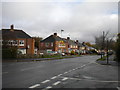
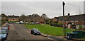
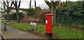
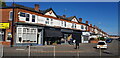
30 photos from this area
Area Information
Key information about the B32 2LP including its size, population, and administrative classification.
- Area Type
- Postcode
- Area Size
- 8708 m²
- Population
- 1772
- Population Density
- 8986 people/km²
House Prices in B32 2LP
37
Properties
£143,300
Average Sold Price
£46,500
Lowest Price
£240,000
Highest Price
Showing 37 properties
| Address | Type | Beds | Baths | Last Sale Price | Last Sale Date | |
|---|---|---|---|---|---|---|
| 58 Blandford Road, Birmingham, B32 2LP | Terraced | 2 | 1 | £170,000 | Oct 2023 | |
| 84 Blandford Road, Birmingham, B32 2LP | Terraced | 2 | 2 | £236,000 | Apr 2023 | |
| 76 Blandford Road, Birmingham, B32 2LP | Terraced | 2 | 1 | £164,000 | Jan 2023 | |
| 62 Blandford Road, Birmingham, B32 2LP | house | 2 | 1 | £150,000 | Sep 2022 | |
| 82 Blandford Road, Birmingham, B32 2LP | Terraced | 2 | 2 | £240,000 | Apr 2022 | |
| 60 Blandford Road, Birmingham, B32 2LP | house | 2 | 1 | £150,000 | Dec 2021 | |
| 68 Blandford Road, Birmingham, B32 2LP | Terraced | 2 | 1 | £94,000 | Mar 2016 | |
| 72 Blandford Road, Birmingham, B32 2LP | Terraced | - | - | £85,000 | Feb 2014 | |
| 88 Blandford Road, Birmingham, B32 2LP | house | - | - | £97,500 | Apr 2005 | |
| 54 Blandford Road, Birmingham, B32 2LP | house | - | - | £46,500 | Oct 2001 |
Page 1 of 4
Energy Efficiency in B32 2LP
Amenities
Schools
| Rank | School | Type | Entry gender | Ages |
|---|
Explore more schools in this area
Go to Schools tabDemographics
Household Size
One person
most common
Accommodation Type
Houses
most common
Tenure
27
majority
Ethnic Group
White
most common
Religion
N/A
most common
Household Composition
N/A
most common
Age
47
median
Adults (30-64 years)
most common
Household Deprivation
N/A
with no deprivation
NS-SEC
16
in Lower managerial occupations
Explore more demographic insights in this area
Go to Demographics tabPlanning
Planning Constraints
- Flood RiskPremium
- Ramsar Wetland SitesPremium
- Area of Outstanding Natural BeautyPremium
- Protected Nature ReservePremium
- Protected WoodlandPremium