Area Overview for B32 2HX
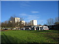
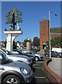
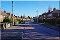
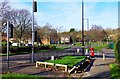
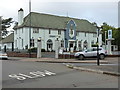
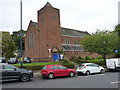
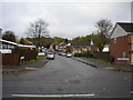
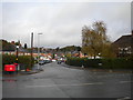
Photos of B32 2HX
Area Information
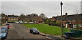
Living in B32 2HX means residing within a specific postcode area that covers a small residential cluster of just 880 square metres. This location serves as a compact residential hub within the broader context of Harborne Ward, situated to the south west of Birmingham city centre. The area has deep historical roots, with the settlement first mentioned in the Domesday Book of 1086 and evolving from a rural village centred around Harborne High Street and St Peter's Church. While the immediate postcode is tiny, it exists within a ward that encompasses historic village areas and parts of Staffordshire boundary history before transferring fully into the city in 1912. You are not buying into an isolated pocket but rather a defined slice of a community with over a thousand years of written history. The population of this specific cluster stands at 1,772 people, creating a tight-knit environment where residents share a defined local identity. Despite the small square footage, the density suggests a close proximity to immediate neighbours typical of village-style living where courtyards and narrow lanes might define the streetscape. This area represents a blend of ancient heritage and modern residential utility. It offers the peace of a historic district while remaining within practical reach of Birmingham's wider amenities. For those seeking a home with historical significance and a sense of established community, this small cluster provides a grounded entry point into the larger Harborne neighbourhood without the sprawl of suburban ex-infrastructure.
- Area Type
- Postcode
- Area Size
- 880 m²
- Population
- 1772
- Population Density
- 8986 people/km²
The property market in B32 2HX is defined by a housing stock that consists almost entirely of houses. Ownership levels tell a clear story about the local market dynamics: only 27% of homes are owner-occupied. This means that for every four homes in the area, three are within the private rental market. This imbalance suggests a prevalence of landlords and investors along with residents on long-term tenancies rather than a traditional community of first-time buyers or families inheriting properties. When you consider looking for homes in this specific postcode cluster, you must navigate a market where securing a tenancy agreement is often the primary route to living there. The small area size of 880 square metres means that prices per square metre could be significantly elevated if converted, but current data does not support speculation on exact values. Instead, the presence of 2,001 people per square kilometre indicates a tightness of housing supply relative to space. This density contributes to a market where properties command a premium for their specific location within Harborne Ward, yet the low ownership rate acts as a barrier to conventional buying. You will encounter a landscape where landlords control a large portion of the stock. Existing homeowners are likely mortgage-free or highly leveraged long-termers. For buyers, this environment requires careful assessment of tenancy laws and rental yields. The market is not one of speculative flips but of established holdings and professional letting, making it a distinct proposition for investors seeking stable rental demand from the area's mature adult residents.
House Prices in B32 2HX
Showing 1 properties
| Address | Type | Beds | Baths | Last Sale Price | Last Sale Date | |
|---|---|---|---|---|---|---|
| Tennal Grange, Tennal Road, Harborne, Birmingham, B32 2HX | community_day_centre | - | - | - | - |
Energy Efficiency in B32 2HX
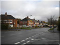
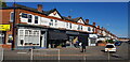
Living in B32 2HX offers convenient access to a range of amenities within practical reach of residents. Retail options are supported by five nearby locations, including Co-op Harborne, Co-op Quinton, and Co-op Hagley. These specific venues provide essential shopping needs alongside convenience stores for everyday groceries. For those commending on public transport, five railway stations lie close by, notably University Railway Station, Selly Oak Railway Station, and Five Ways Railway Station. This connectivity extends to the metro network, with five accessible stations such as Edgbaston Village, Centenary Square, and Winson Green Outer Circle. The area is situated near the historic village centre of Harborne, which features Harborne High Street. This road is lined with old inns, a historical smithy site, and the former lock-up, offering a walkable environment rich in local character. St Peter's Church stands as a focal point of the nearby landscape. You can enjoy a lifestyle that blends the convenience of modern retail chains like the Co-op with the charm of historic High Street architecture. The presence of multiple transport nodes means you can walk to or drive to various destinations easily. Leisure and cultural activities are supported by the proximity to the University Railway Station, which hints at the cultural vibrancy of the wider Selly Oak area. Your daily life is enhanced by the ability to access supermarkets, train lines, and historic landmarks without significant travel time.
Amenities
Schools
Educational provisions for children living in B32 2HX are represented by a single specific institution listed in the immediate vicinity. Welsh House Farm Community School and Special Needs Resources Base operates as a primary school within the local network. This facility holds a 'good' Ofsted rating, confirming that the education provided meets national standards for inclusive and effective learning. As the sole school explicitly detailed for this postcode cluster, it serves a crucial role for local families who require primary education within the Harborne Ward boundaries. The fact that this is a special needs resources base indicates that the area supports inclusive education models alongside standard primary schooling. While a broader list of secondary or higher education institutions is not provided for this specific small postcode, the presence of this well-rated primary facility demonstrates a commitment to educational infrastructure. The 'good' rating is a tangible metric that prospective parents can rely upon when assessing schools near B32 2HX. Families considering homes in this area will find that the primary stage of education is covered by a state-accredited provider with a verified track record. This ensures that regardless of the sporadic nature of comprehensive data lists, there is a functional and rated educational option available for young learners. The school's designation as a community hub further suggests involvement in local social support systems alongside academic instruction.
| Rank | School | Type | Entry gender | Ages |
|---|
Explore more schools in this area
Go to Schools tabDemographics
The community in B32 2HX is characterised by a mature demographic profile where the median age sits at 47. The most common age range comprises adults between 30 and 64 years old, indicating a neighbourhood dominated by families in their prime earning years or residents settling into their later domestic life. This age structure suggests a stable population with significant longevity in their local properties rather than rapid turnover. Over 73% of households rent or live within privately rented accommodation, as home ownership stands at just 27%. This figure places this area distinctly below the national average for owner-occupation, creating a landscape where long-term tenants and landlords form the backbone of the local society. Racial diversity within the area is predominantly White, reflecting the traditional English village feel that has persisted since the 13th-century founding of St Peter's Church. With an area size of only 880 square metres, the physical space is limited, yet the population density figures suggest a high concentration of people in this small footprint. The combination of a median age of 47 and a high rental figure of 73% points to a market where professionals or semi-retirees may seek long-term tenancies in this historic ward. You will find a community built on stability rather than transience. The accommodation type consists primarily of houses, aligning with the historic suburban architecture found along Harborne High Street. This demographic snapshot reveals a settled community where residents value consistency and local connections over rapid property market shifts.
Household Size
Accommodation Type
Tenure
Ethnic Group
Religion
Household Composition
Age
Household Deprivation
NS-SEC
Explore more demographic insights in this area
Go to Demographics tabPlanning
Planning Constraints
- Flood RiskPremium
- Ramsar Wetland SitesPremium
- Area of Outstanding Natural BeautyPremium
- Protected Nature ReservePremium
- Protected WoodlandPremium